
Bourne End · Wycombe · Buckinghamshire

Bourne End Renovations & Design-Build — SL8

Updated 6 November 2026

Where the Wye runs into the Thames, our London team plans and builds house and flat projects for Bourne End, working from the Finchley Road studio in Hampstead, NW3.

The Local Plan says Bourne End and Wooburn thinks of itself as a number of villages rather than a town. For a building project the more useful split is three-way: the riverside conservation area, the flood zone along the Thames, and the streets north of the railway, and which of them an address falls in settles most of what follows.

Serving Bourne End from our Hampstead studio · NW3 6DN
020 7101 3168

Hampstead Renovations design and build studio on Finchley Road
Our Hampstead studio · Finchley Road, NW3 6DN

Bourne End projects

Choose the work your Bourne End home needs

01 Whole house

House Refurbishment in Bourne End

Refurbishing a Bourne End house, from a slate-roofed artisan cottage on Upper Hedsor Road to a timber-framed Riversdale villa or a semi north of the railway. Windows, roofs, brickwork and services are specified for the age of the building and, where it applies, the conservation area guidance.

  • Survey that dates the fabric
  • Painted timber windows, lime pointing
  • Heating and wiring signed off
Explore House Refurbishment in Bourne End

02 More space

House Extensions in Bourne End

Rear and side extensions tested against the permitted development limits, the flood map and, at the edge of the village, the Green Belt policy. Inside the conservation area we keep them below the main roofline and in the materials of the house.

  • Flood zone checked first
  • Permitted development or application
  • Party wall notices served
Explore House Extensions in Bourne End

05 Roof space

Loft Conversions in Bourne End

Loft rooms under Bourne End's clay-tiled and slated roofs. Inside the conservation area any dormer is a planning application, and the appraisal asks for it to be modestly sized on a rear-facing slope.

  • Permitted development or application
  • Protected escape route
  • Notices for steels in party walls
Explore Loft Conversions in Bourne End

07 Flats

Flat Refurbishment in Bourne End

Refurbishing flats in purpose-built blocks, converted buildings and over the shops of the village centre. Lease consents, sound between floors and the conservation area rules for windows are settled before work begins.

  • Lease and freeholder consents
  • Sound and fire separation
  • Windows drawn to the appraisal
Explore Flat Refurbishment in Bourne End

Bourne End homes

What Bourne End's houses are built like

Census 2021 counts households for a ward that ONS calls The Wooburns, Bourne End and Hedsor, which takes in more than Bourne End itself. It found 4,906 households there: 33.2% living in semi-detached houses, 26.7% in detached houses, 19.4% in terraced houses and 17.1% in purpose-built blocks of flats, with smaller numbers in converted houses, other converted buildings and flats in commercial premises.

Where Bourne End stops depends on who draws the line. The neighbourhood plan covers the parish of Wooburn and Bourne End, which leaves out Abbotsbrook, Well End, Little Marlow and Hedsor, except for the Hedsor Road conservation area, which it counts as part of Bourne End. The Local Plan's settlement strategy goes the other way and folds Wooburn Town, Abbotsbrook, Well End, Little Marlow and Hedsor into Bourne End, noting that the settlements are physically connected even though the area regards itself as a number of villages.

The railway made the modern village. The station opened in 1854, and at first little more appeared than a few terraces of cottages at the station end of Hedsor Road. The name itself moved north to the station, having once meant the hamlet at the Hedsor Road and Ferry Lane junction, and the conservation area appraisal notes that Bourne End's major growth has largely been north of the railway line.

South of the River Wye the riverbank was developed for prosperous middle-class housing from the late 19th century, and that is today's Riversdale estate. The appraisal dates most of this to the period 1870 to 1914, a slow but steady growth of villas and private estates, while artisan and working-class housing went up to the east, well away from the riverbanks, and along Upper Hedsor Road.

Further back, the parish grew out of ten historic settlements, and infill has since joined parts of them together. The neighbourhood plan describes the parish as a collection of villages linked by the valley of the River Wye. New building is concentrated on the Local Plan's two allocated sites, BE1 at Slate Meadow and BE2 at Hollands Farm.

Before we draw anything in Bourne End we put the address on two maps, the conservation area boundary and the flood zones, and date the building's fabric on site. Most of the advice below depends on those three answers.

Sources: ONS/Nomis: Census 2021 TS044 Accommodation type, 2022 ward The Wooburns, Bourne End and Hedsor (E05013162); Wooburn and Bourne End Parish Council: Neighbourhood Development Plan 2013-2033, referendum version (28 June 2023); Wycombe District Council: Wycombe District Local Plan (adopted August 2019); Buckinghamshire Council: Riversdale & Hedsor Road Conservation Area Appraisal (February 2018)
Approvals

Checks a Bourne End project goes through

The plans that decide applications across the west planning area, and the Green Belt tests of policies DM42 and DM43, are set out on our Wycombe page. These are the checks that reach a Bourne End address, in roughly the order we run them.

Who decides

Applications for Bourne End addresses are decided by Buckinghamshire Council under the Wycombe District Local Plan (adopted August 2019) and Delivery and Site Allocations Plan (adopted 2013). Inside the parish, the Wooburn and Bourne End Neighbourhood Plan, put to a referendum on 7 September 2023, is read alongside them.

Conservation area or not

The Riversdale and Hedsor Road conservation area covers a long stretch of the Thames's east bank between Bourne End Railway Bridge and Cookham Road Bridge. Inside it, buildings that are not listed still carry extra planning controls, and the 2018 appraisal counts as a material consideration in decisions.

Flood zone

The 2014 flood assessment places the southern area of Bourne End, either side of the A4094 south of Hedsor Road, in Flood Zone 3a, with numerous homes along Riversdale inside it. Flood Zone 2 reaches properties on Cores End Road, west of the A4155 and Station Road, and near the Hedsor Road and Ferry Lane junction.

Green Belt edge

The Local Plan describes the area as surrounded by the Green Belt but not by the Area of Outstanding Natural Beauty. For a house at the edge of the village we check the boundary before anything else, because inside it an extension or replacement must satisfy DM43.

Neighbourhood plan

Running from 2013 to 2033, the plan adds local policies on heritage, infill design and watercourses. Its policy PD3 asks proposals in the parish's conservation areas to respond to the development control advice in their character appraisals.

Building regulations

Building regulations approval is separate from planning permission, and many projects need both. It comes from Buckinghamshire Council's building control service or, if you prefer, a private registered building control approver, who notifies the council by giving an initial notice.

Sources: Buckinghamshire Council: Local Development Scheme, 3. Our current plans and documents (last updated 16 March 2026); Wycombe District Council: Wycombe District Local Plan (adopted August 2019); Buckinghamshire Council: Wooburn and Bourne End Neighbourhood Plan, Information Statement for Referendum (2023); Buckinghamshire Council: Neighbourhood planning, the plans; Buckinghamshire Council: Riversdale & Hedsor Road Conservation Area Appraisal (February 2018); Wycombe District Council: Strategic Flood Risk Assessment Level 1 Update (November 2014); Wooburn and Bourne End Parish Council: Neighbourhood Development Plan 2013-2033, referendum version (28 June 2023); GOV.UK: Building regulations approval - when you need approval; Buckinghamshire Council: Building regulations and control; GOV.UK: Building regulations approval (printable guide)

Local policy

Bourne End's riverside conservation area, its plan and the Thames

The Local Plan puts Bourne End and Wooburn in Tier 2 of its settlement hierarchy. Its village centre is classed as a District Centre rather than a Town Centre, though the plan finds it busy and well served by local amenities. Three local layers then shape most house projects: the riverside conservation area, the neighbourhood plan and the two rivers.

Designated 1986; appraisal February 2018

Riversdale and Hedsor Road

First designated in 1986, with its boundaries extended in 1991, the conservation area divides into three character areas: Upper Bourne End on the eastward spur of Hedsor Road, Abney north of the River Wye, and Riversdale south of it. The appraisal is adopted as a Supplementary Planning Document, and its closing guidelines manage change to windows, roofs, extensions and boundaries.

Wooburn Green and Wooburn Town

The council's list of conservation areas marks Wooburn Green as under review and holds a character survey for it, and lists a character survey for Wooburn Town. The neighbourhood plan counts six conservation areas in the parish, adding Berghers Hill, Clapton Mill and Watery Lane to these and to Riversdale and Hedsor Road.

Referendum 7 September 2023

The neighbourhood plan

Policy PD1 asks that extensions and alterations in a conservation area respect its character and appearance, and that proposals affecting heritage assets come with a proportionate statement of their significance. PD2 sets design principles for infill, PD3 points applicants to the appraisals, and PD4 asks for an ecological buffer beside any watercourse.

The Thames and the Wye

Bourne End is where the River Wye joins the Thames, and the Local Plan says the closeness of both raises concerns about flood risk. The neighbourhood plan leaves flooding out of its own policies and points to the Local Plan's policy DM39 instead.

The appraisal is frank about what has been lost. In Upper Bourne End, it says, permitted development rights have caused very considerable harm: wholesale replacement of windows with standard joinery and UPVC, low front walls removed so cars can park off the road, and original brickwork rendered or painted.

Its guidelines answer that directly. Windows should be painted timber, not stained, usually sliding sashes or side-hung casements; top-hung lights, UPVC and aluminium are described as inappropriate in the conservation area; and joinery details are expected with a planning application.

The neighbourhood area holds 49 grade II listed buildings, and eight listed buildings stand inside the Riversdale and Hedsor Road conservation area. The appraisal also maps unlisted buildings and walls that are protected from demolition, with a general presumption that they stay.

Sources: Wycombe District Council: Wycombe District Local Plan (adopted August 2019); Buckinghamshire Council: Riversdale & Hedsor Road Conservation Area Appraisal (February 2018); Buckinghamshire Council: Conservation areas in Buckinghamshire; Wooburn and Bourne End Parish Council: Neighbourhood Development Plan 2013-2033, referendum version (28 June 2023); Buckinghamshire Council: Wooburn and Bourne End Neighbourhood Plan, Information Statement for Referendum (2023); Wycombe District Council: Strategic Flood Risk Assessment Level 1 Update (November 2014)

Building fabric

Building types in Bourne End and what they mean for the work

The appraisal finds no one material dominant in so mixed an area, though most roofs carry plain clay tiles, with slate appearing in the 19th century, and most modern houses are brick under tiled roofs. Each of the older building types below asks for something different on site.

Artisan cottages and terraces

Upper Bourne End is a ribbon of late 19th-century roadside housing, mostly for artisans and farm workers, with fields running up to the back gardens. Walls mix red and yellow stock brick, render, painted brick and flint, some cottages have brick and flint banded rear walls, and most built after 1876 are roofed in slate.

  • Lime mortar when repointing
  • Slate repaired, not replaced with concrete
  • Low brick and flint front walls kept

Riverside villas

Riversdale's big plots face the curve of the Thames and are reached along a private lane parallel to the river. The earlier houses carry black-painted timber framing on their upper floors over red brick below, with white render or roughcast panels, and many have boathouses, some since converted to separate dwellings.

  • Timber framing surveyed panel by panel
  • Boathouses treated as buildings in their own right
  • Openness to the river kept

Farmhouses and early cottages

Six of the conservation area's pre-1820 buildings are Grade II listed. The oldest farmhouse, at Ferry Lane, is timber-framed, was built about 1600 and is now divided into three. Listed building consent, and a heritage statement prepared by a competent conservation professional, come before any design work on buildings like these.

Flats and later infill

Later change arrived as infill and conversion. The old Andrews Boatyard became six blocks of two-storey apartments with more flats in their roofs, and the riverside mansion at Abney was subdivided into five houses. Work on buildings like these starts with the lease, the freeholder and the shared structure.

Below ground, the conservation area lies flat on the Thames floodplain where the river cuts through chalk hills, and the 2014 flood assessment describes the district's geology as dominated by chalk, with a risk of groundwater flooding from chalk aquifers across it. It recommends detailed topographic survey or infiltration tests to establish the local characteristics of a site, and that is where our foundation and drainage design starts.

Sources: Buckinghamshire Council: Riversdale & Hedsor Road Conservation Area Appraisal (February 2018); Wycombe District Council: Strategic Flood Risk Assessment Level 1 Update (November 2014)

On site

Access, parking and dropped kerbs in Bourne End

The Local Plan records traffic congestion through the village and at Cookham Bridge, and the neighbourhood plan lists congestion points at Cookham Bridge, Blind Lane, Cores End, Furlong Road and Well End. Deliveries and skips are timed around them.

Riversdale is reached by a private road, and Upper Hedsor Road is narrow enough that the appraisal finds its 20mph limit has made little difference to the traffic. On roads like these we agree loading points with neighbours before a lorry is booked.

Parking is the complaint residents raise most often, in every part of the parish. The neighbourhood plan calls on-street parking a communal resource and warns that turning a garage into living space, or building an extension in its place, can push cars from the drive onto the street, so any scheme of ours that takes a garage shows where the cars will go.

A new or wider drive needs a vehicular access licence from Buckinghamshire Council before the kerb is lowered, with a drawing that keeps the access no wider than 4.6m. For the drive itself, a new hard surface of more than 5 square metres between the front wall and the road stays permitted development only if it is porous or drains to a permeable area within the plot. For drives within Riversdale and Hedsor Road, the appraisal prefers gravel and calls large areas of tarmac and concrete out of place.

Before work starts our site manager walks the route from the main road to the front door, notes low branches, overhead cables and narrow gateways, and agrees with the neighbours where materials will be stored.

Sources: Wycombe District Council: Wycombe District Local Plan (adopted August 2019); Wooburn and Bourne End Parish Council: Neighbourhood Development Plan 2013-2033, referendum version (28 June 2023); Buckinghamshire Council: Riversdale & Hedsor Road Conservation Area Appraisal (February 2018); Buckinghamshire Council: Apply for a dropped kerb licence; legislation.gov.uk: GPDO 2015 (SI 2015/596), Schedule 2 Part 1, development within the curtilage of a dwellinghouse (latest available revised)

Scope

Scoping a Bourne End project before a quote

We price a Bourne End project only once the survey, the planning route and the flood position are known, because any one of them can change what is buildable. These steps are the order we work in.

  1. Place the address

    We check the conservation area line, the flood map for planning and the Green Belt boundary for the address, and whether the building is listed.

  2. Survey the building

    A measured survey records walls, roof timbers, floor levels and drains, and dates each part of the fabric we will be working on.

  3. Choose the route

    We settle on permitted development, an application or a lawful development certificate, and list any flood risk assessment, heritage statement or party wall notice the scheme will need.

  4. Design and engineer

    Our architects and structural engineers draw the scheme and its structure together, so the drawings submitted for approval are the drawings we build from.

  5. Quote and sequence

    The quote follows the drawings, with every allowance written out, and the order of works is agreed with you before materials are ordered.

Ready to take the next step? Send the property address and a short outline of what you want to change.

Book a feasibility visit

Our Hampstead base, serving Bourne End

Talk to our Finchley Road studio

Our studio is in Hampstead on Finchley Road, at NW3 6DN. We serve Bourne End from this office. Bring us the practical questions about your house, flat or bathroom and the result you want to achieve.

Contact the studio to discuss your brief and arrange the next step. If you already have drawings, a lease or planning correspondence, tell us what is available.

Book a feasibility visit
Hampstead Renovations
Unit 3 Palace Court
250 Finchley Road
London NW3 6DN

020 7101 3168
contact@hampsteadrenovations.co.uk

Find our studio on Google Maps

Our work

A London project to compare with Bourne End

Our London team takes on projects in Bourne End: in-house architects, designers and structural engineers, working alongside Hampstead Chartered Surveyors & Building Consultancy and run from our Finchley Road studio in Hampstead, NW3, with no office in the county. Planning decisions rest with Buckinghamshire Council, and building control goes through Buckinghamshire Council's building control service, or through a private registered approver if you prefer.

The project below is in London, not Buckinghamshire. It shows how we organise survey, drawings, engineering and site management; a Bourne End scheme follows the same sequence, adapted to the flood zone, the conservation area and the riverside access described on this page.

If the flood map or the appraisal makes an idea unlikely to be approved, we tell you at the feasibility visit rather than after the drawings are done.

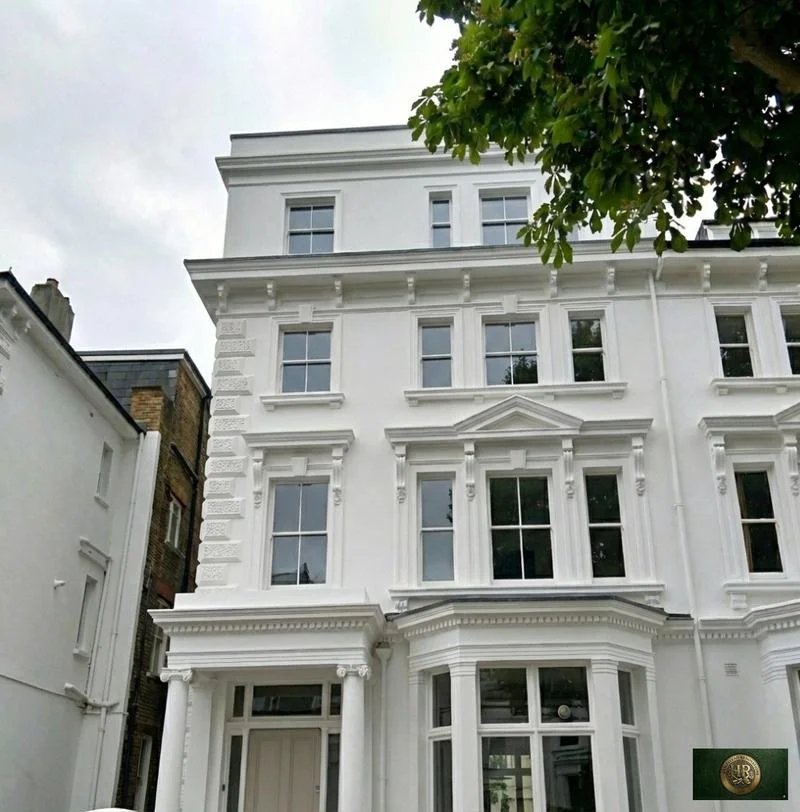
Outside Bourne End, and in London rather than Buckinghamshire: Project example: Belsize Park, NW3. That project of ours is a Victorian townhouse of five storeys; its case study records a basement conversion, a rear extension and loft work, carried out together with a full refurbishment of the interior.

Sources: Buckinghamshire Council: Building regulations and control; GOV.UK: Building regulations approval (printable guide); Hampstead Renovations: Belsize Park Gardens, NW3 case study

Bourne End questions

Renovating in Bourne End: questions we are asked

What does the Wooburn and Bourne End Neighbourhood Plan cover?

It covers the parish of Wooburn and Bourne End for 2013 to 2033, which leaves out Abbotsbrook, Well End and Little Marlow but takes in the Hedsor Road conservation area. Its policies deal with conservation areas and heritage assets, infill design, watercourses and bats, community facilities and pubs, local green spaces, and the semi-rural Hawks Hill and Harvest Hill area. Flood risk is left to the Local Plan's policy DM39.

Is my Bourne End address in the Thames flood zone along Riversdale?

The 2014 flood assessment for the Wycombe area places the southern part of Bourne End, either side of the A4094 south of Hedsor Road, in Flood Zone 3a, with numerous homes along Riversdale inside it, and puts some properties on Cores End Road, near Station Road and by the Hedsor Road and Ferry Lane junction in Flood Zone 2. We check each address on the Environment Agency's flood map for planning, which shows river and sea flooding only, and read the assessment's records of surface water and groundwater flooding alongside it.

Is my home in the Riversdale and Hedsor Road conservation area?

The conservation area covers a large stretch along the east bank of the Thames between Bourne End Railway Bridge and Cookham Road Bridge: Riversdale south of the Wye, the Abney area to its north including Camden Place, and Upper Hedsor Road. Not every house in that stretch is inside the line, so we confirm it on the appraisal map for each address. Wooburn Green and Wooburn Town have conservation areas of their own.

Which Green Belt test applies around Bourne End?

The Local Plan describes Bourne End and Wooburn as surrounded by the Green Belt but not by the Area of Outstanding Natural Beauty. Where a house does sit in the Green Belt, policy DM43 decides whether an extension or replacement is appropriate, measuring volume against the dwelling as it stood on 1 July 1948, any basement included. We set the tests out in full on our Wycombe page.

Who signs off building regulations in Bourne End?

Buckinghamshire Council's building control service does, unless you appoint a private registered building control approver, who tells the council about the work by giving an initial notice. Either way the approval is separate from planning permission, and without it you will not have the certificates of compliance you may need when you sell.

How do you serve Bourne End from your Finchley Road studio?

Our London team of architects, designers and structural engineers, with Hampstead Chartered Surveyors & Building Consultancy, runs Bourne End projects from the Finchley Road studio in Hampstead, NW3; we keep no office in the county. We survey the building in person, prepare the drawings and applications for Buckinghamshire Council, and manage the build with our own site team through to building control sign-off.

Independent
Surveying
Hampstead Renovations operates alongside Hampstead Chartered Surveyors & Building Consultancy — a firm providing chartered building surveying, under shared directorship.
Explore Nearby Areas

Book a feasibility visit

Buckinghamshire overview
Renovations in Buckinghamshire →

See how Bourne End fits within our wider Buckinghamshire pages.

Full Service Directory

Pages for Bourne End

Every service page we publish for Bourne End.

Bourne End

House Refurbishment in Bourne End →

Bourne End

House Extensions in Bourne End →

Bourne End

Kitchen Renovation in Bourne End →

Bourne End

Bathroom Renovation in Bourne End →

Bourne End

Loft Conversions in Bourne End →

Bourne End

Basement Conversions in Bourne End →

Bourne End

Flat Refurbishment in Bourne End →

Chat with us!