
St Albans · St Albans District · Hertfordshire

St Albans Renovations & Design-Build — AL1

Updated 5 November 2026

Architects, engineers and builders for St Albans homes, all based at our Finchley Road studio in Hampstead, NW3.

St Albans runs from Roman Verulamium and the abbey on its hill to Victorian terraces and inter-war avenues, and most of its streets still show their age. Before we design anything we pin down the position of the exact address: conservation area, Article 4 direction, flood zone and groundwater. Policy that applies across the whole district is on our St Albans district page.

Serving St Albans from our Hampstead studio · NW3 6DN
020 7101 3168

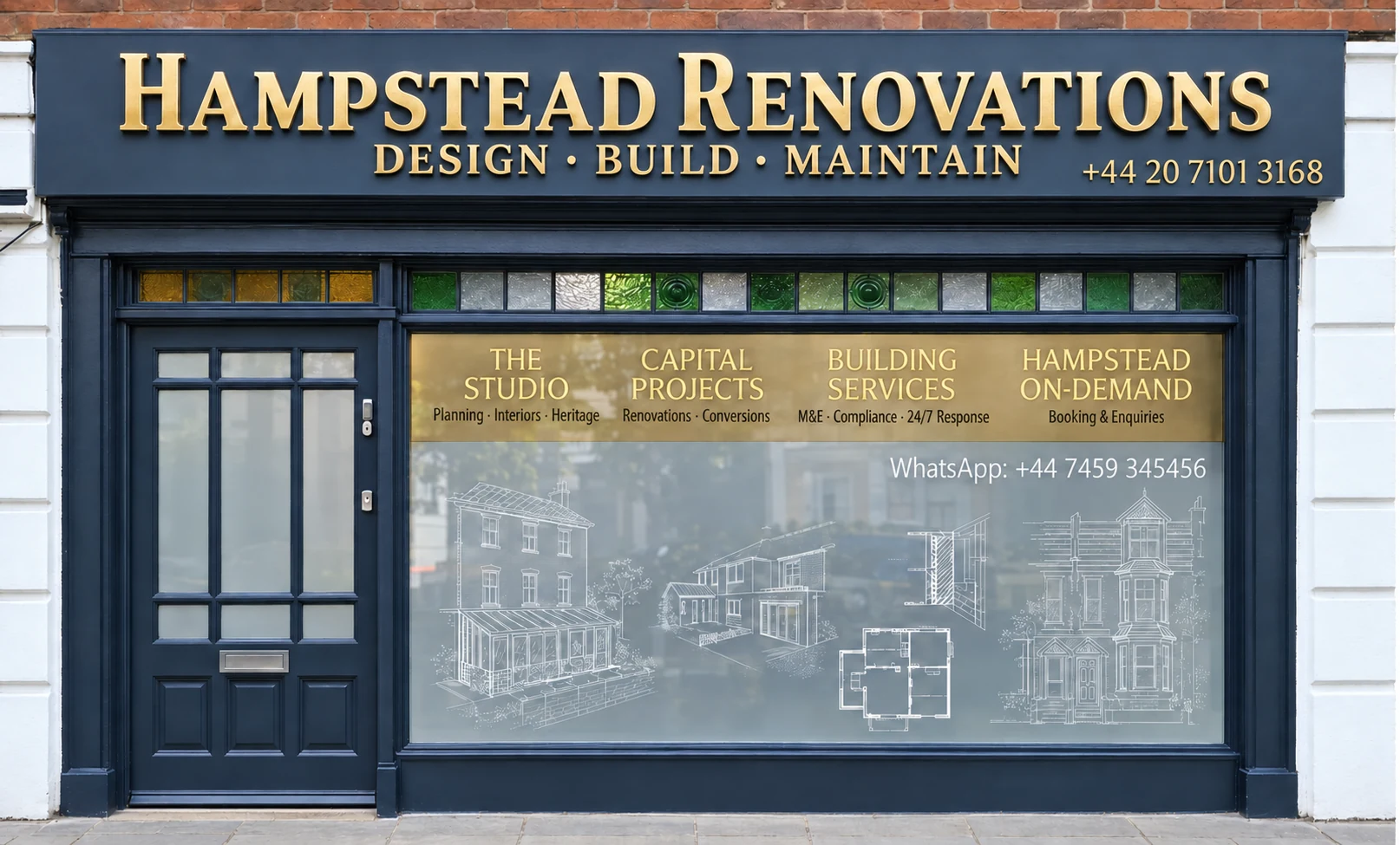
Hampstead Renovations design and build studio on Finchley Road
Our Hampstead studio · Finchley Road, NW3 6DN

St Albans projects

Choose the work your St Albans home needs

St Albans homes

What St Albans's houses are built like

The Local Plan names the historic cathedral city of St Albans and the town of Harpenden as the district's largest settlements, and describes most of its built-up area as suburban housing of the late nineteenth and twentieth centuries. In the city the older layers survive inside that. The conservation area character statement places the ancient core around the abbey on its hilltop, records how the coaching trade grew the town as the first major stop on the road from London, and describes Regency villas built beside two new roads of the late eighteenth and early nineteenth centuries, then terraces and factories once three railways had arrived. St Albans became a city on 28 August 1877.

The 2021 Census shows how much the housing changes from ward to ward. Of the 4,093 households in St Peters ward, 1,745 lived in a purpose-built block of flats and 297 in a converted or shared house. Verulam ward counted 1,290 households in detached houses out of 3,097. In Sopwell ward only 145 of 3,002 households lived in a detached house, against 995 semi-detached and 958 terraced, while Marshalswick West recorded 806 semi-detached and 635 detached among its 1,867 households.

Materials follow the period. On Fishpool Street the dominant historic finish is white-painted plaster render, with a fair amount of exposed timber framing, under high-pitched roofs mostly of plain clay tiles. The houses that made Verulam Road the best residential area of the 1830s and 1840s are terraces of yellow stock brick, tall and stuccoed, and the area keeps mainly slate roofs and timber sliding sashes. Albert Street's mid-Victorian terraces range from dark purple Luton Greys to soft reds, all under slate, while the late Victorian villas of Granville Road and Stanhope Road are mainly red brick with stone or stucco dressings.

Away from the centre the Local Plan describes a district that is mostly suburban and low-rise, generally no more than three storeys high. In the city that covers the Edwardian streets around Clarence Park, where the houses are in the main substantial and detached, the 1920s Arts and Crafts houses of Cunningham Avenue, and the later suburbs beyond them.

At the first visit we place the house in one of these groups before anything else, because its age and construction decide how its walls, floors and roof can be altered.

Sources: St Albans City and District Council: St Albans Local Plan Part A (adopted 9 September 2026); St Albans City and District Council: St Albans Conservation Area Character Statement, contents and introduction (published 2016); ONS / Nomis: Census 2021 TS044 accommodation type, ten St Albans city 2022 wards; St Albans City and District Council: St Albans Conservation Area Character Statement, Fishpool Street and St Michael's Village (character area 4c); St Albans City and District Council: St Albans Conservation Area Character Statement, Verulam Road (character area 5b); St Albans City and District Council: St Albans Conservation Area Character Statement, Holywell Hill and Sopwell Lane (character area 4d); St Albans City and District Council: St Albans Conservation Area Character Statement, Granville Road and Stanhope Road (character area 7j); St Albans City and District Council: St Albans Conservation Area Character Statement, Clarence Park (character area 7i); St Albans City and District Council: Conservation Area Character Statement for Cunningham Avenue (November 2014)

Approvals

Checks a St Albans project goes through

District-wide policy, from the Local Plan adopted on 9 September 2026 to the Green Belt size guide in Policy LG9, is set out on our St Albans district page. The cards below follow the order in which it reaches a project in the city, and add the local detail that alters the outcome here.

Plan adopted 9 September 2026

Who decides

Planning applications for St Albans addresses go to St Albans City and District Council, which decides them against St Albans Local Plan 2026 (Parts A and B) (adopted 9 September 2026). That plan wholly replaces the District Local Plan Review of 1994, which is no longer part of the development plan.

Conservation area and Article 4

The city has its own large conservation area, and Sopwell and Cunningham Avenue are designated separately. The council's District Mapping Service, or a My St Albans account, shows whether an address sits inside one and whether an Article 4 direction applies, and we check both for every property before design starts.

Heritage statement

Where work affects a listed building, a conservation area or their setting, Policy HE1 asks for a heritage statement proportionate to the scale of the proposal, referring to the conservation area character statement. We write it from our survey of the building.

Green Belt at the edges

For a house in the Green Belt, Policy LG9 compares an extension with the original building, defined as the house at 1 July 1948 or, for a later house, as originally built, and Table 3.3 gives a size guide. The whole of the Sopwell Conservation Area lies in the Green Belt. Our district page quotes the table row by row.

Building regulations

The St Albans and Watford shared building control service, which St Albans and Watford run together, handles sign-off, or a private registered approver can do so instead. Planning and building regulations are separate questions, and a project may need both.

Neighbours and trees

Anyone working on a party wall, or near the line between two plots, has to give the neighbour notice under the party wall rules, a process that stands apart from planning and building regulations. Trees in a conservation area that have no Tree Preservation Order are still protected by section 211 of the 1990 Act.

Archaeology

St Albans is rich in archaeological heritage, and Verulamium was the third largest town in Roman Britain. On or beside a site of known archaeological interest, Policy HE3 can require a desk-based assessment or a field evaluation before an application is decided.

Protected woodland

The Chilterns Beechwoods mitigation strategy screens out householder applications and replacement dwellings. An extension or a granny annexe is taken case by case, depending on whether it functions as a separate unit from the main dwelling.

Sources: St Albans City and District Council: Current Local Plan and SPDs (web page); St Albans City and District Council: St Albans Local Plan Part A (adopted 9 September 2026); St Albans City and District Council: Adoption Statement for the St Albans City & District Local Plan 2026 (notice dated 10 September 2026); St Albans City and District Council: Conservation areas (web page); St Albans City and District Council: Article 4 Direction areas (web page); St Albans City and District Council: Conservation Area Character Statement for Sopwell (July 2010); St Albans City and District Council: Building control (web page); GOV.UK: Building regulations approval (printable guide); GOV.UK: Building regulations approval - when you need approval; GOV.UK: Party walls and building work - overview; GOV.UK: Party walls and building work (printable guide); GOV.UK: Tree Preservation Orders and trees in conservation areas (planning guidance); St Albans City and District Council (examination document, Matter 1 Issue 7.2 Appendix 1): Chilterns Beechwoods SAC Mitigation Strategy for Ashridge Commons and Woods SSSI (Part A subject to finalisation)

Local policy

The St Albans conservation area, its character areas and Article 4s

Designated in 1969, the St Albans Conservation Area was among the first in the country, and its boundary has been extended four times since, in 1980, 1981, 1991 and 1996. The council uses its character statements when it assesses applications. The city's own statement, revised in 2014 and published in 2016, divides the conservation area into character areas that run from Verulamium and the Abbey precincts, through Fishpool Street, Holywell Hill and Sopwell Lane, to Victoria Street, Clarence Park and the Spencer Park estate.

Two Article 4 directions lie inside it, Verulam and Fishpool Street, and Sopwell Lane and Albert Street, and a third covers the separate Cunningham Avenue conservation area. An Article 4 direction means an application is needed for some works that the national rules would otherwise allow without one; the council gives the reason as the gradual erosion of character through unsympathetic external alterations.

Article 4 direction

Verulam and Fishpool Street

The Fishpool Street character area is largely covered by the direction, which withdraws permitted development rights for changes that could otherwise be made without permission. Its character statement credits the Verulam Road direction with keeping much of that area's traditional detail.

Article 4 direction

Sopwell Lane and Albert Street

Designated in July 1990 and confirmed in January 1991. On Albert Street every roof is slate except where a few were changed to concrete, which the statement calls a detrimental intrusion now controlled by the direction.

Article 4 direction

Cunningham Avenue

The conservation area was designated on 28 January 2014 and its Article 4 direction took effect that November. It brings extensions, including conservatories and garages, roof changes such as rooflights, porches, patios and hardstandings, exterior painting and heat pumps under planning control.

Sopwell

A small conservation area beside the River Ver on the south side of the city, designated on 30 April 1973 and extended in 2010. All of it lies in the Metropolitan Green Belt, so a house there meets both tests.

Locally listed buildings

Every locally listed building in the district stands in a conservation area, and the city's character statement identifies them. Local listing does not change whether permission is needed, but the council considers whether a proposal uses appropriate materials and keeps features of interest.

Windows and doors

The council's leaflet names Sopwell Lane and Fishpool Street as two of its largest conservation areas affected by Article 4 directions. Only windows and doors of exactly the same design, materials, colour and method of opening count as like-for-like replacements, and swapping timber for uPVC never does.

Two water constraints run through the city as well. The River Ver's flood zones take in parts of south-west St Albans and widen as the river passes through, and the flood extents of the Ellen and Butterwick Brooks, tributaries of the Colne, reach eastern St Albans. The 2018 flood assessment names southern St Albans and Marshalswick among the settlements at highest risk of groundwater flooding, and it notes that groundwater flooding has been recorded in the city itself, while most other incidents were in the surrounding settlements.

We look every address up on the Environment Agency's flood map for planning before design. Basement and groundwater policy for the whole district is on our St Albans district page.

Sources: St Albans City and District Council: St Albans Conservation Area Character Statement, contents and introduction (published 2016); St Albans City and District Council: Conservation areas (web page); St Albans City and District Council: Article 4 Direction areas (web page); St Albans City and District Council: Cunningham Avenue Article 4 Direction (leaflet); St Albans City and District Council: St Albans Conservation Area Character Statement, Fishpool Street and St Michael's Village (character area 4c); St Albans City and District Council: St Albans Conservation Area Character Statement, Verulam Road (character area 5b); St Albans City and District Council: St Albans Conservation Area Character Statement, Holywell Hill and Sopwell Lane (character area 4d); St Albans City and District Council: Conservation Area Character Statement for Sopwell (July 2010); St Albans City and District Council: Locally listed buildings (web page); St Albans City and District Council: Repair or Replacement of Windows and Doors (guidance leaflet); St Albans City and District Council (examination library ENV 004): South West Hertfordshire SFRA Appendix C - Understanding Flood Risk in St. Albans - Final Draft (2018); Environment Agency (GOV.UK service): Get flood risk information for planning in England (Flood map for planning)

Building fabric

Building types in St Albans and what they mean for the work

The character statement finds every period of the city's history still represented in its buildings. The Local Plan adds that traditionally constructed buildings have their own technical requirements, and that inappropriate retrofitting can cause long-term problems to their condition. Every group below brings different questions for our survey.

Timber frames behind render

What lies behind an old Fishpool Street front?

Many Fishpool Street buildings date from the sixteenth and seventeenth centuries and were re-faced in the eighteenth, and at the upper end jettied, timber-framed fronts are still on show. Sopwell Lane keeps medieval timber frames too, mostly plastered or rendered under steep tiled roofs.

Opening up is done a little at a time and photographed, and repairs are designed to work with the frame, in lime where the existing finishes are lime.

Regency and early Victorian terraces

Why are Verulam Road's details worth keeping?

Its tall terraces of yellow stock brick and stucco went up when Verulam Road was the city's best residential address, and the area still has mainly slate roofs and timber sliding sashes.

We survey sashes, shutters and door cases before specifying anything, and repair them in timber.

Mid-Victorian terraces

What has changed on the terraced streets?

Albert Street is still largely two-storey mid-Victorian terraces with timber sashes. On Liverpool Road, lined with terraces of about 1885, about half of the original slate roofs have been replaced with concrete tiles.

Where a roof is being renewed, we price natural slate and check the weight it brings back onto the rafters.

Late Victorian villas

Where is the third bedroom in a Granville Road villa?

Granville Road and Stanhope Road were built piecemeal, mostly two storeys with a few small dormers, as middle-sized houses with rearward projections to give a third bedroom; most were probably taken from builders' pattern books.

That rear projection is usually where a kitchen or bathroom goes, so we survey its walls and foundations closely.

Edwardian houses by Clarence Park

How should a Clarence Park house be extended?

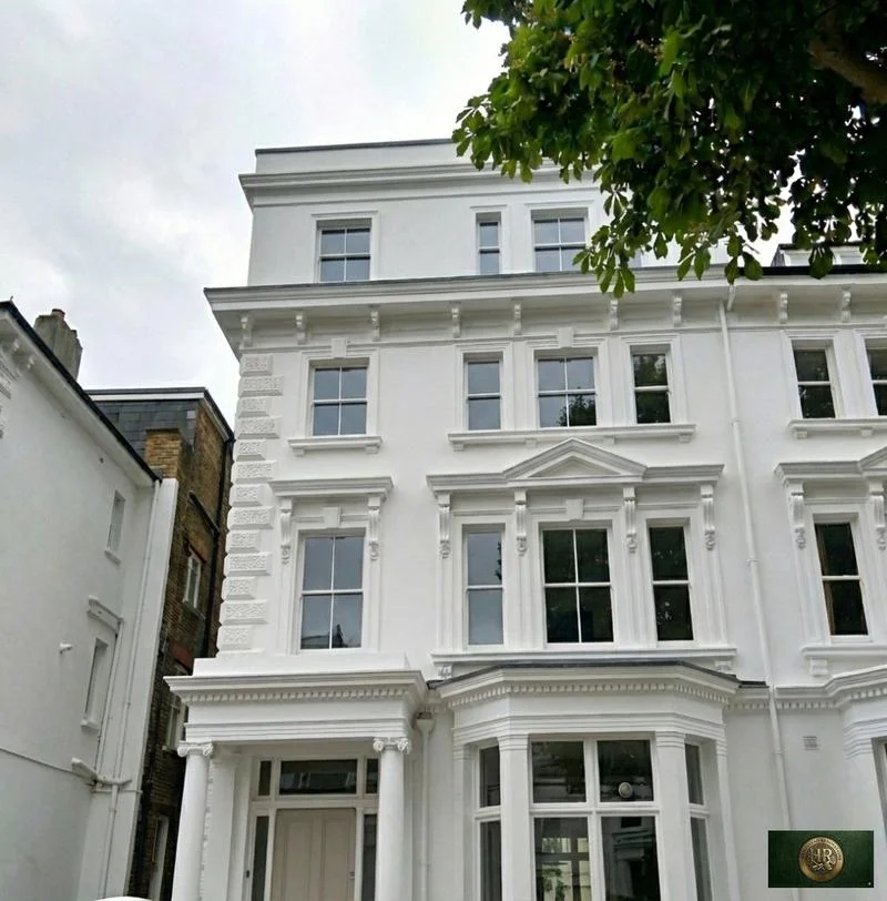
The statement calls the area one of the best preserved late Victorian and Edwardian areas in St Albans, with Queen Anne and Domestic Revival houses carrying white painted timber balconies, sashes and tile hanging, and it asks that new extensions repeat that detailing.

Our drawings record the balconies, tile hanging and bays so the new work can be detailed from them.

Inter-war Arts and Crafts

What makes Cunningham Avenue consistent?

Gabled roofs, timber-framed porches with fretwork, decorative timber windows, mock timber framing, tile hanging or pebbledash against red brick and clay tiled roofs. Later change has been mostly side extensions and alterations to finishes.

Under the Article 4 direction most of those alterations now need permission, so we design them from the start as a planning application.

Larger Victorian houses

What is under a Prospect Road house?

Many of the larger houses there have cellars, some with small areas to the front, and some have been converted to flats. Red brick predominates, alongside London stock bricks, pebbledash and render.

A cellar tells us a good deal about the ground and the walls above it, so we inspect it at the first visit.
Sources: St Albans City and District Council: St Albans Conservation Area Character Statement, contents and introduction (published 2016); St Albans City and District Council: St Albans Local Plan Part A (adopted 9 September 2026); St Albans City and District Council: St Albans Conservation Area Character Statement, Fishpool Street and St Michael's Village (character area 4c); St Albans City and District Council: St Albans Conservation Area Character Statement, Holywell Hill and Sopwell Lane (character area 4d); St Albans City and District Council: St Albans Conservation Area Character Statement, Verulam Road (character area 5b); St Albans City and District Council: St Albans Conservation Area Character Statement, Victoria Street (character area 7c); St Albans City and District Council: St Albans Conservation Area Character Statement, Granville Road and Stanhope Road (character area 7j); St Albans City and District Council: St Albans Conservation Area Character Statement, Clarence Park (character area 7i); St Albans City and District Council: Conservation Area Character Statement for Cunningham Avenue (November 2014); St Albans City and District Council: Cunningham Avenue Article 4 Direction (leaflet); St Albans City and District Council: St Albans Conservation Area Character Statement, Prospect Road (character area 7a)

On site

Access, parking and dropped kerbs in St Albans

How materials reach a St Albans address varies with the street. The character statements describe Fishpool Street as a busy thoroughfare where parked traffic dominates the streetscape in places, count on-street parking as a negative across the roads off Verulam Road, and record front gardens lost to parking, particularly along Alma Road.

Hertfordshire County Council, as highway authority, decides on any new crossing over the pavement: under the Highways Act 1980 nobody may drive over a pavement or verge unless a dropped kerb has been approved and installed by the county. It does not remove healthy highway trees to make room for one, and it will not approve hand digging around protected trees or in conservation areas. A new or extended driveway may also need planning permission, and in Cunningham Avenue the Article 4 direction covers hardstandings and new accesses to an unclassified road.

Extending a house does not normally mean adding parking spaces under Policy TRA4, but existing spaces should not be lost where that would leave a shortfall against the parking standards. We check this before an extension takes over a side drive or a garage.

Delivery points, skip and storage positions, neighbours' access and the protection of the property are all settled before work begins and written into a site set-up plan for you.

Sources: St Albans City and District Council: St Albans Conservation Area Character Statement, Fishpool Street and St Michael's Village (character area 4c); St Albans City and District Council: St Albans Conservation Area Character Statement, Verulam Road (character area 5b); St Albans City and District Council: St Albans Conservation Area Character Statement, Alma Road and Priory Park (character area 7d); Hertfordshire County Council: Residential Dropped Kerbs Policy, version 7 (8 May 2026); St Albans City and District Council: Cunningham Avenue Article 4 Direction (leaflet); St Albans City and District Council: St Albans Local Plan Part A (adopted 9 September 2026)

Scope

Scoping a St Albans project before a quote

We price a St Albans project once we understand the building and the address. Survey, planning route and constraints come first, so the quote reflects what the address really permits.

  1. Feasibility visit

    Together we go through every floor, record when and how the building was put together, look into any cellar or roof void, and judge from the pavement how a site could be organised.

  2. Address check

    We confirm for this specific property whether a conservation area, an Article 4 direction, listing or local listing, Green Belt, flood zone, groundwater risk or tree protection applies.

  3. Measured survey

    The building is drawn as found, with a note of anywhere earlier fabric could be hidden under later plaster or render.

  4. Design and route

    Drawings follow whichever consent route is open: permitted development if the rules allow it, otherwise a planning application carrying the heritage statement and plans the council requires.

  5. Engineering and sign-off

    Beams, openings and foundations are designed by our structural engineer, and we settle who will sign off the building regulations before pricing.

  6. Written scope

    A written schedule itemises the job from first strip-out to final handover, and our quote is calculated line by line from it.

Ready to take the next step? Send the property address and a short outline of what you want to change.

Book a free feasibility visit

Our Hampstead base, serving St Albans

Talk to our Finchley Road studio

Our studio is in Hampstead on Finchley Road, at NW3 6DN. We serve St Albans from this office. Bring us the practical questions about your house, flat or bathroom and the result you want to achieve.

Contact the studio to discuss your brief and arrange the next step. If you already have drawings, a lease or planning correspondence, tell us what is available.

Book a free feasibility visit
Hampstead Renovations
Unit 3 Palace Court
250 Finchley Road
London NW3 6DN

020 7101 3168
contact@hampsteadrenovations.co.uk

Find our studio on Google Maps

Our work

A London project to compare with St Albans

The project below is a London townhouse, not a St Albans one. What carries over is the method: a measured survey, engineering designed with the architecture, protection of the house and its neighbours, and sign-off before handover. What does not carry over is the local position, which we establish afresh for every St Albans address.

The biggest difference is below ground. The whole of St Albans district lies within source protection zones for groundwater, and the 2018 flood assessment advises that basements be avoided in high groundwater zones and that habitable basements should not be permitted in Flood Zone 3. A basement that suits a London street may not suit one here.

Our London team, in-house architects, designers and structural engineers working with Hampstead Chartered Surveyors & Building Consultancy, takes on projects in St Albans from the Finchley Road studio. Planning applications are decided by St Albans City and District Council, and building control goes through the St Albans and Watford shared building control service or a private registered building control approver.

Outside St Albans, and in London rather than Hertfordshire: Project example: Belsize Park, NW3. That project of ours is a Victorian townhouse of five storeys; its case study records a basement conversion, a rear extension and loft work, carried out together with a full refurbishment of the interior.

Sources: St Albans City and District Council: St Albans Local Plan Part A (adopted 9 September 2026); St Albans City and District Council (examination library ENV 001): South West Hertfordshire Strategic Flood Risk Assessment - Report - Final Draft (2018); St Albans City and District Council: Building control (web page); GOV.UK: Building regulations approval (printable guide); Hampstead Renovations: Belsize Park Gardens, NW3 case study

Questions from St Albans owners

Renovating in St Albans: questions we are asked

Which plan decides a planning application in St Albans since September 2026?

St Albans Local Plan 2026 (Parts A and B) (adopted 9 September 2026). The council adopted it at an extraordinary meeting on 9 September 2026, and it wholly replaces the District Local Plan Review of 1994, which with its supplementary documents is no longer part of the development plan. Applications are decided by St Albans City and District Council.

Is my St Albans house in the conservation area, and which character area is it in?

Many older streets are. The St Albans Conservation Area, designated in 1969 and extended four times, is divided in its character statement into character areas from Verulamium and the Abbey to Clarence Park and the Spencer Park estate, and Sopwell and Cunningham Avenue are separate conservation areas. The council's District Mapping Service or a My St Albans account shows the boundary for an address, and we confirm it before design.

Do the Verulam and Fishpool Street, Sopwell Lane or Cunningham Avenue Article 4 directions apply to my home?

Only if the property lies inside one. The first two are within the St Albans Conservation Area; Cunningham Avenue has its own conservation area and direction, in force since 3 November 2014. Inside any of them, works such as altering windows, doors or a roof can need an application even where the national rules would not require one. The council's map layer shows each area, and we check it for the address.

What is the Green Belt test for extending a house on the edge of the city?

Policy LG9 of the Local Plan. Extensions should not create a building disproportionately larger, or of significantly different character, than the original building, which the policy defines as the house at 1 July 1948 or, if built later, as originally constructed. Table 3.3 gives a guide to the size that will normally be permitted, and our St Albans district page quotes it in full.

Is my St Albans address near the River Ver flood zones or a high-groundwater area?

Parts of south-west St Albans are in the Ver's flood zones, and the brooks feeding the Colne affect eastern St Albans. Separately, the 2018 flood assessment lists southern St Albans and Marshalswick among the places at highest risk of groundwater flooding. For every address we look at the Environment Agency's flood map for planning, then at the assessment's groundwater maps.

Who signs off building regulations for St Albans addresses?

The St Albans and Watford shared building control service, which St Albans and Watford councils deliver together, or, if you prefer, a private registered building control approver. Some work needs no separate application: an electrician on a competent person scheme, for example, certifies their own wiring.

Who builds a dropped kerb for a St Albans driveway?

Hertfordshire County Council, as highway authority. Driving over a pavement or verge is not allowed under the Highways Act 1980 unless the county has approved and installed a dropped kerb. A new or extended driveway can also need planning permission, and the county will not approve hand digging around trees in a conservation area.

How do you serve St Albans from your Finchley Road studio?

Drawings, engineering and the management of each job are handled from the Finchley Road studio in Hampstead, NW3, and we keep no premises in Hertfordshire. On site a project manager and our own team run the work, and you have a single point of contact throughout.

Independent
Surveying
Hampstead Renovations operates alongside Hampstead Chartered Surveyors & Building Consultancy — an RICS Regulated firm providing chartered building surveying, under shared directorship.
Explore Nearby Areas

Book a free feasibility visit

Hertfordshire overview
Renovations in Hertfordshire →

See how St Albans fits within our wider Hertfordshire pages.

Full Service Directory

Pages for St Albans

Every service page we publish for St Albans.

St Albans

House Refurbishment in St Albans →

St Albans

Flat Refurbishment in St Albans →

St Albans

House Extensions in St Albans →

St Albans

Kitchen Renovation in St Albans →

St Albans

Bathroom Renovation in St Albans →

St Albans

Loft Conversions in St Albans →

St Albans

Basement Conversions in St Albans →

Chat with us!