
Buckinghamshire · Chiltern, South Bucks and Wycombe · Studio in Hampstead, NW3

Buckinghamshire Renovations & Design-Build

Updated 6 November 2026

House refurbishment, extensions, loft and basement conversions, kitchens, bathrooms and flats in nine Buckinghamshire towns, designed, engineered and built by the team at our Finchley Road studio.

This page collects what applies across the county: who decides, which older plan still governs each area, how far the new county-wide plan has got, what national permitted development rules allow, and the landscape, woodland, flood and groundwater questions to settle before design. The Chiltern, South Bucks and Wycombe pages then set out their own plans and Green Belt tests in full.

Serving Buckinghamshire from our Hampstead studio · NW3 6DN
020 7101 3168

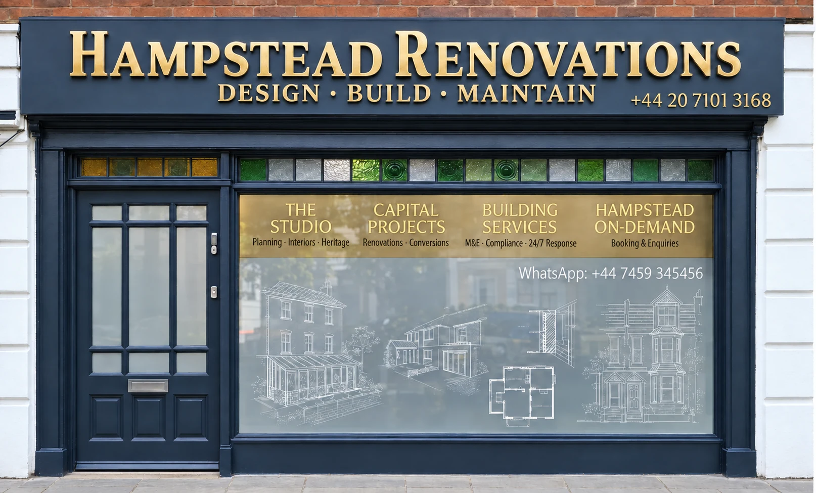
Hampstead Renovations design and build studio on Finchley Road
Our Hampstead studio · Finchley Road, NW3 6DN

Three areas

Find your Buckinghamshire area and town

01 Five towns

Chiltern

The Chiltern page sets out the 1997 Local Plan and 2011 Core Strategy, the GB12 and GB13 extension tests with design policies H13 to H17, the Misbourne, and the made plans in the Chalfonts and Penn. It leads to Amersham, Chalfont St Peter, Chalfont St Giles, Great Missenden and Penn.

  • GB12, GB13 and LSQ1
  • Misbourne flood zones
  • Five town pages
Explore Chiltern

02 Two towns

South Bucks

The South Bucks page works through the 1999 Local Plan and its Green Belt floorspace tests, GB10 and GB11, the Residential Areas of Exceptional Character, Burnham Beeches and the flood record, with links to Gerrards Cross and Beaconsfield.

  • GB10 and GB11
  • H10 areas of exceptional character
  • Gerrards Cross and Beaconsfield
Explore South Bucks

03 Two towns

Wycombe

The Wycombe page covers the 2019 Local Plan and the council's review of it, the DM43 volume bands, the Thames flood zones and the Wooburn and Bourne End plan, and links to Marlow and Bourne End.

  • DM42 and DM43
  • Marlow and Bourne End pages
  • Thames flood zones
Explore Wycombe

Before any drawing

How we take on work in Buckinghamshire

Our London team takes on Buckinghamshire projects from the Finchley Road studio in Hampstead, NW3; we have no office or branch in the county. The team is made up of in-house architects, designers and structural engineers, and works with Hampstead Chartered Surveyors & Building Consultancy.

Planning decisions for every address on these pages rest with Buckinghamshire Council. Building regulations go either to Buckinghamshire Council's building control service or to a private registered building control approver of your choosing.

Nine towns have their own pages: Amersham, Chalfont St Peter, Chalfont St Giles, Great Missenden and Penn in the Chiltern area, Gerrards Cross and Beaconsfield in South Bucks, and Marlow and Bourne End in the Wycombe area. Each one leads to pages for all seven of our services.

  1. Address checks

    Before anyone visits, the address is run through the plan area, the protected landscape boundary, the Green Belt, conservation area and listing records, and the flood map.

  2. First visit

    We walk the house with you, note how it was built and altered, and listen to what the rooms need to do differently.

  3. Survey and feasibility

    A measured survey follows, then a feasibility study that tests the options against the area's policies before any design is fixed.

  4. Drawings and approvals

    Planning drawings, structural design and the building regulations package are prepared in-house and submitted in the right order.

  5. Build and sign-off

    The same team builds the scheme, calls each inspection and hands over the completion certificate with the drawings.

Sources: legislation.gov.uk: The Buckinghamshire (Structural Changes) Order 2019 (SI 2019/957), Part 2, as made (22 May 2019); Buckinghamshire Council: Local Development Scheme, 3. Our current plans and documents (last updated 16 March 2026); Buckinghamshire Council: Building regulations and control; GOV.UK: Building regulations approval - when you need approval

One council

One council for the whole county since 1 April 2020

The Buckinghamshire (Structural Changes) Order 2019 established Buckinghamshire Council as the sole principal authority for Buckinghamshire, and on 1 April 2020 the old districts were abolished as local government areas. The council came into effect on that date, bringing together the former county council and the district councils of Aylesbury Vale, Chiltern, South Bucks and Wycombe.

Planning policy did not start again. The council inherited each legacy council's development plan documents and still uses them to make local planning decisions in the former district areas, so an application is read against the plan of the area the house stands in. Its Local Development Scheme, last updated on 16 March 2026, lists those plans by planning area.

Plans of 1997 and 2011

Chiltern: the east planning area

The former Chiltern District local plan area: the Chiltern District Local Plan (adopted 1 September 1997, consolidated September 2007 and November 2011) and Core Strategy for Chiltern District (adopted 15 November 2011). Green Belt extensions are tested under GB12 or GB13, and the protected landscape under LSQ1.

Chiltern plans and Green Belt tests

Plans of 1999 and 2011

South Bucks: the south planning area

The former South Bucks District local plan area: the South Bucks District Local Plan (adopted 22 March 1999, consolidated September 2007 and February 2011) and South Bucks Core Strategy (adopted February 2011). Green Belt extensions are measured by floorspace under GB10, and rebuilding a house under GB11.

South Bucks plans and Green Belt tests

Plans of 2019 and 2013

Wycombe: the west planning area

The former Wycombe District local plan area: the Wycombe District Local Plan (adopted August 2019) and Delivery and Site Allocations Plan (adopted 2013). Green Belt extensions are measured by volume under DM43, a policy the council's own review rates partially out of date.

Wycombe plans and Green Belt tests

The north and central planning areas, the old Aylesbury Vale, run on the Vale of Aylesbury Local Plan adopted in 2021, and our pages do not cover them. A minerals and waste plan adopted in 2019 applies across the whole council area, and the joint Chiltern and South Bucks Local Plan to 2036 has been withdrawn.

Because each area keeps its own plan, the first thing we settle for any address is which one applies, and every policy quoted in our drawings and statements is taken from that area's documents.

Sources: legislation.gov.uk: The Buckinghamshire (Structural Changes) Order 2019 (SI 2019/957), Part 2, as made (22 May 2019); Buckinghamshire Council: Local Development Scheme, 3. Our current plans and documents (last updated 16 March 2026); Chiltern District Council: Chiltern District Local Plan, adopted 1 September 1997 (alterations 29 May 2001; consolidated September 2007 and November 2011); Chiltern District Council: Core Strategy for Chiltern District (adopted 15 November 2011); South Bucks District Council: South Bucks District Local Plan, adopted March 1999, consolidated September 2007 and February 2011; South Bucks District Council: South Bucks Core Strategy DPD (adopted February 2011); Wycombe District Council: Wycombe District Local Plan (adopted August 2019); Buckinghamshire Council: Regulation 10A Review of the Wycombe District Local Plan and the Delivery and Site Allocations Plan (June 2025)

The new plan

The new county-wide local plan, to 2045

The council is preparing one local plan for its whole area, for the period up to 2045, and it will be part of the development plan. It is meant to guide decisions on where new homes, jobs, infrastructure and community facilities should be located.

A first draft went out for Regulation 18 consultation in September and October 2025. The Regulation 19 consultation, described by the council as the final statutory opportunity to make representations, ran from 23 July 2026 until 6 September 2026 and has now closed.

No later than 31 December 2026

Submission

The council will send the draft plan, its supporting evidence and the consultation responses to the Planning Inspectorate, subject to approval by Full Council.

Due in 2027

Examination

The draft and every duly made representation go before an independent Planning Inspector at an Examination in Public, and the Inspector may recommend Main Modifications.

Scheduled for late 2027

Adoption

The council's scheme places the Inspector's report and adoption between September 2027 and December 2027, when the plan is to be presented to Full Council.

Until it is adopted, it remains emerging policy, and the council goes on using the legacy plans of each former district area for local planning decisions.

We design to the adopted policies and note any draft policy that points another way, so a scheme drawn now does not rest on wording that may still change at examination.

Sources: Buckinghamshire Council: Local Development Scheme, 4. Plans we will work on (last updated 16 March 2026); Buckinghamshire Council: Draft Local Plan for Buckinghamshire 2045 (Regulation 19 consultation); Buckinghamshire Council: Statement of Representations Procedure, Regulation 19 Local Plan (updated 9 September 2026); Buckinghamshire Council: Local Development Scheme, 3. Our current plans and documents (last updated 16 March 2026)

National rules

Permitted development on Buckinghamshire houses

Plenty of work to a house can go ahead without an application, because the General Permitted Development Order 2015 grants the permission itself. In Schedule 2, Part 1, Class A deals with enlarging, improving or otherwise altering a house, and Class B with an addition or alteration to its roof.

Those rights shrink on article 2(3) land. The Order defines it through Schedule 1, Part 1, which takes in conservation areas and any area of outstanding natural beauty, so a house in the Chilterns National Landscape or in any conservation area in the county is covered.

GPDO 2015, paragraph A.2

Class A on article 2(3) land

Class A does not permit cladding any part of the exterior in stone, artificial stone, pebble dash, render, timber, plastic or tiles, an enlargement beyond a side wall of the original house, or a rear extension of more than one storey beyond its original rear wall.

GPDO 2015, paragraphs B.1 and E.3

Roofs and garden buildings

Class B does not apply to a house on article 2(3) land, so a roof extension there cannot rely on it. Under Class E, no part of an outbuilding may stand between a side wall of the house and the boundary.

Local controls can narrow the rights further. An Article 4 Direction removes permitted development rights and gives the council further control, and the council publishes the directions it has issued. Conditions do the same on particular houses: the Chiltern-area policy GB7 and the South Bucks policy GB11 both let a replacement house that is larger than the original lose specified rights by condition.

When the position is uncertain, a lawful development certificate from the council settles it with a decision that is legally binding.

If a scheme leans on permitted development, we search the planning history for conditions, confirm which designations touch the plot, and suggest a certificate before work starts whenever the margin is narrow.

Sources: legislation.gov.uk: GPDO 2015 (SI 2015/596), Schedule 2 Part 1, development within the curtilage of a dwellinghouse (latest available revised); legislation.gov.uk: Town and Country Planning (General Permitted Development) (England) Order 2015 (SI 2015/596), article 2 (latest available revised); legislation.gov.uk: GPDO 2015 (SI 2015/596), Schedule 1 Part 1, Article 2(3) land (latest available revised); Chilterns National Landscape (Chilterns Conservation Board): Chilterns National Landscape Boundary Review (page last updated 25 June 2025); Buckinghamshire Council: Article 4 Directions; GOV.UK (Planning Practice Guidance): When is permission required?; Chiltern District Council: Chiltern District Local Plan, adopted 1 September 1997 (alterations 29 May 2001; consolidated September 2007 and November 2011); South Bucks District Council: South Bucks District Local Plan, adopted March 1999, consolidated September 2007 and February 2011

Protected landscape

The Chilterns National Landscape in Buckinghamshire

In the words of the Chilterns Conservation Board, the National Landscape is an Area of Outstanding Natural Beauty, a formal designation for land of national importance for its natural beauty, and the Countryside and Rights of Way Act 2000 gives it legal protection. The Chiltern-area Local Plan records that the designation was confirmed in December 1965.

Its boundary is settled for now. Natural England has confirmed the cancellation of the Chilterns boundary review because of national budget cuts and says the existing boundary is unaffected and remains in place; as the Wycombe plan puts it, the boundary is set by Government.

Inside the boundary

Natural England's boundary data returns the Chilterns at the Great Missenden and Prestwood points, and Penn's neighbourhood plan puts 80% of the parish in the AONB and the Green Belt. A point on Marlow's northern edge is inside as well.

Outside at the town point

The points for Amersham, Chalfont St Giles, Chalfont St Peter, Beaconsfield, Gerrards Cross and central Marlow return no designation, although the South Bucks area's Core Strategy places the AONB north of Beaconsfield.

Not in it

The Wycombe-area Local Plan describes the Bourne End and Wooburn area as surrounded by the Green Belt but not by the AONB.

National policy looks past the line as well. Inside a Protected Landscape it wants proposals limited in scale and extent and sensitively sited and designed, and within its setting it asks for location and design that avoid, or keep to a minimum, any adverse impact on the landscape.

Each area applies its own landscape policy: LSQ1 in the Chiltern area, Core Policy 9 in South Bucks and DM30 in the Wycombe area, each set out on the area's page.

Our address checks include Natural England's boundary layer. Where a house is inside it or close to it, the scheme starts from the narrower rights and from the local palette of brick, flint and clay tile.

Sources: Chilterns National Landscape (Chilterns Conservation Board): Chilterns National Landscape Boundary Review (page last updated 25 June 2025); Natural England (GOV.UK): Areas of outstanding natural beauty (AONBs): designation and management (last updated 19 November 2024); Chiltern District Council: Chiltern District Local Plan, adopted 1 September 1997 (alterations 29 May 2001; consolidated September 2007 and November 2011); Natural England: Chilterns AONB Boundary Review - Natural Beauty Assessment (NECR691), publication record (uploaded 2026/06/26); Wycombe District Council: Wycombe District Local Plan (adopted August 2019); Natural England Open Data: Areas of Outstanding Natural Beauty (England), point query at the OS Open Names point for Great Missenden; Natural England Open Data: Areas of Outstanding Natural Beauty (England), point query at the OS Open Names point for Prestwood; Penn Parish Council / Buckinghamshire Council: Penn Parish Neighbourhood Plan 2022-2040, Made Plan (made 8 May 2025); planning.data.gov.uk (MHCLG, Natural England data): AONB point query 51.585,-0.785 (north edge of Marlow); Natural England Open Data: Areas of Outstanding Natural Beauty (England), point query at the OS Open Names point for Amersham; Natural England Open Data: Areas of Outstanding Natural Beauty (England), point query at the OS Open Names point for Chalfont St Giles; Natural England Open Data: Areas of Outstanding Natural Beauty (England), point query at the OS Open Names point for Chalfont St Peter; Natural England Open Data: Areas of Outstanding Natural Beauty (England), point query at the OS Open Names point for Beaconsfield; Natural England Open Data: Areas of Outstanding Natural Beauty (England), point query at the OS Open Names point for Gerrards Cross; planning.data.gov.uk (MHCLG, Natural England data): AONB point query 51.5707,-0.7756 (Marlow centre); South Bucks District Council: South Bucks Core Strategy DPD (adopted February 2011); MHCLG (GOV.UK): NPPF Chapter 19, Conserving and enhancing the natural environment (N1-6) (August 2026); MHCLG (GOV.UK): NPPF Annex B, Glossary (August 2026)

Protected woodland

Burnham Beeches and new homes

Burnham Beeches became a Special Area of Conservation to protect its 'beech forest on acid soil' habitat, and like every SAC it is protected under the Conservation of Habitats and Species Regulations 2017, the highest degree of protection available in law. Its southern part, Burnham Beeches National Nature Reserve, is a Public Open Space owned and managed by the City of London Corporation as a charity.

The council's mitigation strategy, a supplementary planning document adopted in November 2020, covers only the east and south planning areas, the former Chiltern and South Bucks districts, and does not apply to the former Wycombe area. Its subject is net new residential development, and the document links a net increase in homes to more visits to the reserve.

Closest to the reserve, in the south planning area, the strategy presumes against residential development within 500 linear metres of its edge. Out to 5.6 kilometres, its core zone of influence, additional residential properties need habitats assessment and mitigation.

The west has its own arrangement. Little Marlow Lakes Country Park hosts a SANG, approved by the council's Cabinet on 2 January 2025 as part of the mitigation agreed for housing at Hollands Farm. Burnham Beeches is also a different site from the Chilterns Beechwoods SAC, which the JNCC lists under its own code.

A brief that might add a dwelling is measured against the strategy's zones at the first meeting, so any mitigation is known before the design is fixed.

Sources: Buckinghamshire Council: Development in the Burnham Beeches Special Area of Conservation; Buckinghamshire Council: Burnham Beeches SAC Strategic Access Management and Monitoring Strategy SPD (adopted November 2020); JNCC: Chilterns Beechwoods Special Area of Conservation (UK0012724)
Flood and groundwater

The Misbourne, the Thames and chalk groundwater

The Misbourne runs through Amersham Old Town, Great Missenden and both Chalfonts and along the eastern boundary of Gerrards Cross, with Flood Zone 2 or 3a on its course in each. The Thames brings Flood Zones 3a and 3b to parts of Marlow and Flood Zone 3a to the southern area of Bourne End.

Groundwater is the other half of the picture. The Environment Agency notes that flooding from groundwater is most common where the underlying bedrock is chalk, and the Chiltern and South Bucks assessment records rising groundwater flooding basements in Old Amersham. Around a point where water is abstracted for domestic supply or for food production lies a source protection zone 1, and there the Agency's stated position is to object in principle to planning applications for development that could physically disturb an aquifer.

For a single address the Environment Agency's Flood Map for Planning comes first: it shows whether a flood risk assessment is needed and provides a printable flood map. Each area's own Strategic Flood Risk Assessment then adds local detail, from the 2014 update in the Wycombe area to the 2018 assessment shared by Chiltern and South Bucks.

No basement is promised from the street. Ground investigation with groundwater readings, the flood zone and the source protection zone decide whether one makes sense, and the answer comes once those are known.

Sources: Chiltern and South Bucks District Councils: Strategic Flood Risk Assessment Level 1 (November 2018); Chiltern and South Bucks District Councils: Strategic Flood Risk Assessment Level 1 (December 2018); Wycombe District Council: Strategic Flood Risk Assessment Level 1 Update (November 2014); Environment Agency: The Environment Agency's approach to groundwater protection (LIT 7660; under review); Environment Agency (GOV.UK): Groundwater source protection zones (SPZs) (last updated 1 August 2024); Environment Agency (GOV.UK service): Get flood risk information for planning in England (Flood map for planning)

Sign-off

Building control and dropped kerbs in Buckinghamshire

Building regulations sit apart from planning. Across the county the council's service is Buckinghamshire Council's building control service, whose pages cover making an application, booking a site inspection and finding the building control history of a property, with guidance on renovating buildings and on extensions.

The council is not the only option: national guidance lets an owner use a private registered building control approver, and it also notes that the person doing the work could be prosecuted and fined for not complying with building regulations.

Highways belong to the council as well. Lowering the kerb outside a house for vehicle access needs a vehicular access licence from Buckinghamshire Council, and its checklist runs from the planning position to your contractor's risk assessment and method statement and statutory undertaker plans.

Our engineers produce the calculations and our site managers book the inspections, so building control sees one consistent set of drawings from the first application to the completion certificate.

Sources: GOV.UK: Building regulations approval - when you need approval; Buckinghamshire Council: Building regulations and control; Buckinghamshire Council: Apply for a dropped kerb licence

Our Hampstead base, serving Buckinghamshire

Talk to our Finchley Road studio

Our studio is in Hampstead on Finchley Road, at NW3 6DN. We serve Buckinghamshire from this office. Bring us the practical questions about your house, flat or bathroom and the result you want to achieve.

Contact the studio to discuss your brief and arrange the next step. If you already have drawings, a lease or planning correspondence, tell us what is available.

Book a feasibility visit
Hampstead Renovations
Unit 3 Palace Court
250 Finchley Road
London NW3 6DN

020 7101 3168
contact@hampsteadrenovations.co.uk

Find our studio on Google Maps

Our work

A London project to compare before you brief us

The example below is a London house, not one in Buckinghamshire. Look at it for the way several kinds of work were planned together and handled by one team, which is how a whole-house brief is run wherever it is.

Our renovation guides go through each stage in more depth, and the London pages for house extensions, loft conversions, basement conversions, house refurbishment, flat refurbishment, kitchen renovation and bathroom renovation explain how each kind of job is organised. The all areas page shows Buckinghamshire beside the rest of the places we cover.

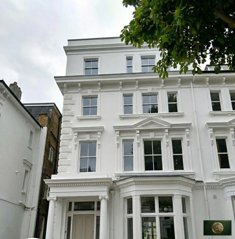
Outside Buckinghamshire, and in London rather than Buckinghamshire: Project example: Belsize Park, NW3. That project of ours is a Victorian townhouse of five storeys; its case study records a basement conversion, a rear extension and loft work, carried out together with a full refurbishment of the interior.

Sources: Hampstead Renovations: Belsize Park Gardens, NW3 case study

Buckinghamshire questions

Renovating in Buckinghamshire: what people ask first

Do you take on projects in Buckinghamshire, and how?

Yes. Our London team of in-house architects, designers and structural engineers, working with Hampstead Chartered Surveyors & Building Consultancy, takes on projects in nine Buckinghamshire towns from our Finchley Road studio in Hampstead, NW3; we have no office in the county. Planning is decided by Buckinghamshire Council, and building control runs through Buckinghamshire Council's building control service or a private registered building control approver.

Which plan decides my application when Buckinghamshire has one council?

The plan of the former district area the house is in. Buckinghamshire Council uses the 1997 Local Plan and 2011 Core Strategy in the Chiltern area, the 1999 Local Plan and 2011 Core Strategy in South Bucks, and the 2019 Local Plan and the 2013 allocations plan in the Wycombe area, together with any made neighbourhood plan.

Where has the new county-wide local plan got to, and what does it change for now?

Its Regulation 19 consultation closed on 6 September 2026, submission to the Planning Inspectorate is due no later than 31 December 2026, and the Examination in Public is due to take place in 2027. It has not been adopted, so applications are still decided under the legacy plans of each area.

Is my home in the Chilterns National Landscape, and what changes on article 2(3) land?

Check the address on Natural England's boundary data: the Great Missenden and Prestwood points are inside, as are 80% of Penn parish and a point on Marlow's northern edge, while the Amersham, Chalfont, Beaconsfield and Gerrards Cross points are outside. On article 2(3) land Class A extensions are narrower, Class B roof additions are not permitted development, and a Class E outbuilding cannot stand between a side wall and the boundary.

Does the Burnham Beeches SAC affect an extension to my house?

The council's strategy for the SAC is tied to net new residential development in the east and south planning areas, with a presumption against residential development within 500 linear metres of the boundary in the south planning area, and it does not apply in the former Wycombe area. If a scheme would add a dwelling, it should be checked against the strategy before design starts.

Who provides building control in Buckinghamshire?

Buckinghamshire Council's building control service, which takes building regulations applications, books site inspections and holds the building control history of properties. A private registered building control approver can be appointed instead, and tells the local authority about the work by giving an initial notice.

Who approves a dropped kerb in Buckinghamshire?

Buckinghamshire Council, through a vehicular access licence for lowering the kerb outside your house. The application needs a planning permission or a lawful development certificate, plans of the access and of any change to the front boundary, and a contractor qualified under the New Roads and Street Works Act 1991.

Independent
Surveying
Hampstead Renovations operates alongside Hampstead Chartered Surveyors & Building Consultancy — a firm providing chartered building surveying, under shared directorship.
Explore Nearby Areas

Book a feasibility visit

All areas
All areas we cover →

See how Buckinghamshire sits alongside the London areas on our areas page.

Full Service Directory

Pages for Buckinghamshire

Every district page we publish for Buckinghamshire.

Buckinghamshire

Chiltern →

Buckinghamshire

South Bucks →

Buckinghamshire

Wycombe →

Chat with us!