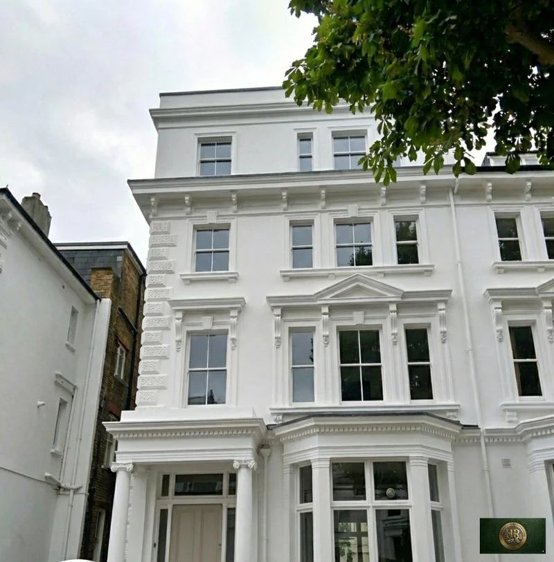
House
extensions
in Bourne End, SL8

Designers, Architects, Engineers & Builders Under One Roof.
One Studio. One Contract. One Team.
An extension in Bourne End is tested three ways before it is drawn: against the flood map along the Thames, against the conservation area guidance by the river and on Upper Hedsor Road, and, at the edge of the village, against the Green Belt.
Plots differ more than houses do. Riversdale's villas sit in large plots facing the river, their gardens kept open towards the bank; Upper Bourne End is a ribbon of roadside cottages whose back gardens stop where the fields begin; and the census ward counted 1,630 households in semi-detached houses and 954 in terraces in 2021, where a rear extension will often reach the boundary with next door.
The flood assessment and the parish plan both shape what is possible. The southern part of the village lies in Flood Zone 3a, and the neighbourhood plan expects much of the area's further building to come from residential extension, infill and backland development.
Sources: Buckinghamshire Council: Riversdale & Hedsor Road Conservation Area Appraisal (February 2018); ONS/Nomis: Census 2021 TS044 Accommodation type, 2022 ward The Wooburns, Bourne End and Hedsor (E05013162); Wycombe District Council: Strategic Flood Risk Assessment Level 1 Update (November 2014); Wooburn and Bourne End Parish Council: Neighbourhood Development Plan 2013-2033, referendum version (28 June 2023)
What a Bourne End house can add without an application
Outside the conservation area, a single-storey rear extension can be permitted development if it reaches no further than 4 metres past the original rear wall of a detached house, or 3 metres for any other house. Away from article 2(3) land a larger single-storey extension, up to 8 or 6 metres, can go ahead after the council's prior approval process, and any part within 2 metres of the boundary is held to 3 metres at the eaves.
Rear extensions with two or more storeys are limited to 3 metres beyond the rear wall and must keep 7 metres from the boundary opposite it. Across every extension and outbuilding, no more than half of the plot around the original house can be built over, and outside materials must look like those of the house.
Inside the Riversdale and Hedsor Road conservation area, which counts as article 2(3) land, Class A permits no side extension, no rear extension of more than one storey and no cladding of the outside in stone, render, timber, plastic or tiles. Side and two-storey rear extensions there therefore need planning permission.
Where a scheme sits close to the limits, a lawful development certificate from the council settles the question. Permitted development never removes the need for building regulations approval or party wall notices.
Sources: legislation.gov.uk: GPDO 2015 (SI 2015/596), Schedule 2 Part 1, development within the curtilage of a dwellinghouse (latest available revised); legislation.gov.uk: Town and Country Planning (General Permitted Development) (England) Order 2015 (SI 2015/596), article 2 (latest available revised); legislation.gov.uk: GPDO 2015 (SI 2015/596), Schedule 1 Part 1, Article 2(3) land (latest available revised); GOV.UK (MHCLG): Permitted development rights for householders: technical guidance (September 2019)
Flood Zone 3a, the river bank and the Green Belt edge
In Flood Zone 3a, which takes in numerous homes along Riversdale, the flood assessment's development table says building extensions, outbuildings included, should be discouraged to avoid raising flood levels elsewhere. In Flood Zone 2 it asks for them to be designed carefully so they do not block overland flow paths and raise the risk to adjoining properties.
National policy wants a site-specific flood risk assessment with development proposals in Flood Zones 2, 3a and 3b, although householder development is excused the sequential test. The local assessment asks those reports to set out flood resilience and resistance measures, and generally wants floor levels at least 300mm above the 1 in 100 river flood level including climate change, though that varies with the zone and the kind of development.
Gardens that run down to the water bring another consent. The Local Plan notes that works near a main river, closer than 8 metres to it or in its floodplain, may need an Environment Agency permit, and the neighbourhood plan asks development beside a watercourse to keep an ecological buffer back from the top of its bank.
The Local Plan describes the area as surrounded by the Green Belt. For a house inside it, policy DM43 sets the conditions an extension must meet to be appropriate and asks that it look proportionate to the original dwelling, while national policy allows extensions that add nothing disproportionate to the building as it stood on 1 July 1948. The volume thresholds are set out on our Wycombe page.
Sources: Wycombe District Council: Strategic Flood Risk Assessment Level 1 Update (November 2014); MHCLG (GOV.UK): NPPF Chapter 18, Managing flood risk and coastal change (F1-9) (published 29 September 2026); Wycombe District Council: Wycombe District Local Plan (adopted August 2019); Environment Agency and Defra (GOV.UK): Flood risk activities: environmental permits (last updated 9 October 2026); Wooburn and Bourne End Parish Council: Neighbourhood Development Plan 2013-2033, referendum version (28 June 2023); MHCLG (GOV.UK): NPPF Chapter 13, Protecting Green Belt land (GB1-8) (August 2026)
Designing for the conservation area and the parish plan
The appraisal wants an extension to relate to the original building rather than stand beside it as a separate object, subservient to the main house and with a lower roofline. It should not dominate the house or swallow a historic plot, and the gaps between buildings, which keep each one distinct, should not be filled.
Sides and rears seen from public places must be as well designed as fronts. Good modern design is not ruled out, and the local palette is traditional brick for walls with sand-faced clay tiles and slate for roofs. Since 2006 most applications in the conservation area have needed a design and access statement.
Policy PD1 of the neighbourhood plan adds its own test: extensions in a conservation area should respect its character and appearance, and proposals affecting heritage assets need a proportionate statement of heritage significance. From the Berkshire bank the Thames Path gives continuous views of the riverside houses in their grounds, so we draw a river elevation as carefully as the street one.
Two practical points come up often. The neighbourhood plan warns that putting an extension where a garage stood can move parked cars onto the street, so we show where they will go; and building at the boundary, or working on an existing party wall, means serving notice on the neighbour.
Sources: Buckinghamshire Council: Riversdale & Hedsor Road Conservation Area Appraisal (February 2018); Wooburn and Bourne End Parish Council: Neighbourhood Development Plan 2013-2033, referendum version (28 June 2023); GOV.UK: Party walls and building work (printable guide)
Planning and building a Bourne End extension
Our London team of in-house architects, designers and structural engineers, working with Hampstead Chartered Surveyors & Building Consultancy, takes on extensions in Bourne End from our Finchley Road studio in Hampstead, NW3. Applications go to Buckinghamshire Council, and the building regulations, which cover the construction and extension of buildings, are checked by Buckinghamshire Council's building control service or by a registered approver from the private sector.
On a riverside plot we draw the flood route before the rooms: where water would go, where the new floor sits, and how you would leave the house with dry feet. The plan is then fitted around those three lines.
Foundations are designed after trial holes, not before, and the engineer's details go to the builder with the architect's drawings as a single set.
Outside Bourne End, and in London rather than Buckinghamshire: Project example: Hampstead Garden Suburb, NW11. That project of ours added a rear extension of a single storey to an Arts and Crafts house, and had to win consent from both the Hampstead Garden Suburb Trust and the council, as its case study records.
Sources: Buckinghamshire Council: Building regulations and control; GOV.UK: Building regulations approval (printable guide); GOV.UK: Building regulations approval - when you need approval; Hampstead Renovations: Meadway, NW11 case study
House Extensions in Bourne End: Questions
Is my Bourne End house in the Green Belt, and what is the council's test for an extension?
The Local Plan describes Bourne End and Wooburn as surrounded by the Green Belt, so a house at the edge of the village may be inside it, and we check the boundary for each address. Inside it, policy DM43 sets conditions an extension must meet to be appropriate, comparing volume with the original dwelling as it stood on 1 July 1948, and asks that it look proportionate to that dwelling.
Does an extension in the Riversdale & Hedsor Road conservation area need planning permission?
Often, yes. A conservation area counts as article 2(3) land under the Order, and there Class A permits no side extension and no rear extension of more than one storey, and rules out cladding in stone, render, timber, plastic or tiles. A modest single-storey rear extension can still be permitted development, and a lawful development certificate will confirm it.
What does the Wooburn and Bourne End Neighbourhood Plan say about extensions?
Policy PD1 asks extensions and alterations in a conservation area to respect its character and appearance, and does not support inappropriate ones unless the public benefits demonstrably outweigh the harm. PD3 sends applicants to the development control advice in the character appraisals, and the plan warns that replacing a garage with an extension can move parked cars onto the street.
How does flood risk affect an extension in Bourne End?
In Flood Zone 3a, which covers the southern part of the village and Riversdale, the 2014 flood assessment says extensions should be discouraged to avoid raising flood levels elsewhere. An extension in Flood Zone 2 or 3 needs a site-specific flood risk assessment, which should set out resilience measures and, generally, a floor level 300mm above the 1 in 100 river flood level with climate change allowed for.
Who signs off building regulations for an extension in Bourne End?
Buckinghamshire Council's building control service, or a private registered building control approver if you appoint one. The Building Regulations 2010 cover the construction and extension of buildings, and approval under them is separate from planning permission, so an extension built as permitted development still needs it.
How should I prepare my Bourne End home for a feasibility visit about an extension?
Have the title plan to hand so we can see the boundaries, along with any earlier planning decisions for the house and a note of any flooding you know about. Clear access to the garden, the drains and the loft lets us check levels and the existing structure in one visit.
Book a feasibility visit
Request a visit
Completed renovation project example