Local knowledge with a purpose
Understand the building before changing it
Brent’s Local Plan describes Queen’s Park as an area of Victorian terraces, but the name also belongs to Westminster’s separate Queen’s Park Estate, which Westminster lists under W10. Establish which council covers the address and what kind of building you own, whether a terraced house, a semi-detached villa, a home above a shop or a flat in a block, before choosing finishes.
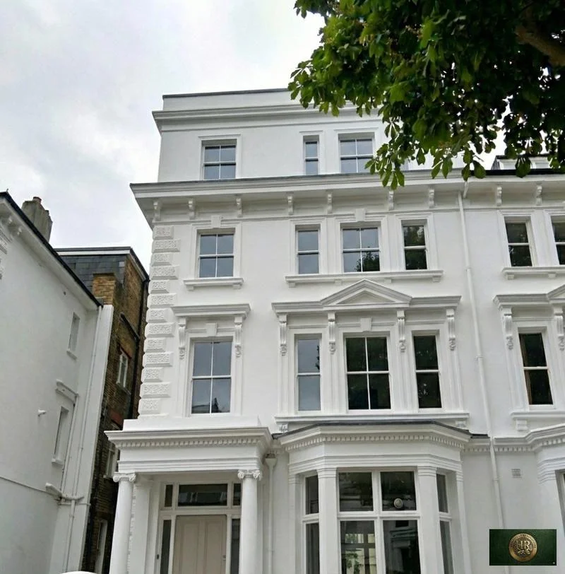
Brent’s character appraisal, adopted on 28 May 2024, places its Queen’s Park area between Salusbury Road to the east and Chamberlayne Road to the west, with Brondesbury Park Station to the north and Queen’s Park Station marking the southern edge. Rows of two- and three-storey Victorian and Edwardian terraces dominate the streets, with small groups of semi-detached villas. Hopefield Avenue, Montrose Avenue and Summerfield Road, built from 1897 to 1899, use yellow London stock brick with stone dressings, while Kempe Road’s houses have classically influenced window dressings, including floral capitals, and cast-iron balconies.
Brent: Queen’s Park Conservation Area boundary extension character appraisal, December 2024 (PDF)
On Chevening Road, the appraisal describes relatively large two-storey red-brick semi-detached houses behind generous front gardens and, on part of the west side, large three-storey red-brick semis behind a generous forecourt; that side was under construction by 1899, with houses designed by G A Sexton and built by Bennet and Gimbrett. The shop terraces at 46–56 (even) and 53–101 (odd) Salusbury Road have two levels of accommodation above each shop and mostly keep timber sash windows, and Lonsdale Road is a wide cobbled road, unique in Brent, fringed with converted stables, workshops and mews buildings.
Brent: Queen’s Park Conservation Area boundary extension character appraisal, December 2024 (PDF)
Westminster’s Queen’s Park Estate Conservation Area lies in the north-west corner of the City of Westminster, adjoining Brent, and covers a large swathe of housing between Harrow Road and Kilburn Lane. Its 2005 audit describes terraces of two-storey cottages with gardens, generally two bays wide and mostly in yellow stock brick in Flemish bond with red brick detailing, under shallow-pitched Welsh slate roofs and with double-hung, single-glazed timber sliding sashes; some were purpose-built as flats with a shared front door. Historic England lists 68 to 82 and 132 to 154 (even) Fifth Avenue, terraces of about 1880, at Grade II.
Westminster: Queens Park Estate Conservation Area Audit, adopted 15 April 2005 · Historic England: 68–82 (even) Fifth Avenue W10, Grade II · Historic England: 132–154 (even) Fifth Avenue W10, Grade II
The first local check
Two councils use the name, so start from the address
Brent and Westminster each have a ward called Queen’s Park, and each has a Queen’s Park conservation area, so neither the place name nor the postcode tells you whose rules apply. Confirm the council through the official lookup, then check that council’s conservation-area boundary, any list entry, any Article 4 direction and its plan, the lease or title and the property’s planning history. Brent’s Cabinet approved an extension of the Queen’s Park Conservation Area on 28 May 2024, so check the address on Brent’s interactive policies map or ask Brent for the current boundary.