Local knowledge with a purpose
Understand the building before changing it
The council calls De Beauvoir Town the first large-scale housing development built to a formal plan in Hackney. Its conservation area, as the 2008 appraisal draws it, runs from the north side of Downham Road to the south side of Balls Pond Road, and from the east side of Southgate Road to just west of Kingsland Road.
Hackney declared the central and southern conservation areas in 1971 and 1977 and extended them north in 1998, when some parts moved into the new Kingsland Conservation Area and the Lockner Estate was added. The appraisal of May 2008, which replaced every earlier document, calls De Beauvoir a cohesive estate, planned in the late Georgian period and built in the early Victorian one: planned from 1821, it went up mainly from 1835 into the 1850s, with De Beauvoir Square at the centre of Richard Benyon De Beauvoir’s ‘new town’.
Hackney Council: De Beauvoir conservation area and its Article 4 direction · De Beauvoir conservation area appraisal Part 1 of 2 (May 2008), linked from the council’s De Beauvoir conservation area page
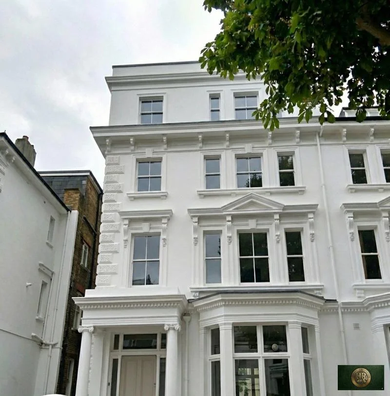
Most of the houses are Italianate. Many are villas, some semi-detached, with entrances set back to the side and designed to look like separate blocks, as on De Beauvoir Road, Buckingham Road and Northchurch Terrace. Northchurch Road is almost entirely detached villas or semi-detached houses. The other recurring design is the short ‘bookend’ terrace of four or six houses with projecting end bays, seen on Southgate Grove, Lawford Road, Culford Road and Ufton Road. In Hertford Road, the semi-detached Benyon Cottages of 1839 apply the Italianate style to modest houses.
De Beauvoir conservation area appraisal Part 1 of 2 (May 2008), linked from the council’s De Beauvoir conservation area page · De Beauvoir conservation area appraisal Part 2 of 2 (May 2008), linked from the council’s De Beauvoir conservation area page · Hackney Council: De Beauvoir conservation area and its Article 4 direction
De Beauvoir Square is the exception. Its Tudor-Jacobean pairs, from 1838, are two storeys over basements with attics under sharp gables, and the council notes their shaped gables, sculptured chimneys and lozenge-pattern leaded lights; the central garden is a protected London Square, ringed by Grade II listed railings. On Southgate Road, the listed terraces at Nos. 110 to 116 and 126 to 130 are three storeys of stock brick with stuccoed ground floors and Ionic porches, and houses on Downham Road have front steps and porches with free-standing columns.
De Beauvoir conservation area appraisal Part 2 of 2 (May 2008), linked from the council’s De Beauvoir conservation area page · Hackney Council: De Beauvoir conservation area and its Article 4 direction · Hackney Council: registered parks and gardens and London Squares · Planning Data: railings around De Beauvoir Square garden, Grade II, list entry 1226602 · De Beauvoir conservation area appraisal Part 1 of 2 (May 2008), linked from the council’s De Beauvoir conservation area page · Planning Data: 110-116 Southgate Road N1, Grade II, list entry 1235413
The first local check
Southgate Road and Balls Pond Road divide two councils
Neither the N1 postcode nor the name De Beauvoir Town settles the council, the conservation area or the controls. Southgate Road is the borough boundary: its east side is in Hackney and the De Beauvoir Conservation Area, its west side in Islington, where Islington’s East Canonbury Conservation Area begins. Balls Pond Road is split too: the appraisal puts its south side between Southgate Road and Dalston Junction in the conservation area, and its north side in Islington. Englefield Road, Northchurch Road, Downham Road and Southgate Road also appear in Islington’s East Canonbury guidelines of January 2002, so a street name alone does not settle the council. Check the exact address: use GOV.UK’s council finder with the property’s own postcode, then the conservation area map, the Article 4 database, the list entry, the lease and the planning history.