
Three Rivers · Hertfordshire

Three Rivers Renovations & Design-Build — Hertfordshire

Updated 5 November 2026

Refurbishment, extensions, loft and basement conversions in Three Rivers, from the first survey to building control sign-off, by our design-and-build team in Hampstead.

Rickmansworth and Chorleywood have their own pages; this one holds the district rules they share. It covers the adopted plans of 2011 to 2014 and the new Local Plan under ministerial direction, the Green Belt floorspace guidance, the council's design criteria for extensions, conservation areas and Article 4 directions, groundwater and flood risk, the Chilterns, neighbourhood plans and building control.

Serving Three Rivers from our Hampstead studio · NW3 6DN
020 7101 3168

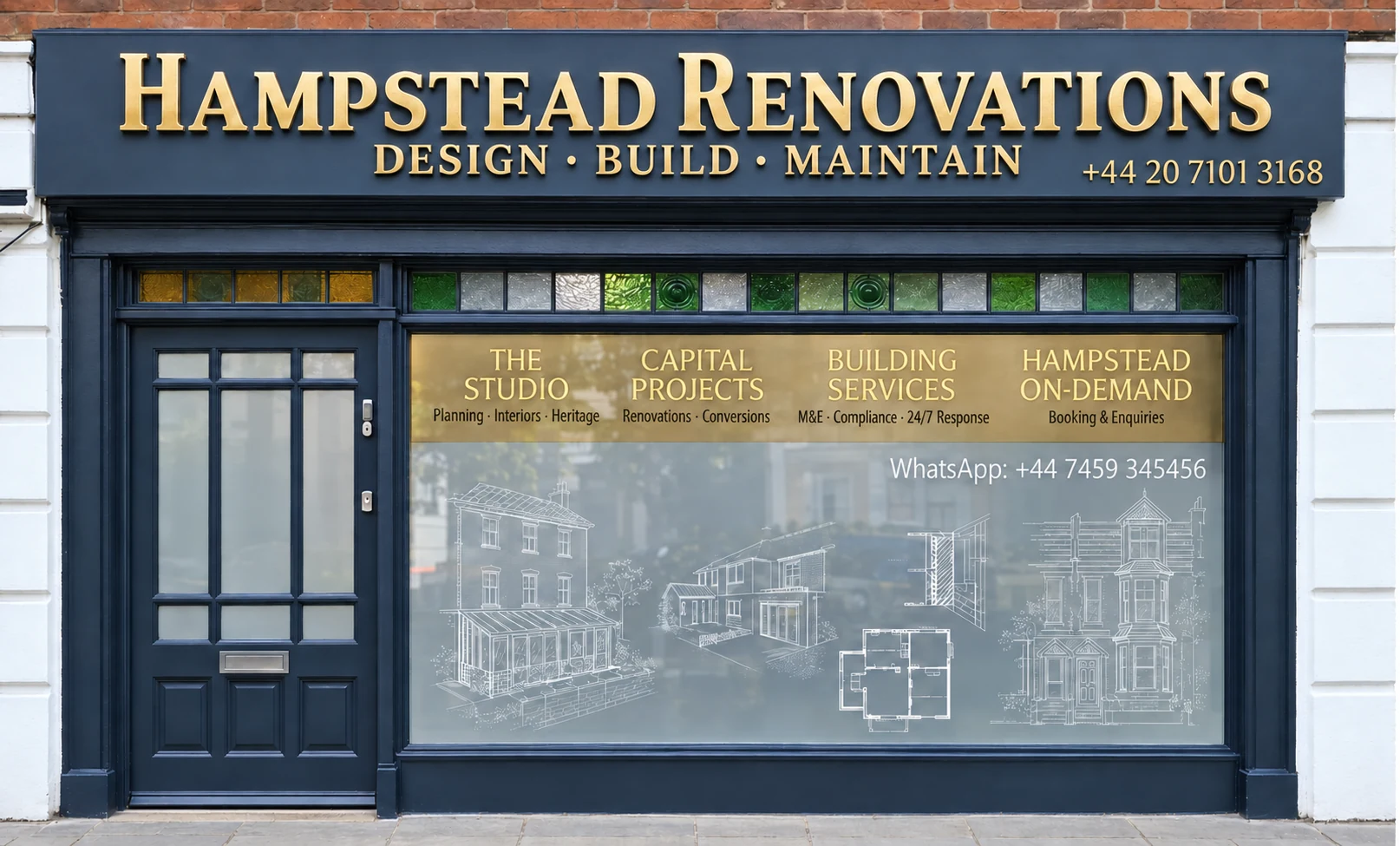
Hampstead Renovations design and build studio on Finchley Road
Our Hampstead studio · Finchley Road, NW3 6DN

Three Rivers towns

Choose your Three Rivers town

01 Seven services

Rickmansworth

The Rickmansworth page reads this district policy against the town where the Colne, Chess and Gade meet, its conservation areas and the Batchworth neighbourhood plan. Its links lead to our Rickmansworth pages for flats and houses: refurbishment, extensions, lofts, basements, kitchens and bathrooms.

  • Flat and house refurbishment
  • Extensions and lofts
  • Kitchen, bathroom and basement work
Explore Rickmansworth

02 Six services

Chorleywood

Chorleywood's hub applies the same rules alongside the parish neighbourhood plan, the Article 4 controls on the Common and the Station Estate, and the edge of the Chilterns. From it you reach six Chorleywood service pages written for houses in the parish.

  • Refurbishing houses
  • Loft conversions and extensions
  • Bathrooms, kitchens and basements
Explore Chorleywood

The plan in force

Three Rivers' plans of 2011 to 2014, and the new Local Plan after ministerial intervention

Applications in the district are decided under the Three Rivers Core Strategy (adopted 17 October 2011) and Development Management Policies Local Development Document (adopted July 2013) and Site Allocations Local Development Document (adopted 2014), read with the neighbourhood plan for the parish wherever one has been made. The Core Strategy was adopted by the council on 17 October 2011, and the Development Management Policies document of July 2013 sets out the criteria the council uses to assess all planning applications in the district.

Alongside them the council still refers to its Supplementary Planning Guidance No.3, Extensions to Dwellings in the Green Belt, dated August 2003, when it assesses applications, and Policy DM2 points applicants to that adopted guidance for floorspace and the other factors weighed in householder cases.

The replacement, the Three Rivers Local Plan 2026-2042, has been through ministerial intervention. Full Council agreed on 27 January 2026 to take it to Regulation 19 consultation, but on 5 February 2026 the Minister of State for Planning and Housing issued a holding direction preventing the council from taking “any step in connection with the adoption of the Plan”. A Local Plan Intervention Letter followed on 18 March 2026, with nine directions to the council.

The Regulation 19 consultation then ran from 31 July to 25 September 2026 and has closed. The council is preparing the documents needed to submit the plan for independent examination by the Planning Inspectorate, working to a Local Development Scheme adopted in June 2026. Once adopted, the new plan will replace the Core Strategy and the two Local Development Documents; until then it is emerging policy only.

Every Three Rivers application we prepare cites the adopted documents, and the planning statement notes where the emerging plan points the same way or differently, so a scheme designed now is not caught out if the new plan is adopted while it is being built.

Sources: Three Rivers District Council: Development Management Policies LDD (adopted July 2013); Three Rivers District Council: Development Plan (Current Local Plan); Three Rivers District Council: Batchworth Neighbourhood Plan; Three Rivers District Council: SPG No.3 Extensions to Dwellings in the Green Belt (August 2003); Three Rivers District Council: New Local Plan (update September 2026); Three Rivers District Council: Local Development Scheme (June 2026)

Green Belt

Policy DM2 and the 40% guidance in SPG3

Green Belt covers 77% of the area of Three Rivers. Under Policy DM2, extensions to buildings in the Green Belt that are disproportionate in size, individually or cumulatively, to the original building will not be permitted, and the building's relationship to other buildings, whether it is or would become prominent, and whether openness is preserved are all taken into account.

SPG No.3, August 2003

SPG3: the floorspace test

“Extensions resulting in a cumulative increase in floorspace of over 40% compared with the original dwelling will normally be unacceptable”.

The base is the original floorspace when built, or as at 1948 if built before then, and the cumulative total of extensions is assessed, not just the application in hand. Existing garages and outbuildings are left out of both sides of the sum unless they were built at the same time as, and integral with, the original dwelling.

  • Exception: dormer windows proportionate to the house, glazed across the full frontage
  • Exception: ground floor conservatories of modest size compared to the house and site
  • Exception: ‘in-fill’ extensions that do not increase the apparent bulk of the building
SPG No.3, August 2003

SPG3: openness

Single storey side extensions “will normally be viewed as adversely effecting the openness of the Green Belt, if side extensions result in more than 80% of the frontage being covered by buildings.”

First floor extensions, dormers apart, should not significantly widen the original building, and rear extensions are normally viewed more favourably than side ones. Raising the ridge, or replacing a storey partly within the roof with a full storey, will normally be considered to harm openness.

Small dwellings, defined as 110 square metres of floor area or less measured externally, with limited basic amenities may be allowed larger extensions to bring them up to contemporary living standards. The same figure appears in DM2's test for a replacement dwelling, which should not materially exceed the size of the original or, where the original has a floor area under 110 square metres measured externally, may reach 110 square metres excluding the garage, and must not harm openness more than the original through its siting.

Garden buildings have a test of their own. DM2 supports ancillary buildings only where they are clearly subordinate to the house, sited where they would not be prominent in the landscape, and free of features normally associated with a dwelling, such as dormer windows. Extending a garden into the countryside beyond the existing curtilage will not be supported.

The emerging plan keeps the 40% approach, now measured externally: extensions or alterations adding more than 40% over the original building will normally be considered disproportionate. It counts a residential outbuilding close to the house as an extension, counts earlier additions whoever built them and whether or not they used permitted development rights, and applies the same criteria to basement extensions as to those above ground. These are draft policies and not yet adopted.

On a Green Belt house we draw the original dwelling, each later addition and the proposal as separate floor plans with areas measured externally, so the floorspace percentage, the frontage test and the emerging plan's figure can all be read from the same set of sheets.

Sources: Three Rivers District Council: Development Management Policies LDD (adopted July 2013); Three Rivers District Council: SPG No.3 Extensions to Dwellings in the Green Belt (August 2003); Three Rivers District Council: Three Rivers Local Plan 2026-2042 Part I (Regulation 19, July 2026); Three Rivers District Council: New Local Plan (update September 2026)

Design

Three Rivers' rear-extension depths and the 45-degree rule

Most dwellings in the district are terraced, semi-detached or detached, and Appendix 2 of the Development Management Policies sets the council's design criteria for extending them. The emerging plan traces their styles from timber-framed Tudor buildings to Arts and Crafts and Metro-Land development of the 1920s and 1930s, with Rickmansworth, Croxley Green and Chorleywood growing up around the Metropolitan Line stations. For a single storey rear extension, “generally, the maximum depth should be 3.6m, or 4m in the case of detached dwellings”, a distance that may be reduced if the extension would harm adjoining properties or be unduly prominent.

Side extensions are spaced to avoid a terracing effect. A first floor extension over a garage or an earlier ground floor extension should be at least 1.2 metres from the flank boundary, and a two storey extension may sit on the boundary only if its first floor is set in by at least 1.2 metres. That distance must increase in low density areas, while in high density areas an absolute minimum of 1 metre will be considered.

Two storey rear extensions should not cross a 45 degree splay line drawn across the rear garden from a point on the shared boundary level with the neighbour's rear wall. The council applies that principle having regard to the spacing and relative positions of the houses, land levels and the position of neighbouring windows.

Dormers

“Dormer windows should always be subordinate to the main roof.” They should sit below the ridge, in from each end of the roof and back from the plane of the wall below, and front dormers may not always suit the street scene.

Crown roofs

“Crown roofs can exacerbate the depth of properties and often result in an inappropriate bulk and massing.” They are generally discouraged, with traditional pitched roofs favoured.

Hips, gables and ridges

Hip to gable extensions are discouraged on semi-detached houses because they unbalance the pair. Where a street's roofs are uniform, a higher ridge is unlikely to be supported, and the council encourages a streetscene plan with any proposal to raise one.

We measure the neighbouring rear walls and windows as well as the house itself, so the splay lines and flank distances are drawn from surveyed positions, and a streetscene elevation is included with any scheme that changes the roofline.

Sources: Three Rivers District Council: Development Management Policies LDD (adopted July 2013); Three Rivers District Council: Three Rivers Local Plan 2026-2042 Part I (Regulation 19, July 2026)

Heritage

Three Rivers conservation areas, Article 4 directions and the local list

There are 22 conservation areas in the district. The emerging plan describes them as including settlements around ancient commons such as Croxley Green, Chorleywood and Sarratt, the historic cores of Rickmansworth and Abbots Langley, and areas of 19th and 20th century housing such as Loudwater, Moor Park and Heronsgate, the first Chartist settlement.

The council's heritage page links individual pages for areas including Batchworth Heath, Chorleywood Common, Chorleywood Station Estate, Croxley Green, Heronsgate, Loudwater Estate, Moor Park, Rickmansworth and Sarratt. There are also 350 listed buildings and structures in Three Rivers, and work that affects the significance of one needs Listed Building Consent first.

The council considers every planning application from a conservation point of view and says applications may be refused on conservation grounds alone, in a conservation area and beyond it. Anyone intending to prune or remove a tree in a conservation area has to notify the council first.

Article 4 directions add controls in particular places. A direction does not prevent the development it covers; it means planning permission has to be obtained first. In the Chorleywood Common conservation area an Article 4(2) direction requires permission for alterations to windows, chimneys, front boundaries and hardstanding, including hardstanding in permeable materials, and the Chorleywood Station Estate conservation area has its own Article 4 direction, listed on the council's page for the area alongside the 2005 appraisal.

The council's appraisal of the Moor Park conservation area, designated on 18 May 1995, records that an Article 4 Direction withdrawing permitted development rights for means of enclosure, hardstanding and rooflights was made by the council and approved by the Secretary of State in January 2005. The same appraisal asks for any application including a basement to come with a Flood Risk Assessment detailing the effect on existing underground water courses. Our Rickmansworth page describes that area from the appraisal.

The council also maintains its own list of locally important buildings, published in documents for Abbots Langley, Chorleywood, Croxley Green, Moor Park and Eastbury, Rickmansworth and Sarratt. These buildings do not have the protection of listed buildings, and permission is not needed to demolish one unless it is in a conservation area or covered by an Article 4 direction; the list's purpose is to stop alterations and extensions that need permission from harming a building's character or appearance.

Roof work in older houses carries one more duty. The council reminds owners that it is illegal to disturb bats and certain protected birds, and that building work must not disturb them, as they can be present in roof spaces.

For a house in a conservation area or on the local list, the joinery, chimneys and boundary treatments are photographed and recorded before design begins, the Article 4 position for the street is checked, and any bat survey the circumstances call for is arranged before a roof is opened.

Sources: Three Rivers District Council: Heritage (listed buildings, local list, conservation areas); Three Rivers District Council: Three Rivers Local Plan 2026-2042 Part I (Regulation 19, July 2026); Three Rivers District Council: Article 4 direction; Three Rivers District Council: Chorleywood Common conservation area; Three Rivers District Council: Chorleywood Station Estate conservation area; Three Rivers District Council: Moor Park conservation area; Three Rivers District Council: Moor Park Conservation Area Appraisal (October 2006, adopted November 2006)
Groundwater

Source protection zones across Three Rivers

The 2026 flood assessment notes that online mapping shows the entire district covered by groundwater source protection zones, reflecting the chalk aquifer beneath it. Large areas fall in Zones 1 and 2, notably the valleys of the Colne, Chess and Gade and the Hartsbourne and Moor Park Streams.

High groundwater flood risk is concentrated in the floodplains of the Colne, Chess and Gade, where the chalk and gravel can lift groundwater to, or just below, the surface. The assessment names Rickmansworth, Croxley Green, Loudwater, Carpenders Park and South Oxhey as the settlements at highest risk, and warns that shallow groundwater can worsen poor drainage and that groundwater ingress can damage below-ground infrastructure.

Level 1 SFRA, 2026

Basements in flood zones

“Habitable uses of basements within Flood Zone 3 and areas at high risk of surface water flooding should not be permitted”, and basement dwellings, classed as highly vulnerable, have to pass the Exception Test in Flood Zone 2.

Level 1 SFRA, 2026

Levels at the sewer

Where a site sits below the ground level at its public sewer connection, care is needed so the development is not at greater risk of sewer surcharge. Finished floor and manhole cover levels higher than the connecting manhole are good practice; otherwise mitigation may be needed.

Planning adds its own layer: in the Green Belt the emerging plan would assess a basement extension against the same criteria as an extension above ground.

A basement in Three Rivers is never promised from the street. Boreholes and groundwater monitoring, the source protection zone, the flood zone and the level of the sewer connection decide whether one is sensible, and once those are known you get a straight answer. The Rickmansworth and Chorleywood basement pages apply this to each town.

Sources: Three Rivers District Council (JBA): Level 1 Strategic Flood Risk Assessment 2026; Three Rivers District Council: Three Rivers Local Plan 2026-2042 Part I (Regulation 19, July 2026); Three Rivers District Council: New Local Plan (update September 2026)

Flood risk

The Colne, the Gade and the canal

The district is named after the Colne, the Chess and the Gade, which meet at Rickmansworth, its largest town. The low-lying Colne valley carries the most extensive river flood risk, affecting Rickmansworth and Batchworth, while steeper ground keeps the Chess and Gade floodplains close to their valleys, although the Chess floodplain reaches into Loudwater.

The Grand Union Canal crosses the district from north-east to south-west, meeting the Gade at Croxley Green and the Chess and Colne at Rickmansworth. Several overtopping incidents between Rickmansworth and West Hyde largely affected the towpath, with no damage to property, and raised or reinforced walls and embankments line the canal at Batchworth, the Chess at Rickmansworth and the Colne from Rickmansworth to Maple Cross.

Surface water has its own routes. One flow path in the west of the district runs down a dry valley from Chorleywood to Rickmansworth, ponding where a railway embankment crosses it, and Rickmansworth and Chorleywood are among the settlements with the greatest historic risk of sewer flooding.

The council's Level 1 and Level 2 Strategic Flood Risk Assessment of 2026 supersedes the South West Hertfordshire assessment of 2018, so the 2026 maps and guidance are the ones to read for an address in the district.

Before floor levels are set we take the 2026 maps for the plot, look for dry-valley and sewer flooding history in the street, and design the drainage so that a new extension does not push more water towards the neighbours.

Sources: Three Rivers District Council (JBA): Level 1 Strategic Flood Risk Assessment 2026; Three Rivers District Council: New Local Plan (update September 2026)

Protected landscape

The Chilterns National Landscape in Three Rivers

Approximately 546 hectares of the Chilterns National Landscape lie within Three Rivers, in a sparsely populated part of the district. The Development Management Policies describe that land as largely chalk stream, river, valley, and adjacent hillsides and woods.

Natural England's boundary data places some Chorleywood parish postcodes inside the Chilterns boundary and others outside it, so whether a Chorleywood house is in the National Landscape depends on the exact address; the parish's neighbourhood plan describes the parish as situated on the boundary.

Policy DM7, which still uses the older name, the Chilterns Area of Outstanding Natural Beauty, supports development within or near it unless the proposal would fail to conserve or enhance its character through siting, design or appearance, detract from its setting and the views into and out of it, or detract from public enjoyment of the landscape. For development in or near it the council has regard to the Chilterns Buildings Design Guide and its technical notes on flint, brick and roofing materials.

Where a house is in or beside the National Landscape, the Chilterns guidance on brick, flint and roofing informs the material choices from the outset, and the drawings show how the extension will look from public paths as well as from the road.

Sources: Three Rivers District Council: Three Rivers Local Plan 2026-2042 Part I (Regulation 19, July 2026); Three Rivers District Council: Development Management Policies LDD (adopted July 2013); Natural England: National Landscapes (AONB) England feature service, point query at WD3 5SL; postcodes.io (ONSPD-derived): postcode WD3 5SL; Natural England: National Landscapes (AONB) England feature service, point query at WD3 5HZ; postcodes.io (ONSPD-derived): postcode WD3 5HZ; Chorleywood Parish Council / Three Rivers DC: Chorleywood Neighbourhood Plan (linked as Updated July 2026)

Neighbourhood plans

Five made neighbourhood plans in Three Rivers

There are five neighbourhood plans in the district, for Croxley Green, Chorleywood, Batchworth, Sarratt and Abbots Langley. As the council notes, a neighbourhood plan cannot be used to prevent development in its area.

Croxley Green

Approved in 2018 following a residential referendum.

Chorleywood

Approved in 2021 after the referendum of 6 May 2021; its area corresponds with the Chorleywood Parish Council boundary.

Batchworth

Approved in May 2025 following a referendum and now made, so it forms part of the Development Plan. It covers Eastbury, Moor Park and Rickmansworth within the Community Council's parish boundaries.

Sarratt

Approved in December 2025 following a residential referendum.

Abbots Langley

Adopted in June 2026 following a residential referendum.

Where a house sits in Batchworth or Chorleywood parish, the neighbourhood plan's policies form part of our design brief rather than a check at the end; the Rickmansworth and Chorleywood pages set out what they ask for.

Sources: Three Rivers District Council: Neighbourhood planning; Three Rivers District Council: Development Plan (Current Local Plan); Three Rivers District Council: Chorleywood Neighbourhood Plan Decision Statement (Regulation 18(2)); Three Rivers District Council: Batchworth Neighbourhood Plan; Batchworth Community Council / Three Rivers DC: Batchworth Neighbourhood Plan 2023-2038, Referendum Version

Sign-off

Building control for Three Rivers addresses

The council's own page says building control services in the district are provided by Hertfordshire Building Control, which is jointly owned by Three Rivers and seven other Hertfordshire local authorities. Its services include plans assessments and site inspections.

You do not have to use it. National guidance allows a private registered building control approver to be appointed in place of the local authority service, in which case the approver informs the local authority by giving an initial notice.

Driving across a footway to a new parking space needs a dropped kerb approved and installed by Hertfordshire County Council; the Highways Act 1980 does not let you cross a pavement or verge by car until one is in place.

Three Rivers adjoins Greater London to the south, where the London Boroughs of Harrow and Hillingdon meet its boundary. For homes on that side, see our London pages, among them Northwood and Pinner.

Plans, calculations and specifications go to the building control body as one package; inspections are called as each element is ready, and the completion certificate comes to you once the final inspection is passed. Party wall notices run separately and are served early.

Sources: Three Rivers District Council: Building control; GOV.UK: Building regulations approval (printable guide); Hertfordshire County Council: Residential Dropped Kerbs Policy, version 7 (8 May 2026); Three Rivers District Council: Three Rivers Local Plan 2026-2042 Part I (Regulation 19, July 2026)

Our Hampstead base, serving Three Rivers

Talk to our Finchley Road studio

Our studio is in Hampstead on Finchley Road, at NW3 6DN. We serve Three Rivers from this office. Bring us the practical questions about your house, flat or bathroom and the result you want to achieve.

Contact the studio to discuss your brief and arrange the next step. If you already have drawings, a lease or planning correspondence, tell us what is available.

Book a free feasibility visit
Hampstead Renovations
Unit 3 Palace Court
250 Finchley Road
London NW3 6DN

020 7101 3168
contact@hampsteadrenovations.co.uk

Find our studio on Google Maps

Working with us

How we take on projects in Three Rivers

Our London team takes on projects in Rickmansworth and Chorleywood with in-house architects, designers and structural engineers, and with Hampstead Chartered Surveyors & Building Consultancy. The planning application is decided by Three Rivers District Council; building regulations approval comes from Hertfordshire Building Control, or, where you appoint one, from a private registered building control approver.

Everything is run from Finchley Road in Hampstead, NW3. A first visit to the house establishes how it is built, which of the constraints on this page touch it, and what you want from the space.

That visit leads to a measured survey and a feasibility study tested against the district policies above, then the planning drawings and structural design; the same team then builds the scheme and brings it through to sign-off.

Outside Three Rivers, and in London rather than Hertfordshire: Project example: Belsize Park, NW3. That project of ours is a Victorian townhouse of five storeys; its case study records a basement conversion, a rear extension and loft work, carried out together with a full refurbishment of the interior.

Sources: Three Rivers District Council: Development Management Policies LDD (adopted July 2013); Three Rivers District Council: Building control; GOV.UK: Building regulations approval (printable guide); Hampstead Renovations: Belsize Park Gardens, NW3 case study

Three Rivers questions

Planning and building in Three Rivers: common questions

Which plans decide an application in Three Rivers, and where has the new Local Plan got to?

The Three Rivers Core Strategy (adopted 17 October 2011) and Development Management Policies Local Development Document (adopted July 2013) and Site Allocations Local Development Document (adopted 2014), together with a parish's neighbourhood plan where one is in force. The new Local Plan 2026-2042 went through Regulation 19 consultation from 31 July to 25 September 2026, after a ministerial holding direction of 5 February 2026 and an intervention letter of 18 March 2026. The council is preparing to submit it for independent examination, so it is emerging policy only.

How big can a Green Belt extension be in Three Rivers?

Policy DM2 refuses extensions that are disproportionate in size, individually or cumulatively, to the original building. The council's SPG3 adds that extensions resulting in a cumulative increase in floorspace of over 40% compared with the original dwelling, as built or as at 1948, will normally be unacceptable, with exceptions for proportionate dormers, modest ground floor conservatories and in-fill extensions, and that single storey side extensions covering more than 80% of the frontage will normally be seen as harming openness.

How deep can a rear extension be under Three Rivers' design guidance?

Appendix 2 of the Development Management Policies says that, generally, the maximum depth of a single storey rear extension should be 3.6m, or 4m for a detached house, and that this may be reduced if the extension would affect the neighbours or be unduly prominent. Two storey rear extensions should not intrude into a 45 degree splay line drawn from the shared boundary level with the neighbour's rear wall.

Which neighbourhood plans are made in Three Rivers?

Five: Croxley Green, approved in 2018; Chorleywood, approved in 2021; Batchworth, covering Eastbury, Moor Park and Rickmansworth, approved in May 2025; Sarratt, approved in December 2025; and Abbots Langley, adopted in June 2026. Each followed a residential referendum.

Does a basement in Three Rivers need a flood risk assessment?

It depends on where the house is. The 2026 flood assessment says habitable basements should not be permitted in Flood Zone 3 or in areas at high risk of surface water flooding, and that basement dwellings in Flood Zone 2 must pass the Exception Test, while the whole district lies in groundwater source protection zones. In the Moor Park conservation area the council's appraisal asks for any application including a basement to come with a Flood Risk Assessment covering underground water courses.

Who provides building control in Three Rivers?

Hertfordshire Building Control, which the council's own page names as its building control service and which is jointly owned by Three Rivers and seven other Hertfordshire local authorities. Owners can choose a private registered building control approver instead.

Independent
Surveying
Hampstead Renovations operates alongside Hampstead Chartered Surveyors & Building Consultancy — an RICS Regulated firm providing chartered building surveying, under shared directorship.

Book a free feasibility visit

Hertfordshire overview
Renovations in Hertfordshire →

See how Three Rivers fits within our wider Hertfordshire pages.

Full Service Directory

Pages for Three Rivers

Every town page we publish for Three Rivers.

Three Rivers

Rickmansworth →

Three Rivers

Chorleywood →

Chat with us!