
Chalfont St Peter · Chiltern · Buckinghamshire

Chalfont St Peter Renovations & Design-Build — SL9

Updated 6 November 2026

Our London team takes on house and flat projects in Chalfont St Peter, from Gold Hill Common to Chalfont Common, and runs each one from the Finchley Road studio in Hampstead, NW3.

The village climbs both sides of the Misbourne valley, with the A413 along the valley floor between its eastern and western halves. Detached houses from the 1870s to the post-war cul-de-sacs make up most of it, and three small conservation areas, a made neighbourhood plan and a High Street that floods all bear on what can be built. Policy for the whole plan area is on our Chiltern page.

Serving Chalfont St Peter from our Hampstead studio · NW3 6DN
020 7101 3168

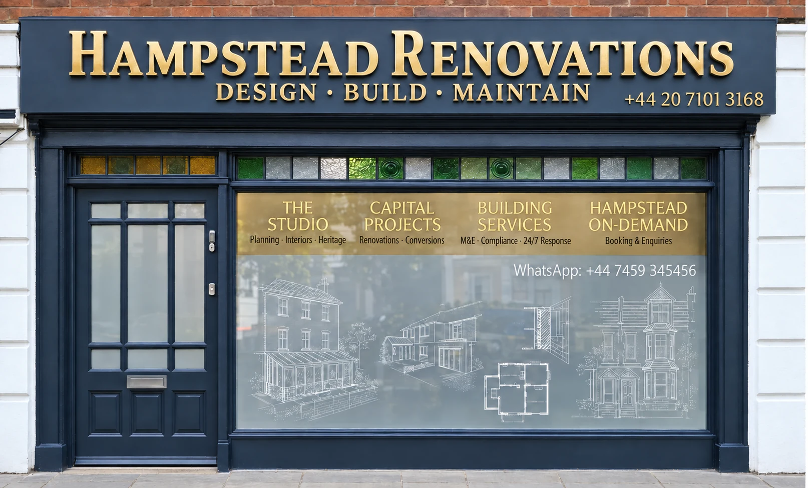
Hampstead Renovations design and build studio on Finchley Road
Our Hampstead studio · Finchley Road, NW3 6DN

Chalfont St Peter projects

Choose the work your Chalfont St Peter home needs

01 Whole house

House Refurbishment in Chalfont St Peter

Refurbishing a Chalfont St Peter house, from an Arts & Crafts semi on the Firs Estate to a wide-fronted detached house in a post-war cul-de-sac. Heating, wiring, insulation and windows are planned around the age of the building and the character area it sits in.

  • Survey of the house as built
  • Windows matched to the original pattern
  • Heating, wiring and insulation
Explore House Refurbishment in Chalfont St Peter

Chalfont St Peter homes

What Chalfont St Peter's houses are built like

Detached houses account for 2,680 of the 4,300 households the 2021 Census found in the Chalfont St Peter ward, or 62.3%. Semi-detached houses held another 679 and terraces 297. Purpose-built blocks of flats housed 525 households, and the remainder lived in conversions or above commercial premises: 52 in converted or shared houses, 15 in other converted buildings and 49 in commercial buildings.

In 1890 this was a small village ringed by open countryside, with commons at Gold Hill and Austenwood. Growth followed the station the Great Central and Great Western companies opened at Gerrards Cross in 1906, and new drives and cul-de-sacs were laid out between 1926 and 1955. In the south, closely spaced detached houses went up along Latchmoor Way, Lewins Road and Hill Rise Crescent, while the Leachcroft estate and Layter's Close were built as semi-detached and terraced housing.

From 1955 to 1975 smaller parcels filled in, often as cul-de-sacs such as Criss Grove, and estates of wide-fronted detached houses consolidated the Chalfont Common side. Plots are smaller and housing denser around Royle Close and Hill Farm Road, with some terraces. Since 1975 new building has mostly been small and kept inside the built area, and the neighbourhood plan records significant pressure to refurbish and extend the dwellings already there.

The centre is older. The neighbourhood plan dates the area around the High Street and Market Place to at least the medieval period, with buildings set at the back of the pavement in a continuous frontage, and describes attractive vernacular and Georgian buildings whose setting is compromised by modern flats and offices on the eastern side of the High Street.

Postcodes run across these lines. SL9 takes in addresses in the Chalfont St Peter, Chalfont St Giles, Gerrards Cross, Denham, Fulmer and Hedgerley parishes and in the unparished part of Three Rivers, and HP8 is shared between Buckinghamshire and Three Rivers in Hertfordshire. We confirm the council and the plan area from the full address, never from the outcode.

Neighbouring Gerrards Cross and Chalfont St Giles have their own pages. Here, a first survey starts by placing the house in its street pattern, since a Firs Estate semi of the 1900s and a detached house in a 1960s cul-de-sac call for very different handling.

Sources: ONS/Nomis: Census 2021 TS044 Accommodation type, 2022 ward Chalfont St Peter (E05013135); Chalfont St Peter Parish Council: Chalfont St Peter Neighbourhood Plan 2013-2028; postcodes.io (ONSPD-derived): outcode SL9; ONS Postcode Directory via postcodes.io (ONSPD-derived): outcode HP8
Approvals

Checks a Chalfont St Peter project goes through

The policy that applies across the whole plan area, from the saved local plan policies to the Green Belt tests, is set out on our Chiltern page. These cards follow it onto a Chalfont St Peter address and add the village's own layer.

Who decides

Planning applications for Chalfont St Peter addresses are decided by Buckinghamshire Council, which still uses the older plans for the former Chiltern District local plan area. Our London team of in-house architects, designers and structural engineers, with Hampstead Chartered Surveyors & Building Consultancy alongside, takes on projects in the village and prepares the drawings, statements and application.

Neighbourhood plan

The Chalfont St Peter Neighbourhood Plan covers 2013 to 2028 and the council lists it among the Chiltern area's made plans, so its housing and Village Centre policies apply here as well as the area's own. A review of it is listed among the emerging plans, which we follow as it moves forward.

Inside a conservation area?

Three conservation areas were designated in 1992: Gold Hill Common East Side, North Park and Kingsway, and The Firs Estate. Conservation areas count as article 2(3) land, which narrows permitted development, so the boundary is checked for the address before anything is drawn.

Green Belt

The built-up area of Chalfont St Peter was left out of the Green Belt, but Green Belt surrounds the village, so a house at the edge may sit inside it. There Policy GB13 permits extensions that stay subordinate to the original dwelling and are not intrusive in the landscape; the full tests are on our Chiltern page.

Building regulations

Plans, inspections and completion go through Buckinghamshire Council's building control service, unless you appoint a private registered building control approver, who then notifies the council with an initial notice. Planning permission and building regulations approval are different consents, and some projects need both.

Neighbours and trees

Building at the boundary, working on a party wall or digging below and near a neighbour's foundations means notice to that neighbour first. In a conservation area, trees without a Tree Preservation Order are still protected under section 211 and the council must be notified before work on them; the 1997 Local Plan maps important trees in the conservation area at Gold Hill East.

Sources: ONS Open Geography Portal: Parish to Ward to Local Authority District (December 2019) Lookup in England and Wales (query); Buckinghamshire Council: Local Development Scheme, 3. Our current plans and documents (last updated 16 March 2026); Chalfont St Peter Parish Council: Chalfont St Peter Neighbourhood Plan 2013-2028; Buckinghamshire Council: Neighbourhood planning - the plans; Chiltern District Council: Chiltern District Local Plan, adopted 1 September 1997 (alterations 29 May 2001; consolidated September 2007 and November 2011); legislation.gov.uk: Town and Country Planning (General Permitted Development) (England) Order 2015 (SI 2015/596), article 2 (latest available revised); legislation.gov.uk: GPDO 2015 (SI 2015/596), Schedule 1 Part 1, Article 2(3) land (latest available revised); Buckinghamshire Council: Building regulations and control; GOV.UK: Building regulations approval (printable guide); GOV.UK: Building regulations approval - when you need approval; GOV.UK: Party walls and building work - overview; GOV.UK: Party walls and building work - work you must tell your neighbour about; GOV.UK: Tree Preservation Orders and trees in conservation areas (planning guidance)

Local policy

Chalfont St Peter's three conservation areas and the Misbourne

Each of the three conservation areas, all designated in 1992, keeps a different stage of the village's growth: building from the 1870s to the 1930s beside Gold Hill Common, large houses of 1900 to 1930 in North Park and Kingsway, and the Arts & Crafts houses of the Firs Estate. The council's current list carries an appraisal for each.

Gold Hill Common East Side

Runs along the east border of Gold Hill Common, where the built character dates from the 1870s to the 1930s. The neighbourhood plan puts buildings around the common on its indicative list of local heritage assets.

North Park and Kingsway

Good quality large houses of 1900 to 1930 with minimal infill or later alteration. The 1997 Local Plan names North Park, Kingsway and The Firs Estate as places where special architectural character was enough to justify designation, and puts North Park's housing in three of its categories of special residential character.

The Firs Estate

Largely land from a 19th-century brickworks at Austenwood Common, built over between 1900 and 1915 with detached and semi-detached houses in the Arts & Crafts style. The neighbourhood plan designates Austenwood Common, with the green space around it and in Austenway, as Local Green Space.

The Village Centre

Not a conservation area, and few of its buildings are listed. A review recommended considering part of the historic core for designation; in the meantime Policy VC1 requires new development in the centre to conserve or enhance its character, and Policy VC2 supports improvements to buildings that contribute positively to it.

Outside those areas the neighbourhood plan still shapes design. It maps ten character areas, drawn from a townscape character assessment of the village published in 2011, and Policy H5 asks each Design and Access Statement to show how a scheme fits the characteristics of its character area; Policy H6 resists development that fails to reinforce them.

For alterations and extensions that need planning permission, Policy H7 expects the design, character and quality of the building to be maintained or enhanced, and the application has to include a statement saying how. The plan's examples are sympathetic scale, durable materials such as locally sourced brick, and window frames and doors that reflect the original proportions, materials and glazing patterns.

The River Misbourne flows north to south through the village. The 2018 flood assessment places several High Street properties in Flood Zone 3a and other parts of the village, west of the A413, along Lower Road and on parts of the High Street, in Flood Zone 2. In prolonged rain the river overtops its banks at several points, and it flooded the High Street in 2001.

Water also rises from below. The same assessment records rising groundwater causing or worsening flooding at the foot of Gravel Hill, and finds the steep catchment leaves the centre open to surface water flooding, most of all when groundwater levels are high.

Before any design work we look the address up on the Environment Agency's flood map for planning, and for anything below ground the groundwater position is settled first.

Sources: Chalfont St Peter Parish Council: Chalfont St Peter Neighbourhood Plan 2013-2028; Buckinghamshire Council: Conservation areas in Buckinghamshire; Chiltern District Council: Chiltern District Local Plan, adopted 1 September 1997 (alterations 29 May 2001; consolidated September 2007 and November 2011); Chiltern and South Bucks District Councils: Strategic Flood Risk Assessment Level 1 (November 2018); Environment Agency (GOV.UK service): Get flood risk information for planning in England (Flood map for planning)

Building fabric

Building types in Chalfont St Peter and what they mean for the work

Detached houses are the rule here: 62.3% of the ward's households lived in one in 2021, and the neighbourhood plan finds a high proportion of larger homes compared with other villages in the district and with England as a whole.

Late Victorian and Edwardian detail

What do the early suburban houses share?

The 1997 Local Plan notes that detailing became more accentuated in the late Victorian and Edwardian periods, and lists what it found around Austenway: decorative bargeboards with pendants, half timbering and render, leaded and stained glass, and wooden casements with small panes above large ones.

That joinery and glass is recorded at the measured survey, so repairs follow the original rather than a catalogue.

North Park's large houses

What sets North Park apart?

Large, good quality houses of 1900 to 1930 with minimal infill or later alteration, and oriel windows that the 1997 Local Plan pictures as one of the area's features.

Every change starts from detailed elevations of what is there, because on houses so little altered even small changes show.

Inter-war drives

What did the drives of 1926 to 1955 leave?

New drives and cul-de-sacs, and in the south closely spaced detached houses along Latchmoor Way, Lewins Road and Hill Rise Crescent.

Close spacing puts side extensions and scaffold near the boundary, so access and party wall questions come up at the first visit.

Post-war cul-de-sacs

What about the estates built after 1955?

Cul-de-sacs such as Criss Grove on smaller parcels, and on the Chalfont Common side estates of detached houses with wide frontages, laid out so that all available land was built on.

Wide frontages leave room at the side and tight layouts leave little behind, so both are measured before we suggest where new space should go.

Semis and terraces

Where are the attached houses?

The Leachcroft estate and Layter's Close were built as semi-detached and terraced housing, and the area around Royle Close and Hill Farm Road has smaller plots and some terraces. The ward had 679 households in semi-detached houses and 297 in terraces in 2021.

Shared walls bring party wall notices into most structural work, and a small plot limits where materials can be kept.

Flats in the village

Where are the flats?

The 2021 Census counted 525 households in purpose-built blocks of flats in the ward and 49 in commercial buildings, over shops for example, and the neighbourhood plan notes modern flats on the eastern side of the High Street.

A flat refurbishment begins with the lease and with the floors and walls shared with neighbours, and is planned around the common parts.

Sources: ONS/Nomis: Census 2021 TS044 Accommodation type, 2022 ward Chalfont St Peter (E05013135); Chalfont St Peter Parish Council: Chalfont St Peter Neighbourhood Plan 2013-2028; Chiltern District Council: Chiltern District Local Plan, adopted 1 September 1997 (alterations 29 May 2001; consolidated September 2007 and November 2011)

On site

Access, parking and dropped kerbs in Chalfont St Peter

With poor public transport, the neighbourhood plan says, most residents rely heavily on their cars, and employment in the Village Centre adds to the pressure on parking there. Skips, scaffold and deliveries have to fit around both.

Grass verges, open front gardens and mature trees typify the village in the plan's words, and it sees them under threat from high fencing and paved or decked areas. It counts the green intersections at junctions and the roadside verges as a key part of the village's character, and the Parish Council's strategy is to stop cars parking on them with granite blocks, timber bollards or trees.

The kerb outside a house is lowered only under a vehicular access licence from Buckinghamshire Council. Extending or lowering an existing dropped kerb needs planning permission or a letter confirming none is required, and a contractor with a New Roads and Street Works Act qualification. The council says it cannot tell you whether planning permission is needed, so we settle that before applying.

Before the first delivery we draw up a site plan showing where the skip and scaffold go, which way lorries arrive and how verges and a neighbour's drive are kept clear, and you sign it off.

Sources: Chalfont St Peter Parish Council: Chalfont St Peter Neighbourhood Plan 2013-2028; Buckinghamshire Council: Apply for a dropped kerb licence

Scope

Scoping a Chalfont St Peter project before a quote

A quote here is built from what we find, not from a rate. Nothing is priced until the house has been surveyed, the planning route is clear and anything below ground is understood.

  1. Walk round

    We see the house and garden with you, listen to what you want to change, and work out how a lorry, a skip and a scaffold would reach it.

  2. Address checks

    Conservation area, character area, Green Belt, flood zone, groundwater, listed or local heritage status and protected trees are confirmed for that exact address.

  3. Measured survey

    Our surveyors draw the building as it stands, roof voids, floor structures and drainage runs included, along with anything hidden behind later linings.

  4. Design and route

    Drawings follow whichever route the address allows: permitted development where it applies, a householder application with the character area statement the neighbourhood plan expects, or the freeholder's consent for a flat.

  5. Engineering

    Our structural engineers design beams, foundations and any retaining walls, and we agree with you who will act as building control.

  6. Written scope

    Every item from strip-out to the last coat of paint is listed, and the quote is priced line by line from that list.

Ready to take the next step? Send the property address and a short outline of what you want to change.

Book a feasibility visit

Our Hampstead base, serving Chalfont St Peter

Talk to our Finchley Road studio

Our studio is in Hampstead on Finchley Road, at NW3 6DN. We serve Chalfont St Peter from this office. Bring us the practical questions about your house, flat or bathroom and the result you want to achieve.

Contact the studio to discuss your brief and arrange the next step. If you already have drawings, a lease or planning correspondence, tell us what is available.

Book a feasibility visit
Hampstead Renovations
Unit 3 Palace Court
250 Finchley Road
London NW3 6DN

020 7101 3168
contact@hampsteadrenovations.co.uk

Find our studio on Google Maps

The valley

Both sides of the Misbourne valley

Chalfont St Peter spreads over both sides of the Misbourne valley, which runs roughly north to south, and the A413 follows the valley floor beside the line of the old London to Aylesbury road. Where it runs as dual carriageway, built in the late 1960s to bypass the old road through the village, it divides the eastern and western sides.

The valley sides rise steeply in places, and views across from one side to the other are, in the neighbourhood plan's words, a unique feature of the village, especially sensitive to change when seen from higher ground. Green Belt surrounds the village, the Colne Valley Regional Park covers almost all the open land to its east, and the north-east of the parish lies in the Chilterns Area of Outstanding Natural Beauty, though the village's Ordnance Survey reference point falls outside it on Natural England's data.

Drainage is the hidden constraint. The plan records the sewer overloading and overflowing for lack of capacity, groundwater leaking into foul sewers built for foul flows only, and frequent surface water flooding across most of the Village Centre whenever it rains, with the Lower Road area particularly prone.

That is why our engineers look at a plot's drainage before its floor plan: where surface water can go, how high the water table comes and whether the sewer can take more. Floor levels, soakaways and anything below ground follow from those answers.

Outside Chalfont St Peter, and in London rather than Buckinghamshire: Project example: Belsize Park, NW3. That project of ours is a Victorian townhouse of five storeys; its case study records a basement conversion, a rear extension and loft work, carried out together with a full refurbishment of the interior.

Sources: Chalfont St Peter Parish Council: Chalfont St Peter Neighbourhood Plan 2013-2028; Natural England Open Data: Areas of Outstanding Natural Beauty (England), point query at the OS Open Names point for Chalfont St Peter; Hampstead Renovations: Belsize Park Gardens, NW3 case study

Chalfont St Peter questions

Renovating in Chalfont St Peter: questions we are asked

Does the Chalfont St Peter Neighbourhood Plan apply to my home, and is it being reviewed?

If the home is in the parish, yes. The plan covers 2013 to 2028 and the council lists it among the Chiltern area's made plans. Its housing policies ask a design to fit the characteristics of its character area and an alteration or extension to maintain or enhance the building, and its Village Centre policies apply in the centre. The council also lists a review of the plan among the emerging plans, so we work to the made plan and keep track of the review.

Is my home in one of Chalfont St Peter's conservation areas?

Possibly. There are three, all designated in 1992: Gold Hill Common East Side, along the east border of the common; North Park and Kingsway, large houses of 1900 to 1930; and The Firs Estate, Arts & Crafts houses built over a former brickworks at Austenwood Common. The council publishes an appraisal for each. The historic Village Centre is not a conservation area, though its own policy asks new development to conserve or enhance its character. We confirm the boundary for every address before design.

Is my address in the Misbourne flood zone or the groundwater area at the foot of Gravel Hill?

It may be. The 2018 flood assessment puts several High Street properties in Flood Zone 3a, and parts of the village west of the A413, along Lower Road and elsewhere on the High Street in Flood Zone 2. It also records rising groundwater causing or worsening flooding at the foot of Gravel Hill, and warns that a blocked flood relief culvert could raise the risk. For one address the zone comes from the Environment Agency's flood map for planning, which we check together with the groundwater position before design.

Which Green Belt policies apply around Chalfont St Peter?

The built-up area of the village is outside the Green Belt, which surrounds it. For a house in the Green Belt and outside the areas of Policies GB4 and GB5, Policy GB13 of the 1997 Local Plan permits extensions that are subordinate to the size and scale of the original dwelling and not intrusive in the landscape, and it weighs earlier extensions cumulatively. Policy GB15 deals with outbuildings such as a detached garage. National policy treats an extension as not inappropriate where it adds no disproportionate increase over the original building. Our Chiltern page sets the tests out in full.

Who signs off building regulations in Chalfont St Peter?

Buckinghamshire Council's building control service takes building regulations applications, books site inspections and holds the building control history of properties. You can instead appoint a private registered building control approver, who tells the council about the work by giving an initial notice. Where the installer belongs to a competent person scheme, the installer certifies the work and no application is needed from you.

Who approves a dropped kerb in Chalfont St Peter?

Buckinghamshire Council, by issuing a vehicular access licence to lower the kerb outside your house. To extend or lower an existing dropped kerb it asks for planning permission or a letter confirming none is needed, a contractor with a New Roads and Street Works Act qualification, and a plan of any change to the front wall, fence or hedge. It will not tell you whether planning permission is needed, so we check that first. The neighbourhood plan also values the village's grass verges and open front gardens, which shapes how we design a new driveway.

Independent
Surveying
Hampstead Renovations operates alongside Hampstead Chartered Surveyors & Building Consultancy — a firm providing chartered building surveying, under shared directorship.

Book a feasibility visit

Buckinghamshire overview
Renovations in Buckinghamshire →

See how Chalfont St Peter fits within our wider Buckinghamshire pages.

Full Service Directory

Pages for Chalfont St Peter

Every service page we publish for Chalfont St Peter.

Chalfont St Peter

House Refurbishment in Chalfont St Peter →

Chalfont St Peter

House Extensions in Chalfont St Peter →

Chalfont St Peter

Kitchen Renovation in Chalfont St Peter →

Chalfont St Peter

Bathroom Renovation in Chalfont St Peter →

Chalfont St Peter

Loft Conversions in Chalfont St Peter →

Chalfont St Peter

Basement Conversions in Chalfont St Peter →

Chalfont St Peter

Flat Refurbishment in Chalfont St Peter →

Chat with us!