
Cobham · Elmbridge · Surrey

Cobham Renovations & Design-Build — KT11

Updated 2 November 2026

One team designs, engineers and builds your Cobham project, run from our Finchley Road studio in Hampstead, NW3.

Cobham sits beside the River Mole, ringed by Green Belt, with five conservation areas inside the settlement. We start every project by settling which of those apply to the exact address. This page covers Cobham, Stoke d'Abernon and Downside; the rules that apply across the borough are on our Elmbridge page.

Serving Cobham from our Hampstead studio · NW3 6DN
020 7101 3168

Hampstead Renovations design and build studio on Finchley Road
Our Hampstead studio · Finchley Road, NW3 6DN

Services in Cobham

Choose the work your Cobham home needs

01 Whole house

House Refurbishment in Cobham

Refurbishment of a Cobham house, from new services and rewiring to repaired windows, floors and joinery. We plan the work around the age of the house and, where one applies, its conservation area.

  • Survey and measured drawings
  • Services, finishes and joinery
  • Repair before replacement
Explore House Refurbishment in Cobham

02 More space

House Extensions in Cobham

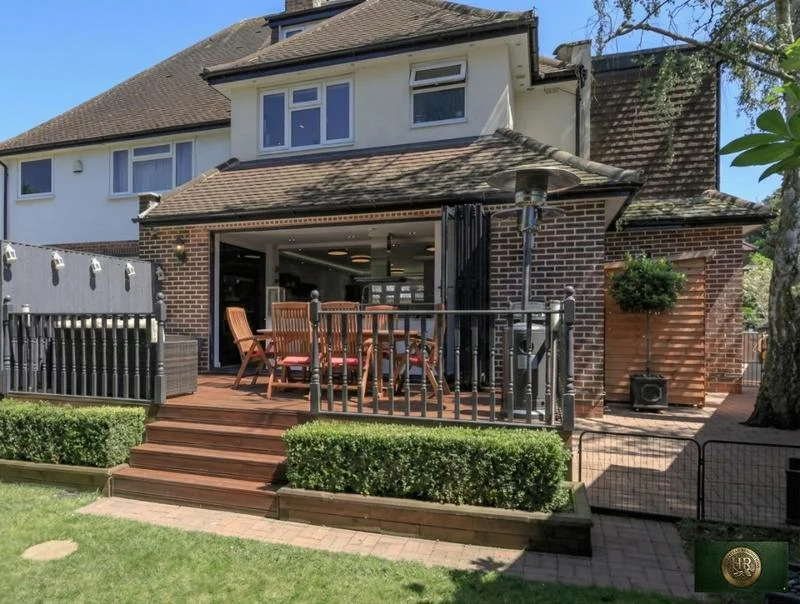
Rear, side and wrap-around extensions designed for the plot and for the planning route the address allows. Green Belt, flood zone and conservation area are checked before a line is drawn.

  • Permitted development or planning
  • Structural engineer's design
  • Party wall notices
Explore House Extensions in Cobham

Cobham homes

What Cobham's houses are built like

The Core Strategy describes the housing across Cobham, Oxshott, Stoke d'Abernon and Downside as a significant majority of detached and semi-detached houses, with very few terraces or flats. At the 2021 Census the Cobham and Downside ward held 3,721 households: 1,152 in detached houses, 1,028 semi-detached, 684 terraced and 716 in purpose-built blocks of flats or tenements.

The town began as two places. The council's appraisal of the Cobham Conservation Area describes Street Cobham to the north and Church Cobham to the south, and the conservation area itself follows the old core of Church Cobham along Church Street, River Hill and Mill Road beside the Mole.

The later layers are recorded in the council's 2012 companion guide for Cobham, Oxshott, Stoke d'Abernon and Downside. The 2024 Design Code has replaced it for applications made after 6 January 2025, so we use it only to describe the place. It identifies the first of Tartar Hill's two phases as a late Victorian and Edwardian grid of terraces and semi-detached houses with small front gardens, taking in the lower parts of Hogshill Lane, Cedar Road and Spencer Road; Northfields as mostly two-storey semi-detached houses and short terraces of the 1930s and the post-war years; the Burhill Estate as large houses on very large plots; and Fairmile as mainly private estates.

The Tilt lies about half a mile south-east of the town. Most of its buildings date from the mid to late 19th century, when Cobham, to its west, and Stoke d'Abernon, to its east, were both expanding, and in its urban-edge character area the houses are semi-detached, built as pairs. Downside, separate again, is a village of 19th-century cottages around a large triangular common.

When residents described Cobham for the Design Code, they pointed to extensive areas of generally detached houses with wide roads, green verges and large plots, and to a town set alongside the River Mole and its floodplain with the Green Belt beyond.

For us the first survey question in Cobham is which of these groups the house belongs to. Age, materials, plot and planning position all follow from the answer.

Sources: Elmbridge Borough Council: Elmbridge Core Strategy; Office for National Statistics (Nomis): Census 2021 table TS044, accommodation type (households), Cobham and Downside ward (E05011075); Elmbridge Borough Council: Cobham Conservation Area Character Appraisal and Management Plan (endorsed 11 June 2019); Elmbridge Borough Council: Cobham conservation area; Elmbridge Borough Council: Design Code SPD page; Elmbridge Borough Council: Companion guide - Cobham, Oxshott, Stoke d'Abernon and Downside; Elmbridge Borough Council: The Tilt Conservation Area Character Appraisal and Management Plan (2015); Elmbridge Borough Council: Downside Village conservation area; Elmbridge Borough Council: Elmbridge Design Code 2024 (SPD)

Approvals

Checks a Cobham project goes through

Borough-wide rules, from the plan in force to the Green Belt test and the flood guidance on basements, are set out on our Elmbridge page. Below is the order in which they reach a Cobham project, with the local detail that changes the answer.

From 1 April 2027

Who decides

Planning applications for Cobham addresses go to Elmbridge Borough Council until 31 March 2027; East Surrey Council from 1 April 2027. A householder application is submitted with the council's Design Code Checklist, which the validation list now asks for.

Conservation area or not

There are five conservation areas within the settlement. Inside one, most applications need a Heritage Statement and permitted development rights for alterations and extensions are reduced, so we confirm the boundary on the council's My Neighbourhood map before design starts.

Green Belt

Green Belt land surrounds the settlement, and the Downside Village, The Tilt and Plough Corner conservation areas lie wholly within it. For a house in the Green Belt, policy DM18 of the Development Management Plan governs extensions; our Elmbridge page quotes it in full.

Building regulations

Building control is Elmbridge Building Control Services (EBCS), for Elmbridge Borough Council, until 31 March 2027, and from 1 April 2027 the provider named by East Surrey Council. A private registered building control approver is the alternative, and the regulations apply whether or not the work needs planning permission.

Neighbours

Building on or at a shared boundary, working on a party wall, or digging below and near a neighbour's foundations all need notice to the neighbour. Where houses are joined, as in Cobham's pairs and terraces, the shared wall makes that likely; on a detached plot we check how close new foundations come to the house next door.

Trees

In a conservation area, felling or lopping a tree needs notice to the council, and a tree under a Tree Preservation Order needs consent. Several significant trees in the Lower Tilt are already protected by orders.

Sources: The Surrey (Structural Changes) Order 2026 (S.I. 2026/264), article 3; Elmbridge Borough Council: Design Code SPD page; Elmbridge Borough Council: Elmbridge Core Strategy; Elmbridge Borough Council: About conservation areas; Elmbridge Borough Council: Cobham Conservation Area Character Appraisal and Management Plan (endorsed 11 June 2019); Elmbridge Borough Council: Downside Village conservation area; Elmbridge Borough Council: The Tilt Conservation Area Character Appraisal and Management Plan (2015); Elmbridge Borough Council: Cobham (Plough Corner) Conservation Area statement of designation; Elmbridge Borough Council: Development Management Plan (April 2015); Elmbridge Borough Council: Building control; GOV.UK: Building regulations approval; GOV.UK: Party walls and building work (printable guide); Elmbridge Borough Council: The Tilt Conservation Area statement of designation

Local policy

Cobham's conservation areas, flood position and setting

Core Strategy policy CS10, for Cobham, Oxshott, Stoke d'Abernon and Downside, expects all new development to be well designed and to integrate with and enhance local character, particularly in the five conservation areas within the settlement: The Tilt, Downside Village, Stoke d'Abernon, Cobham and Plough Corner.

Cobham

Designated on 31 July 1973 around the historic core of Church Cobham and the River Mole: Mill Road, River Hill and Church Street. Its buildings include the Grade I Church of St Andrew; Ham Manor, Cedar House and Church Stile House at Grade II*; and Cobham Mill at Grade II. The council's planning committee endorsed its character appraisal and management proposals on 11 June 2019.

Cobham (Plough Corner)

Designated on 28 November 1990 around the junction of Downside Road and Plough Lane, with a large part of Cobham Park, its house and lodge. The Plough and Plough Corner Cottage are listed timber-framed buildings, and the whole area is in the Green Belt.

Downside Village

Designated in 1979 and extended in 2014: a large, rough triangular common edged mainly by 19th-century cottages, entirely within the Green Belt. Its designation statement calls it the only remaining rural village in Elmbridge.

The Tilt

Designated on 31 July 1979 and extended on 10 March 2015: a linear settlement of enclosed and partly enclosed open spaces that were once a much larger common. Its southward views cross Green Belt fields and the floodplain of the Mole.

Stoke d'Abernon

Designated in 1979 and extended northwards in 1989, around the ancient church and manor house on the banks of the river. See the Stoke d'Abernon section below.

Article 4 directions

The council lists two in Cobham, on land off Woodlands Lane and land off Pointers Road. Both withdraw rights in Part 2 and Part 4 of the permitted development order; householder rights sit in Part 1, development within the curtilage of a dwellinghouse, which neither direction names.

Flood risk comes from the council's 2024 Strategic Flood Risk Assessment, which treats Cobham, Oxshott, Stoke d'Abernon and Downside as one settlement area. It places 84% of that area in Flood Zone 1, 5% in Flood Zone 2, 1% in Flood Zone 3 and 11% in Flood Zone 3b, the functional floodplain. The assessment says that 3b land comprises the rural floodplain of the Middle Mole and also includes developed areas around the station, covered below.

The Middle Mole has no formal flood defences here. The assessment's record for Cobham includes Mill Road flooding in December 1994, the river breaking its banks into the town centre and Mill Road in December 2019, and doing so again at Cobham in January 2024. It lists Downside Road, Plough Lane and Fairmile Lane among the wetspots prone to surface water flooding.

Before design we look up the address on the Environment Agency's flood map for planning, which also says whether an application needs a flood risk assessment. The borough's basement and Green Belt rules are on our Elmbridge page.

Sources: Elmbridge Borough Council: Elmbridge Core Strategy; Elmbridge Borough Council: Cobham conservation area; Elmbridge Borough Council: Cobham (Plough Corner) conservation area; Elmbridge Borough Council: Cobham (Plough Corner) Conservation Area statement of designation; Elmbridge Borough Council: Downside Village conservation area; Elmbridge Borough Council: Downside Village Conservation Area statement of designation; Elmbridge Borough Council: The Tilt conservation area (Cobham); Elmbridge Borough Council: The Tilt Conservation Area Character Appraisal and Management Plan (2015); Elmbridge Borough Council: Stoke d'Abernon conservation area; Elmbridge Borough Council: Permitted development and article 4 directions; legislation.gov.uk (The National Archives): The Town and Country Planning (General Permitted Development) (England) Order 2015, Schedule 2, Part 1 (development within the curtilage of a dwellinghouse) - latest available (revised); Elmbridge Borough Council: Level 1 Strategic Flood Risk Assessment, April 2024 (AECOM); Environment Agency (gov.uk service): Flood map for planning (Get flood risk information for planning in England)

Stoke d'Abernon

Stoke d'Abernon: the church, the manor and the station roads

We cover Stoke d'Abernon from this page. Residents told the Design Code team that it has its own character, with a local parade, post office and garden centre, and the Code notes an inter-war neighbourhood of detached houses beside the station.

Its conservation area is built around the old church and manor house on the bank of the Mole. St Mary's Church is listed Grade I and still holds Saxon remains; the Manor House is Grade II*; and North Lodge and South Lodge, both Grade II, date from 1869, North Lodge being a flint cottage with stone dressings.

Flood and access matter most around the station. The flood assessment's functional floodplain takes in developed areas at Cobham and Stoke d'Abernon station, including Winston Drive, Station Road and Blundel Lane, although existing building footprints shown to exclude floodwater are not defined as functional floodplain. It also names Stoke d'Abernon among the places where the potential for groundwater flooding is greater, where the underlying geology is more permeable. The superseded 2012 companion guide described the housing near the station, south of Stoke Road, as denser, with narrow roads dominated by parked cars and front gardens largely turned over to parking.

For a Stoke d'Abernon house our first three questions at the feasibility visit are the flood zone, the groundwater position, and where a delivery lorry or skip can stand.

Sources: Elmbridge Borough Council: Elmbridge Design Code 2024 (SPD); Elmbridge Borough Council: Stoke d'Abernon conservation area; Elmbridge Borough Council: Stoke D'Abernon Conservation Area statement of designation; Elmbridge Borough Council: Level 1 Strategic Flood Risk Assessment, April 2024 (AECOM); Elmbridge Borough Council: Companion guide - Cobham, Oxshott, Stoke d'Abernon and Downside

Building fabric

Building types in Cobham and what they mean for the work

The Cobham appraisal finds a good survival of vernacular building, in local brick and tile and in timber framing. Each type of house below raises its own survey questions.

Timber frames behind brick

What is behind an old Church Cobham front?

In the conservation area's much-altered older houses, much medieval and later fabric, usually timber framing and possibly early chimney stacks, is hidden behind later brick facades, and those fronts can often mask older window patterns, some of which survive at the side or rear.

We open up in small, recorded stages and design repairs around the frame rather than through it.

Georgian red brick

How is fine old brickwork repaired?

The conservation area has good Georgian red brick and some surviving tuck pointing, a thin line of white lime putty run along the joints.

We record the joint profile and mortar before any repointing is specified, and match it.

Arts and Crafts houses

Who shaped the conservation area's Arts and Crafts work?

The appraisal finds a rich seam of Arts and Crafts houses in the conservation area, and most notably extensions and remodellings, almost all by the architect Leonard Martin, who lived at Overbye in Church Street.

We draw their joinery, chimneys and roof details in the survey so that any new work is designed against them.

Victorian and Edwardian pairs

What gives The Tilt's houses their character?

The best examples have contrasting brick around doors and windows, natural slate roofs, canted bays and timber sliding sashes; the appraisal finds quality diminished in places by painted brickwork and lost original windows and doors.

On these houses we repair sashes first and leave unpainted brick unpainted.

Estate cottages

Why do Downside's estate cottages look alike?

Single ownership by the Cobham Park Estate has kept them largely uniform: red brick, mostly natural slate roofs and red brick chimneys, with some cast iron casements with diamond glazing bars still in place.

Matching brick and slate, and repairing those casements, is where our specification starts.

Detached houses on large plots

What changes on the private estates?

The 2012 companion guide describes the wider area as large houses in semi-rural settings with large semi-private and private estates, and residents told the Design Code team about detached homes on large plots with wide roads and verges.

On those plots we look first at services, layout and room to extend, and we still check trees and boundaries before planning the site.

Sources: Elmbridge Borough Council: Cobham Conservation Area Character Appraisal and Management Plan (endorsed 11 June 2019); Elmbridge Borough Council: The Tilt Conservation Area Character Appraisal and Management Plan (2015); Elmbridge Borough Council: Downside Village Conservation Area Character Appraisal and Management Plan (2014); Elmbridge Borough Council: Companion guide - Cobham, Oxshott, Stoke d'Abernon and Downside; Elmbridge Borough Council: Elmbridge Design Code 2024 (SPD)
On site

Access, parking and dropped kerbs in Cobham

How materials reach a Cobham house depends on the street. The appraisal notes Church Street's notably narrow pavements and how vehicles can dominate views along it, and in The Tilt the lack of garages leaves most cars parked on the road.

The 2012 companion guide recorded that many front gardens around Tartar Hill had become hardstandings for parking, and residents told the Design Code team that paving over front gardens loses greenery and adds to worries about flooding.

A new or wider drive across the footway needs a vehicle crossover from Surrey County Council until 31 March 2027; East Surrey Council from 1 April 2027. Under the county's current process, approval is needed from both the county and the district council, the application must come from the freeholder, and only the county's approved contractors may build it. Working on the footway without permission is an offence, and the county asks that hedges, walls and trees are not removed before an application is made.

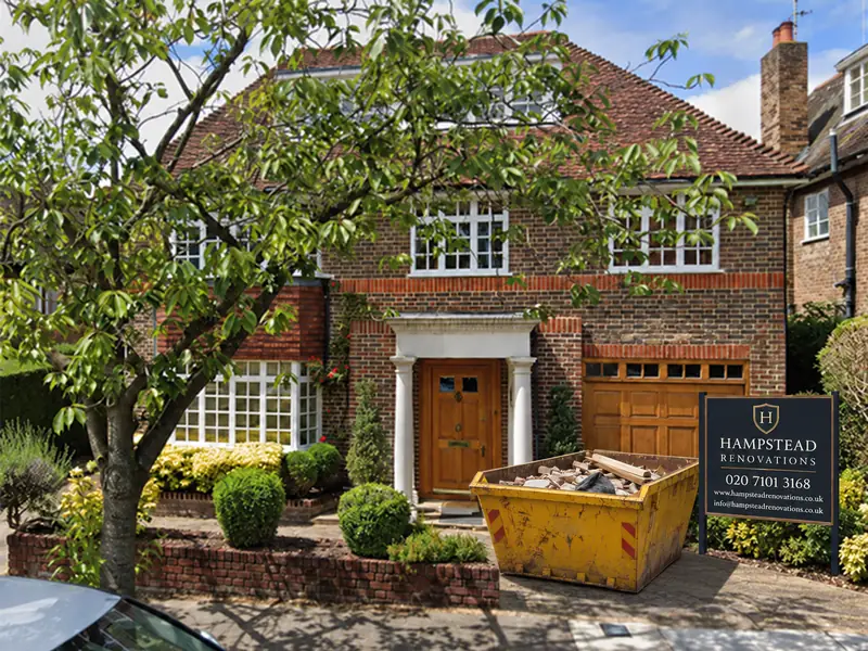
Before work starts we agree where deliveries stop, where a skip can go, how neighbours keep their access, and how the house is protected, and that goes into the site set-up plan we give you.

Sources: Elmbridge Borough Council: Cobham Conservation Area Character Appraisal and Management Plan (endorsed 11 June 2019); Elmbridge Borough Council: The Tilt Conservation Area Character Appraisal and Management Plan (2015); Elmbridge Borough Council: Companion guide - Cobham, Oxshott, Stoke d'Abernon and Downside; Elmbridge Borough Council: Elmbridge Design Code 2024 (SPD); Surrey County Council: Vehicle crossovers or dropped kerbs (Surrey County Council)

Scope

Scoping a Cobham project before a quote

We price a Cobham project once we understand the house. The survey, the planning route and the constraints come before any figure, so the price describes the work the address actually allows.

  1. Feasibility visit

    We walk the house and the plot with you, note its age and construction, and look at how a site would be set up from the street.

  2. Constraints for the address

    Conservation area, Green Belt, flood zone, listed or locally listed status, protected trees and shared walls are checked for the exact property.

  3. Measured survey

    Our surveyors record the house as built, including the places where older fabric may sit behind later finishes.

  4. Design and route

    We design to the route the address allows: permitted development where it applies, or an application with the statements the council asks for.

  5. Engineering and building control

    A structural engineer designs openings, beams and foundations, and the building control route is fixed before work is priced.

  6. Written scope

    Every element is listed, from strip-out to handover, and the price is built from that list.

Ready to take the next step? Send the property address and a short outline of what you want to change.

Book a free feasibility visit

Our Hampstead base, serving Cobham

Talk to our Finchley Road studio

Our studio is in Hampstead on Finchley Road, at NW3 6DN. We serve Cobham from this office. Bring us the practical questions about your house, flat or bathroom and the result you want to achieve.

Contact the studio to discuss your brief and arrange the next step. If you already have drawings, a lease or planning correspondence, tell us what is available.

Book a free feasibility visit
Hampstead Renovations
Unit 3 Palace Court
250 Finchley Road
London NW3 6DN

020 7101 3168
contact@hampsteadrenovations.co.uk

Find our studio on Google Maps

Cobham and the Mole

A town shaped by its river

Cobham lies low beside the River Mole. The flood assessment puts the town at about 20m above Ordnance Datum and the river's floodplain at 15 to 20m, and the Cobham designation statement places the historic centre around the outside edge of a northward meander of the river.

The river has done damage before. The September 1968 flood is widely accepted as the worst recorded in the area, and it destroyed Downside Bridge at Cobham; the assessment counts Cobham's residential areas among those with a history of repeated flooding.

The ground varies too: Taplow Gravel or alluvium over Bagshot sand and the Claygate Member. The assessment expects infiltration drainage to suit the main built-up area of Cobham and Oxshott but to face very significant constraints on the Mole floodplain.

That order shapes our designs here. Soakaways, floor levels and anything below ground are decided once the flood and ground position for the plot is known, never before.

Outside Cobham, and in London rather than Surrey: Holland Avenue, Wimbledon SW20. That completed project of ours combined a loft conversion, a double-storey extension to the rear and side, and a whole-home refurbishment, as its case study describes.

Sources: Elmbridge Borough Council: Level 1 Strategic Flood Risk Assessment, April 2024 (AECOM); Elmbridge Borough Council: Cobham Conservation Area statement of designation; Hampstead Renovations: Holland Avenue, Wimbledon SW20 case study

Cobham questions

Renovating in Cobham: questions we are asked

Is my Cobham home in the Cobham conservation area or another one?

It may be in one of five. The Core Strategy counts five conservation areas in the settlement: Cobham itself (Church Street, River Hill and Mill Road), Cobham (Plough Corner), Downside Village, The Tilt and Stoke d'Abernon. The council's My Neighbourhood map shows whether a property is inside one, and we confirm it for every address before design begins, because it changes permitted development rights and means most applications need a Heritage Statement.

Is Cobham in the Green Belt, and how does that change an extension?

Green Belt land surrounds the settlement area, and the Downside Village, The Tilt and Plough Corner conservation areas lie wholly within it. For a house in the Green Belt, Development Management Plan policy DM18 judges an extension against the original building, which the plan defines as the house as it stood on 1 July 1948, or as first built if later. We check the boundary for the address, and our Elmbridge page quotes the test word for word.

Which council decides a planning application in Cobham now, and from 1 April 2027?

Elmbridge Borough Council until 31 March 2027; East Surrey Council from 1 April 2027. Under the regulations that govern the change, plans adopted by the old council have effect as if adopted by its successor, so the Core Strategy and Development Management Plan continue to have effect in Cobham after the change.

Is my Cobham address in a flood zone?

Most of the settlement area is in Flood Zone 1: the council's 2024 assessment puts 84% of Cobham, Oxshott, Stoke d'Abernon and Downside there. Another 11% is Flood Zone 3b, the functional floodplain, which the assessment shows at risk in a 1 in 30 year flood from the Middle Mole and the River Rythe. The Environment Agency's flood map for planning gives the zone for a single address and tells you whether an application needs a flood risk assessment; we check it before design starts.

Who signs off building regulations for work in Cobham?

Elmbridge Building Control Services (EBCS), for Elmbridge Borough Council, until 31 March 2027, and from 1 April 2027 the provider named by East Surrey Council. You can choose a private registered building control approver instead, and some work, such as wiring done by an electrician who belongs to a competent person scheme, is certified without you seeking approval yourself.

Do you take on single-room projects in Cobham, such as a kitchen or bathroom?

Yes. A kitchen or a bathroom on its own gets the same survey, drawings, site set-up and sign-off as a larger project. If the room is in an older house or a conservation area, we plan the work around the fabric that has to stay.

What happens when you visit a Cobham property for the first time?

We walk the house and garden with you, talk through what you want to change, and look at the things that decide the route: the age and construction of the house, any conservation area or Green Belt boundary, the flood zone, trees, shared walls and access from the road. Afterwards we set out in writing what we found, which surveys or drawings come next, and what the project needs before it can be priced.

Where is your studio, and how do you serve Cobham from it?

Our studio is on Finchley Road in Hampstead, NW3, and we have no premises in Surrey. Design, drawings and project management run from the studio; our site team and project manager work at the house, and you have one contact throughout.

Does this page cover Stoke d'Abernon and Downside as well?

Yes. Both sit in the same Core Strategy area as Cobham, under policy CS10, and both have their own conservation areas, so we cover them here. Oxshott, in the same policy area, has its own page.

Independent
Surveying
Hampstead Renovations operates alongside Hampstead Chartered Surveyors & Building Consultancy — an RICS Regulated firm providing chartered building surveying, fire safety and project advisory services, under shared directorship. Both practices are based in Hampstead NW3, giving Cobham clients access to professional oversight from survey through to handover.

Book a free feasibility visit

Surrey overview
Renovations in Surrey →

See how Cobham fits within our wider Surrey pages.

Full Service Directory

Pages for Cobham

Every service page we publish for Cobham.

Cobham

House Refurbishment in Cobham →

Cobham

House Extensions in Cobham →

Cobham

Kitchen Renovation in Cobham →

Cobham

Bathroom Renovation in Cobham →

Cobham

Loft Conversions in Cobham →

Cobham

Basement Conversions in Cobham →

Chat with us!