
Rickmansworth · Three Rivers · Hertfordshire

Rickmansworth Renovations & Design-Build — WD3

Updated 5 November 2026

Our London team takes on projects in Rickmansworth, Moor Park and Batchworth from the Finchley Road studio in Hampstead, NW3, with design, engineering and the build under one roof.

Rickmansworth is the largest town in Three Rivers and the place where the Colne, the Chess and the Gade meet the Grand Union Canal. Old streets, a 1930s estate, a made neighbourhood plan and some of the district's highest flood and groundwater risk all meet here, so we settle which of them touch the address before anything is drawn. Policy that applies across the whole district is on our Three Rivers page.

Serving Rickmansworth from our Hampstead studio · NW3 6DN
020 7101 3168

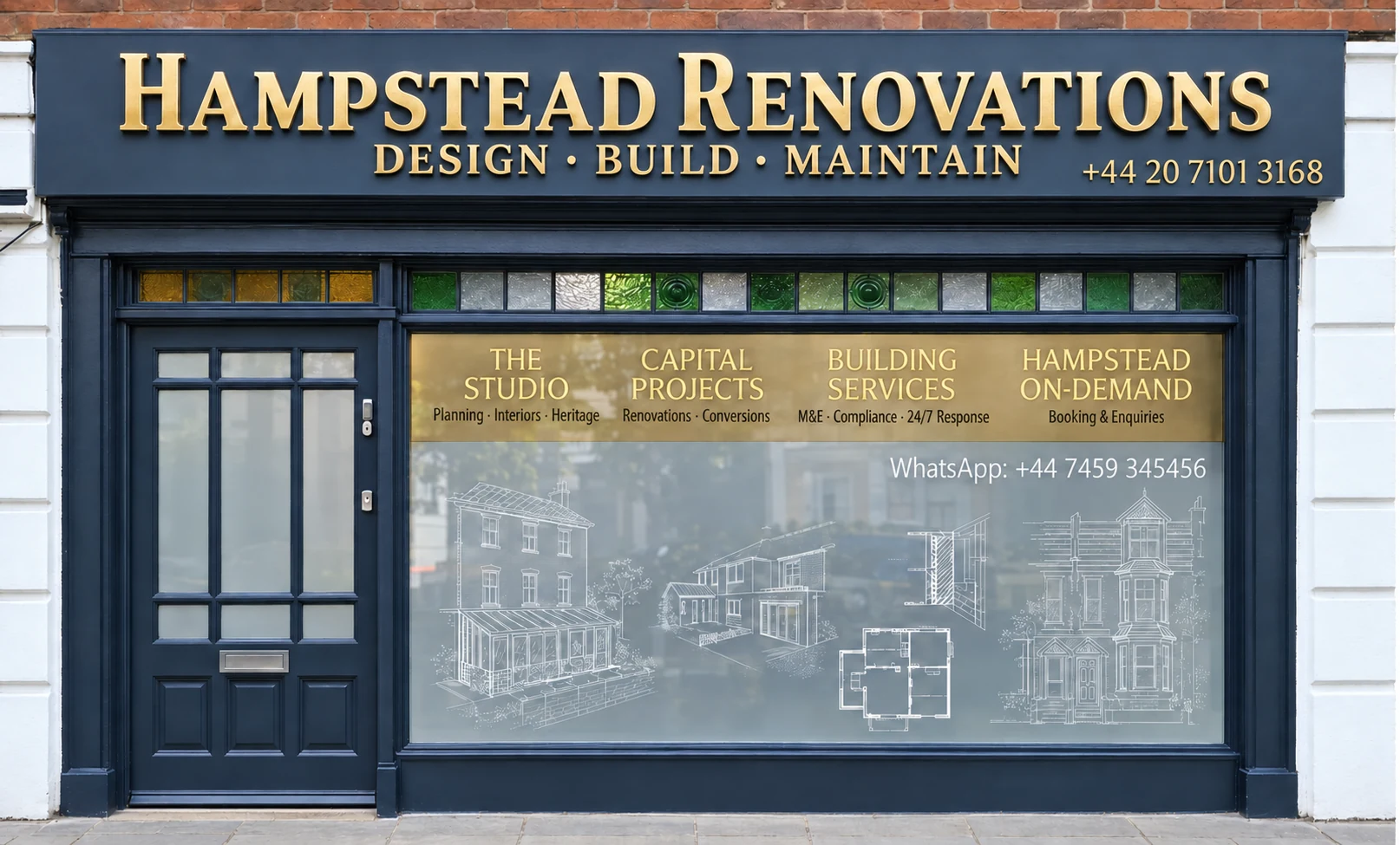
Hampstead Renovations design and build studio on Finchley Road
Our Hampstead studio · Finchley Road, NW3 6DN

Rickmansworth projects

Choose the work your Rickmansworth home needs

01 Whole house

House Refurbishment in Rickmansworth

Refurbishing a Rickmansworth house, whether a Victorian terrace behind the High Street or an inter-war detached house further out. Heating, wiring, insulation, windows and joinery are planned around the age of the building and any conservation area it sits in.

  • Measured survey before design
  • Heating, wiring and insulation
  • Original features kept or matched
Explore House Refurbishment in Rickmansworth

02 Flats

Flat Refurbishment in Rickmansworth

Refurbishing flats in the town centre's purpose-built blocks and in converted buildings, with the lease and the neighbours above and below in mind from the outset. Sound through the floor and the fire door onto the shared landing are designed in, not added at the end.

  • Freeholder permission under the lease
  • Sound between flats
  • Fire doors onto shared landings
Explore Flat Refurbishment in Rickmansworth

Rickmansworth homes

From the town centre to Moor Park: Rickmansworth's homes

At the 2021 Census the Rickmansworth Town ward held 3,398 households. Of these, 966 lived in detached houses, 634 in semi-detached houses and 350 in terraces, while 1,211 lived in purpose-built blocks of flats, with a smaller number in converted houses, other converted buildings and flats above or within commercial premises.

That spread follows the town's growth. The Batchworth Neighbourhood Design Code finds Victorian terraced houses still standing in the historic centre, interspersed with later building, and some 17th to 19th-century buildings along the High Street that give it an intimate scale. Beyond the centre most housing is inter-war or post-war, in a variety of styles and often recognisably Metro-land; the neighbourhood plan records that the town expanded through Metroland development in the 1920s and 1930s.

Flats cluster in the middle of town. The Design Code notes a growing number of apartment blocks, mostly in the centre and some converted from offices, with most of them at four or five storeys while the houses on the residential streets are mainly two.

Each neighbourhood around the centre has its own pattern. Moneyhill, west of the town centre, is detached houses in its eastern part, which is a conservation area, and more semi-detached and terraced housing to the west, generally on long plots with large back gardens. The Harefield Road area is mostly semi-detached and detached, with some bungalows on Sherfield Avenue. Eastbury is dominated by detached houses, many of them 1930s Metroland.

Moor Park & Eastbury is counted as its own ward. Of its 2,100 households in 2021, 1,559 lived in detached houses and 311 in purpose-built flats.

Postcodes do not follow the council boundary here. The WD3 postcode district is shared by Three Rivers, Watford, Buckinghamshire and the London Borough of Hillingdon, and some Three Rivers addresses use HA6, a district shared with Hillingdon. The town centre's own WD3 1AE sits in Batchworth parish, so we confirm the council from the full address rather than the outcode.

Across the boundary, Northwood and Pinner are in London and have their own pages: Northwood and Pinner. In Rickmansworth, the first survey question is which of the places above the property belongs to, because the answer tells us its age, its construction and its planning position.

Sources: ONS/Nomis: Census 2021 TS044, Rickmansworth Town ward; Batchworth Community Council / Three Rivers DC: Batchworth Neighbourhood Design Code (Appendix 1 to the Batchworth Neighbourhood Plan); Batchworth Community Council / Three Rivers DC: Batchworth Neighbourhood Plan 2023-2038, Referendum Version; ONS/Nomis: Census 2021 TS044, Moor Park & Eastbury ward; postcodes.io (ONSPD-derived): outcode WD3; postcodes.io (ONSPD-derived): outcode HA6; postcodes.io (ONSPD-derived): postcode WD3 1AE (Rickmansworth town centre)
Approvals

Checks a Rickmansworth project goes through

Our Three Rivers page covers policy across the district: the adopted plans, the Green Belt floorspace test and the rear-extension depths. The cards here follow that policy as it lands on a Rickmansworth address, adding the local layer that can change the outcome.

Who decides

Planning applications for Rickmansworth, Batchworth and Eastbury addresses go to Three Rivers District Council, decided under Three Rivers Core Strategy (adopted 17 October 2011) and Development Management Policies Local Development Document (adopted July 2013) and Site Allocations Local Development Document (adopted 2014). Our London team of in-house architects, designers and structural engineers, working with Hampstead Chartered Surveyors & Building Consultancy, takes on projects here and prepares the drawings, statements and application.

Neighbourhood plan

The Batchworth Neighbourhood Plan was approved at referendum in May 2025 and is now made, so it forms part of the development plan for the town. Its design and drainage policies, covered in the next section, apply alongside the district's own.

Inside a conservation area?

Batchworth contains six conservation areas. Within one, the council considers every application from a conservation point of view and may refuse it on conservation grounds alone, so we check the address against the council's conservation areas map at the outset.

Green Belt

Batchworth Heath conservation area lies wholly in the Green Belt. For any house in it, Policy DM2 compares extensions with the original building, and the council's Green Belt guidance treats a cumulative floorspace increase of over 40% as normally unacceptable; the Three Rivers page quotes both.

Building regulations

Hertfordshire Building Control signs the work off, or a private registered building control approver can, in which case the council is informed through an initial notice. Building regulations approval is separate from planning permission, and a project may need both.

Neighbours and trees

Building at the boundary, working on a party wall or digging below a neighbour's foundation level means notice to the neighbour. In a conservation area the council must be told before a tree is pruned or removed; trees there without a Tree Preservation Order are protected under section 211.

Sources: Three Rivers District Council: Development Management Policies LDD (adopted July 2013); Three Rivers District Council: Development Plan (Current Local Plan); Three Rivers District Council: Core Strategy (adopted 17 October 2011); Three Rivers District Council: Batchworth Neighbourhood Plan; Batchworth Community Council / Three Rivers DC: Batchworth Neighbourhood Design Code (Appendix 1 to the Batchworth Neighbourhood Plan); Three Rivers District Council: Heritage (listed buildings, local list, conservation areas); Three Rivers District Council: Rickmansworth conservation area; Three Rivers District Council: Batchworth Heath Conservation Area Appraisal (January 2013); Three Rivers District Council: SPG No.3 Extensions to Dwellings in the Green Belt (August 2003); Three Rivers District Council: Building control; GOV.UK: Building regulations approval (printable guide); GOV.UK: Building regulations approval - when you need approval; GOV.UK: Party walls and building work - overview; GOV.UK: Party walls and building work (printable guide); GOV.UK: Party walls and building work - work you must tell your neighbour about; GOV.UK: Tree Preservation Orders and trees in conservation areas (planning guidance)

Local policy

Rickmansworth's conservation areas, the Batchworth plan and the Colne

The old town centre was designated a conservation area in 1993, taking in part of the historic High Street. The neighbourhood plan notes that its medieval core, around the High Street and Church Street, still exists, and that the presence of water is a key feature of it.

Rickmansworth Town

The council's appraisal on file dates from 1993, with a map of the Rickmansworth conservation areas. A new draft Character Appraisal and Management Plan, which also reviews the boundary, was consulted on until 12 August 2026 and is now under review before being finalised, so for a town-centre address we read both.

Batchworth Heath

Designated in January 1994: an ancient heath of 7 hectares around a large pond, with seven Grade II listed buildings, among them the 17th-century Batchworth Heath Cottages and the late 18th-century, red brick Batchworth Heath House. Its 2013 appraisal expects Green Belt policy, more than conservation policy, to limit the size of extensions.

Nightingale Road and Cedars Avenue

The conservation area covering Nightingale Road, Upper Nightingale Road and Cedars Avenue forms the eastern part of Moneyhill, west of the town centre, and is mainly detached houses.

Listed and locally listed buildings

Works to a listed building that affect its significance need Listed Building Consent first; Basing House, near the library, is one listed at Grade II. The council also keeps two Rickmansworth local lists: those buildings lack statutory protection, but the list exists to stop alterations needing planning permission from harming their character.

The Batchworth plan's design policy asks new development to respond to the Design Code on building heights, materials, frontages, plot widths, boundary treatments and street enclosure, and says proposals that depart from it need full justification. Its sustainable design policy asks refurbishments to take a low carbon approach, cutting heat loss and adding energy saving measures and renewable sources.

The 2026 Strategic Flood Risk Assessment puts the district's most extensive river flood risk in the low-lying valley of the Colne, which affects Rickmansworth and Batchworth, and lists Rickmansworth among the settlements at highest risk of groundwater flooding, where chalk and gravel can bring groundwater up to, or just below, the surface. It also records more of the district's recent flood incidents in Rickmansworth than anywhere else.

The neighbourhood plan places flood risk along the confluence of the Colne, Gade and Chess and where they meet the Grand Union Canal, with extensive areas at risk from surface water too, and it says heavily paved front gardens are causing major problems in parts of Eastbury and Rickmansworth.

Before design, every address is checked against the flood map for planning that the Environment Agency publishes. District-wide flood and basement guidance is on our Three Rivers page.

Sources: Batchworth Community Council / Three Rivers DC: Batchworth Neighbourhood Plan 2023-2038, Referendum Version; Three Rivers District Council: Rickmansworth conservation area; Three Rivers District Council: Heritage (listed buildings, local list, conservation areas); Three Rivers District Council (Have Your Say): Rickmansworth Conservation Area Appraisal, project page; Three Rivers District Council: Batchworth Heath Conservation Area Appraisal (January 2013); Three Rivers District Council: Batchworth Heath conservation area; Batchworth Community Council / Three Rivers DC: Batchworth Neighbourhood Design Code (Appendix 1 to the Batchworth Neighbourhood Plan); Three Rivers District Council (JBA): Level 1 Strategic Flood Risk Assessment 2026; Environment Agency (GOV.UK service): Get flood risk information for planning in England (Flood map for planning)

Moor Park

Moor Park: what the council's appraisal says

Moor Park lies south-east of Rickmansworth town centre and has been a conservation area since 18 May 1995. The council's appraisal describes low-density Metroland development planned on a comprehensive scale in the 1930s, almost wholly residential and mainly detached houses, with a small shopping parade and some flats beside the station on Main Avenue.

Its layout comes from its history. The appraisal records the original estate company starting work on 288 acres in 1922, spreading south and west from the halt that is now Moor Park station, and building resuming after the war along the original lines. Today Moor Park (1958) Ltd, run by residents, maintains the private roads, verges and open spaces, and countryside designated Green Belt surrounds the estate on three sides.

Private obligations can sit in a property's deeds. The appraisal says these are not planning issues the council can enforce, and it advises every applicant to ask the estate company which, if any, apply to their property.

For planning, the appraisal sets criteria for development. Buildings, garages and car ports included, should cover no more than 15% of the plot, and that cover counts any basement area extending beyond the ground floor. At least 20% of the frontage at the building line should stay clear along the flanks, building in front of the existing building line is unacceptable, and deep floor plans are unlikely to be acceptable.

Roofs are expected to be duo pitched, flat roofs or flat-topped sections are judged out of keeping, and front dormers are acceptable only where they are already a common feature of the street. Since January 2005 an Article 4 direction has withdrawn permitted development rights for rooflights, hardstanding, walls, gates, fences and other means of enclosure across the conservation area.

Basement levels evident on street elevations are considered uncharacteristic and unacceptable, and any application including a basement should be accompanied by a flood risk assessment of its effect on underground water courses.

For an address on the estate we measure the plot against the coverage and frontage figures at the first survey, before any design.

Sources: Three Rivers District Council: Moor Park Conservation Area Appraisal (October 2006, adopted November 2006)

Building fabric

Building types in Rickmansworth and what they mean for the work

Brick dominates. The Design Code names yellow stock brick, red brick and white render as Batchworth's predominant materials, with slate or concrete tiles the commonest roofs, and asks for close attention to the bond, size, colour and texture of any matching brick.

Terraces off the High Street

What lies behind the High Street?

The roads off the High Street mix terraced housing, apartment buildings and small offices, and the houses behind it generally sit a short way back behind small front gardens.

On these houses we look at shared walls, chimney breasts and rear additions before planning new openings or service runs.

Older High Street buildings

How old is the fabric in the centre?

The Design Code dates some High Street buildings to the 17th to 19th centuries, and the neighbourhood plan credits historic buildings along Church Street with much of its character.

Older fabric is opened up in recorded stages, and repairs are specified to match what is found rather than what is assumed.

Inter-war and Metro-land houses

What do the 1920s and 1930s houses usually need?

Outside the centre most houses are inter-war or post-war, often Metro-land in style, and many of Eastbury's detached houses are 1930s Metroland.

Rewiring, heating, insulation and extensions are the usual work; original roofs, chimneys and windows are recorded first, because they set the character of the street.

Detached houses on the estate

What sets Moor Park's houses apart?

The appraisal describes detached two-storey houses with pitched roofs on individual plots, many original features including chimneys, and many important trees protected by Tree Preservation Orders.

We plot trees, chimneys and roof pitches on the measured drawings, and every new element is then designed against them.

Apartment blocks and conversions

Where are the town's flats?

Most apartment blocks are in the centre, typically four or five storeys, and some buildings there have changed from office to residential use.

A flat starts with the lease, the floors and walls shared with neighbours, and the route of services through the common parts.

Houses near the water

What changes beside the rivers and canal?

All three rivers meet in Rickmansworth, and the Grand Union Canal runs with the Colne and the Gade through the town; surface water also ponds where the Colne floodplain flattens.

Near the water, floor levels, drainage and the ground are established before anything is designed below or beside the house.

Sources: Batchworth Community Council / Three Rivers DC: Batchworth Neighbourhood Design Code (Appendix 1 to the Batchworth Neighbourhood Plan); Batchworth Community Council / Three Rivers DC: Batchworth Neighbourhood Plan 2023-2038, Referendum Version; Three Rivers District Council: Moor Park Conservation Area Appraisal (October 2006, adopted November 2006); Three Rivers District Council (JBA): Level 1 Strategic Flood Risk Assessment 2026

On site

Access, parking and dropped kerbs in Rickmansworth

How materials reach a Rickmansworth property depends on the street. The Design Code describes the High Street as normally busy with traffic and narrow pavements, and the neighbourhood plan notes commuters from outside the area parking in Moneyhill before catching the train or tube.

Green verges are typical of Batchworth's residential streets. The neighbourhood plan asks contractors to park carefully and holds applicants and homeowners responsible for repairing any verge damage the works cause.

A new driveway needs a dropped kerb, and Hertfordshire County Council says you are not allowed to drive over a pavement or verge unless it has approved and installed one. Where planning permission is also needed, Policy BW CC4 supports a dropped kerb or crossover only with suitable on-site drainage and no increase in surface run-off, and where a front garden is paved it asks for as much lawn and planting as possible to be kept.

On the Moor Park estate the appraisal asks that hardstanding between the house and the road is no larger than needed to park and turn, and where a new crossover would affect a private road, a further application goes to Moor Park (1958) Ltd as well.

Our site manager fixes the delivery point, where a skip or scaffold can stand, and how verges, footways and a neighbour's access are protected, and records those decisions in a site set-up plan you approve before anyone arrives.

Sources: Batchworth Community Council / Three Rivers DC: Batchworth Neighbourhood Design Code (Appendix 1 to the Batchworth Neighbourhood Plan); Batchworth Community Council / Three Rivers DC: Batchworth Neighbourhood Plan 2023-2038, Referendum Version; Hertfordshire County Council: Residential Dropped Kerbs Policy, version 7 (8 May 2026); Three Rivers District Council: Moor Park Conservation Area Appraisal (October 2006, adopted November 2006)

Scope

Scoping a Rickmansworth project before a quote

We put no figure on a Rickmansworth project until the building, the planning route and the ground are understood. The quote then prices the work the address can actually take.

  1. First visit

    We go round the property and the plot with you, hear what you would like to alter, and see how scaffold, deliveries and a skip would reach it from the road.

  2. Address checks

    Conservation area, the Moor Park appraisal where it applies, Green Belt, flood zone, groundwater, listed or locally listed status and protected trees are confirmed for that specific address.

  3. Measured survey

    The building is drawn as it stands by our surveyors, roof voids, floor structures and drainage runs included, along with anything hidden behind later finishes.

  4. Design and planning route

    Drawings are prepared for whichever route is open: permitted development if available, a householder application carrying the supporting documents the council requires, or, for a flat, the freeholder's permission.

  5. Engineering and building control

    Our structural engineers design beams, foundations and any retaining walls, and we agree who will act as building control before anything is priced.

  6. Written scope

    Every item from strip-out to handover is listed, and the quote is assembled from it line by line.

Ready to take the next step? Send the property address and a short outline of what you want to change.

Book a free feasibility visit

Our Hampstead base, serving Rickmansworth

Talk to our Finchley Road studio

Our studio is in Hampstead on Finchley Road, at NW3 6DN. We serve Rickmansworth from this office. Bring us the practical questions about your house, flat or bathroom and the result you want to achieve.

Contact the studio to discuss your brief and arrange the next step. If you already have drawings, a lease or planning correspondence, tell us what is available.

Book a free feasibility visit
Hampstead Renovations
Unit 3 Palace Court
250 Finchley Road
London NW3 6DN

020 7101 3168
contact@hampsteadrenovations.co.uk

Find our studio on Google Maps

Rivers and ground

Where three rivers meet a canal

The Colne, the Chess and the Gade all meet in Rickmansworth, and the Grand Union Canal runs through the town beside the Colne and the Gade. The flood assessment lists raised or reinforced walls and embankments on the canal at Batchworth, on the Chess at Rickmansworth and on the Colne from Rickmansworth to Maple Cross.

Its record of incidents in the town includes groundwater flooding on Church Street, Batchworth, in February 2004 and on Kewferry Road in November 2006, and properties flooding on Uxbridge Road in 2007 when the Colne rose. Canal overtopping between Rickmansworth and West Hyde has mostly affected the towpath rather than property.

Groundwater is the less visible risk. The assessment says high groundwater does more than flood basements: shallow groundwater can worsen poor drainage and its ingress can damage below-ground infrastructure. No national groundwater flood dataset is detailed enough to map it, so emergence mapping read with topography and flow paths is used instead.

So our engineers set floor levels, choose between soakaways and attenuation, and decide whether anything goes below ground only once the plot's flood zone, groundwater and drainage outfall are known.

Outside Rickmansworth, and in London rather than Hertfordshire: Project example: Belsize Park, NW3. That project of ours is a Victorian townhouse of five storeys; its case study records a basement conversion, a rear extension and loft work, carried out together with a full refurbishment of the interior.

Sources: Batchworth Community Council / Three Rivers DC: Batchworth Neighbourhood Plan 2023-2038, Referendum Version; Three Rivers District Council (JBA): Level 1 Strategic Flood Risk Assessment 2026; Hampstead Renovations: Belsize Park Gardens, NW3 case study

Rickmansworth questions

Renovating in Rickmansworth: questions we are asked

What does the Batchworth Neighbourhood Plan cover in Rickmansworth and Moor Park?

The plan was approved at referendum in May 2025 and is now made, so it forms part of the development plan used on planning applications. It covers Eastbury, Moor Park and Rickmansworth within the Community Council's boundaries. Among its policies are high quality design, which asks schemes to respond to the Batchworth Neighbourhood Design Code; sustainable design, which expects refurbishments to take a low carbon approach; and the paving of front gardens, which favours keeping lawn and planting and keeping run-off out of the drains.

Is my Rickmansworth house in one of the town's conservation areas?

It may be. Batchworth contains six: Rickmansworth Town; Nightingale Road, Upper Nightingale Road and Cedars Avenue; Moor Park; Batchworth Heath; Frith Wood; and Stocker's Lock and Farm. The council publishes a map of the Rickmansworth conservation areas and is finalising a new appraisal for the town after consulting on a draft until 12 August 2026. We confirm the boundary for every address before design, because inside a conservation area the council considers each application from a conservation point of view.

What does the council's Moor Park appraisal say about plot coverage, basements and the Article 4 direction?

Buildings, including garages and car ports, should cover no more than 15% of the plot, and that cover counts basement areas that extend beyond the ground floor. Basement levels evident on street elevations are considered uncharacteristic and unacceptable, and any application with a basement should include a flood risk assessment of its effect on underground water courses. The Article 4 direction, approved in January 2005, withdrew permitted development rights for rooflights, hardstanding, walls, gates, fences and other means of enclosure, so those works need planning permission first.

Is my Rickmansworth address in the Colne valley flood zones or a high-groundwater area?

Possibly. The 2026 flood assessment places the district's most extensive river flood risk in the low-lying Colne valley, affecting Rickmansworth and Batchworth, and lists Rickmansworth among the settlements at highest risk of groundwater flooding. Surface water ponds where the Colne floodplain flattens, and the neighbourhood plan records land within Flood Zone 3 east of Moor Park along the railway. For one address, the zone comes from the Environment Agency's flood map for planning; we check it, together with the groundwater position, before design.

What is Three Rivers' Green Belt test for an extension?

Policy DM2 says extensions to buildings in the Green Belt that are disproportionate in size, individually or cumulatively, to the original building will not be permitted. The council's Green Belt guidance adds that a cumulative floorspace increase of over 40% compared with the original dwelling will normally be unacceptable, and it counts all earlier extensions, not just the new one. Batchworth Heath lies wholly in the Green Belt; for other addresses we check the boundary first, and the full wording is quoted on our Three Rivers page.

Do you refurbish flats in Rickmansworth?

Yes. At the 2021 Census 1,211 households in the Rickmansworth Town ward lived in purpose-built blocks of flats, with more in converted houses and other buildings. A flat refurbishment starts with the lease, which says whether you need permission to make alterations, and it is designed around sound and fire separation from the flats alongside. Our Rickmansworth flat refurbishment page covers the detail.

Who signs off building regulations in Rickmansworth?

Hertfordshire Building Control provides building control for Three Rivers addresses. You may instead appoint a private registered building control approver, and that approver then informs the council of the work with an initial notice. Wiring by an electrician belonging to a competent person scheme, among other jobs, is certified by the installer, so no separate application from you is needed.

Who builds a dropped kerb for a Rickmansworth driveway?

Hertfordshire County Council. It says you are not allowed to drive over a pavement or verge unless a dropped kerb has been approved and installed by the county. Where planning permission is needed as well, the Batchworth Neighbourhood Plan supports a dropped kerb only with suitable on-site drainage and no increase in surface run-off. On the Moor Park estate, a crossover that would affect a private road also needs an application to the estate company.

Independent
Surveying
Hampstead Renovations operates alongside Hampstead Chartered Surveyors & Building Consultancy — an RICS Regulated firm providing chartered building surveying, under shared directorship.
Explore Nearby Areas

Book a free feasibility visit

Hertfordshire overview
Renovations in Hertfordshire →

See how Rickmansworth fits within our wider Hertfordshire pages.

Full Service Directory

Pages for Rickmansworth

Every service page we publish for Rickmansworth.

Rickmansworth

House Refurbishment in Rickmansworth →

Rickmansworth

Flat Refurbishment in Rickmansworth →

Rickmansworth

House Extensions in Rickmansworth →

Rickmansworth

Kitchen Renovation in Rickmansworth →

Rickmansworth

Bathroom Renovation in Rickmansworth →

Rickmansworth

Loft Conversions in Rickmansworth →

Rickmansworth

Basement Conversions in Rickmansworth →

Chat with us!