
Wycombe · West planning area · Buckinghamshire

Wycombe Renovations & Design-Build — Buckinghamshire

Updated 6 November 2026

Refurbishment, extensions, lofts, basements, kitchens, bathrooms and flats in Marlow and Bourne End, with the design, the engineering and the building carried out by one London team.

Marlow and Bourne End have pages of their own; this one gathers the rules of the wider area that they share. It sets out the newest of the three legacy plans and the council's review of it, the volume-based Green Belt test for extending or replacing a house, the Thames and its flood zones, the protected landscape around Marlow, the Wooburn and Bourne End plan and building control.

Serving Wycombe from our Hampstead studio · NW3 6DN
020 7101 3168

Hampstead Renovations design and build studio on Finchley Road
Our Hampstead studio · Finchley Road, NW3 6DN

Wycombe towns

Choose Marlow or Bourne End

01 Town on the Thames

Marlow

The Marlow page covers the town's conservation area, the Thames flood zones west of Marlow Bridge and by Lock Road, and the National Landscape boundary that takes in the town's northern edge but not its centre.

  • Thames Flood Zones 3a and 3b
  • Marlow conservation area
  • Seven service pages
Explore Marlow

02 Villages by the river

Bourne End

Bourne End's page follows the Wooburn and Bourne End neighbourhood plan, the Riversdale and Hedsor Road conservation area on the east bank of the Thames, and the Flood Zone 3a that covers the southern part of the village.

  • Riversdale and Hedsor Road
  • Neighbourhood plan to 2033
  • Southern flood zone
Explore Bourne End

The plans in force

Which plans decide a Wycombe-area application

Applications in Marlow and Bourne End are decided by Buckinghamshire Council under the Wycombe District Local Plan (adopted August 2019) and Delivery and Site Allocations Plan (adopted 2013). Those are the documents its own scheme lists for the former Wycombe District local plan area, the west planning area, and the council uses them to make local decisions.

The old district reached from just south of Aylesbury to the Thames. Its Local Plan records that 71% of it falls within the Chilterns AONB and 48% within the Metropolitan Green Belt, the belt that runs all the way round London. Our pages cover two of its settlements on the river, Marlow and Bourne End.

In June 2025 the council reviewed both plans under Regulation 10A and concluded that, as a whole, they are not out of date. Parts are: since adoption the government has introduced Grey Belt and changed the tests for Green Belt development, the Golden Rules, so DM42 and DM43 are partially out of date, as is the evidence behind flood policy DM39. Ultimately, the review says, the decision-maker decides the weight to give the adopted policies.

The county-wide replacement to 2045 has completed its Regulation 19 consultation and is due before an inspector in 2027. It has not been adopted, so the 2019 plan and the 2013 allocations plan remain the documents applied here.

Where a local policy and the current national framework have drifted apart, our planning statement sets out both, so the scheme stands up on whichever the officer gives more weight.

Sources: Buckinghamshire Council: Local Development Scheme, 3. Our current plans and documents (last updated 16 March 2026); Wycombe District Council: Wycombe District Local Plan (adopted August 2019); Buckinghamshire Council: Regulation 10A Review of the Wycombe District Local Plan and the Delivery and Site Allocations Plan (June 2025); Buckinghamshire Council: Local Development Scheme, 4. Plans we will work on (last updated 16 March 2026); Buckinghamshire Council: Draft Local Plan for Buckinghamshire 2045 (Regulation 19 consultation)

Green Belt

DM42 and DM43: the Wycombe-area volume tests

The Green Belt here is part of the London Metropolitan Green Belt, and Policy DM42 begins from the position that development in it is inappropriate. Its exceptions include development that accords with a made neighbourhood plan, and the replacement or extension of dwellings only when they accord with DM43; other inappropriate development will be refused unless there are very special circumstances.

Local Plan, 2019

DM43: when an extension is appropriate

An extension or replacement is appropriate only when it satisfies one or more of the policy's conditions. Three turn on where the house is: it accords with a made neighbourhood plan; it is in a built-up village shown on the Policies Map; or it is in a ribbon of development with a substantially built-up frontage and the result would not exceed the average volume of its two directly adjacent neighbours.

The rest are volume bands. The volume of existing outbuildings is left out of all of these calculations.

Local Plan, 2019

DM43: the volume bands

Volume means gross external volume, including any basement, against the building as it existed on 1 July 1948.

  • “Where the volume of the original dwelling is less than 240 cubic metres, the total volume of the resulting building is no more than 360 cubic metres”
  • “Where the volume of the original dwelling is between 240 and 720 cubic metres, the total volume of the resulting building is no more than the volume of the original building plus 50%”
  • “Where the volume of the original dwelling is more than 720 cubic metres, the total volume of the resulting building is no more than 1080 cubic metres”
  • For a replacement, “the total volume of the resulting dwelling is no more than the volume of the dwelling which is being replaced”
Local Plan, 2019

DM43: garden buildings

Residential outbuildings are appropriate in a built-up village or under a made neighbourhood plan. Elsewhere in the Green Belt any increase in their volume is appropriate only when all of the conditions apply: existing and proposed outbuildings together within 25% of the original house's volume and within 140 cubic metres, no more than 50% of the curtilage outside the house covered by them, a single level throughout, and no part over 4 metres high.

Local Plan, 2019

DM43: proportion

In every case the development must also respect the open character of the Green Belt and appear proportionate to the original dwelling, with particular account taken of visual impact. Past and proposed extensions to the house are considered together.

The move to volume was deliberate. The council had defined proportionate by gross floorspace, which threw up anomalies over double-height voids and alternative roof designs, and it judged that assessing three-dimensional mass would bring greater clarity and consistency while keeping flexibility for very small dwellings and an upper limit for very large ones.

The plan calls these figures its benchmark approach to how far a house can be extended without disproportionate additions. The council's own Regulation 10A review then found DM43 no longer entirely consistent with national Green Belt policy and in need of updating, so the bands are read alongside the NPPF rather than as the whole test.

For a house where volume is the test, we model the original building, each later addition and the proposal in three dimensions from the measured survey, lower floors included, so every figure in the application can be checked line by line.

Sources: Wycombe District Council: Wycombe District Local Plan (adopted August 2019); Buckinghamshire Council: Regulation 10A Review of the Wycombe District Local Plan and the Delivery and Site Allocations Plan (June 2025)
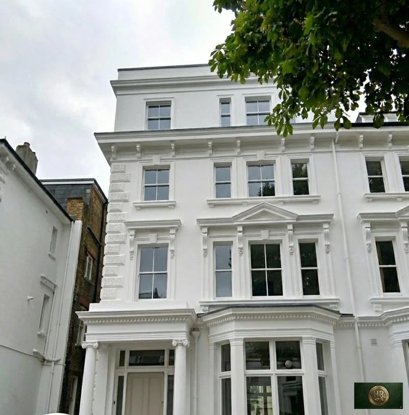
The Thames

Flood Zones 2 and 3 along the Thames at Marlow and Bourne End

Policy DM39 directs all development to the areas at least risk of flooding, refuses inappropriate development where the risk is high, and safeguards the functional flood plain for storing and carrying water in times of flood. Minor development is one of two exceptions to its sequential test, but development in any area at risk of flooding needs a site-specific flood risk assessment, which has to cover resilient and resistant construction among other things.

The 2014 update of the Level 1 flood assessment maps the risk in Marlow street by street. West of Marlow Bridge the area around Pound Lane is in Flood Zone 3a, with many residential properties on the main road and the cul-de-sacs off it; east of the station, housing enclosed by the A404, Lock Road and the railway lies within Flood Zones 3a and 3b; and a number of properties between Glade Road and the A404, south of Westhorpe Road, are in Flood Zone 2.

At Bourne End the southern area is in Flood Zone 3a, with numerous residential properties along Riversdale, and the Local Plan notes that the nearness of the Thames, and the River Wye as well, raise concerns about flood risk.

SFRA Level 1, 2014

Flood Zone 3b

There should be a presumption against all building extensions, so as not to raise flood levels elsewhere, and property sub-division should not be permitted. Basements are not permitted.

SFRA Level 1, 2014

Flood Zone 3a

Building extensions, outbuildings included, should be discouraged to avoid raising flood levels elsewhere. Basement dwellings are not permitted, and for other development no sleeping accommodation is permitted at basement level.

SFRA Level 1, 2014

Flood Zone 2

Extensions and outbuildings may obstruct overland flow paths, so they should be designed carefully to avoid raising the potential risk of flooding to adjoining properties.

In general, floor levels must be at least 300mm above the 1% (1 in 100) AEP river flood level, climate change included, though the figure varies with the flood zone and the nature of the development, and residential property needs dry access in that same 1% event.

The council's Regulation 10A review treats the evidence behind DM39 as partially out of date and points to the need to take better account of flood risk from all sources, now and in the future, with climate change allowances.

Close to a river, the flood zone is settled before anything else: we take the Environment Agency mapping and the assessment's notes for the street, set floor levels and escape routes with the flood risk assessment, and only then decide whether a lower floor has any place in the scheme.

Sources: Wycombe District Council: Wycombe District Local Plan (adopted August 2019); Wycombe District Council: Strategic Flood Risk Assessment Level 1 Update (November 2014); Buckinghamshire Council: Regulation 10A Review of the Wycombe District Local Plan and the Delivery and Site Allocations Plan (June 2025)

Protected landscape

Marlow, the Chilterns National Landscape and the Green Belt

The Local Plan describes Marlow by its setting on the banks of the River Thames and its location in the Chilterns Area of Outstanding Natural Beauty. It calls the town severely constrained by the Green Belt, the AONB and the Thames floodplain, so development will be focused within the town and more limited in scale.

The boundary itself runs along the edge of the town. A query of the national boundary data at a point on Marlow's northern edge returns the Chilterns, while the point at the town centre returns nothing, so whether a Marlow house is on article 2(3) land depends on the street. Of Bourne End and Wooburn, the plan says the area is surrounded by the Green Belt but not by the AONB.

Within the AONB, Policy DM30 requires development to conserve, and where possible enhance, its natural beauty and to deliver the highest quality design, respecting the natural beauty and built heritage of the Chilterns; in its setting, development must not have a significant adverse impact on that beauty. Among the special qualities the plan lists are villages with their brick and flint houses and globally rare chalk streams.

Burnham Beeches is handled differently in this area. The council's mitigation strategy for that SAC does not apply to the former Wycombe area; here a Suitable Accessible Natural Green space at Little Marlow Lakes, west of Bourne End, forms part of the agreed mitigation for the Hollands Farm housing site.

Where a house sits inside the boundary or close to it, materials are chosen from the local palette from the start, and we draw the scheme as it will be seen from public paths and higher ground as well as from the road.

Sources: Wycombe District Council: Wycombe District Local Plan (adopted August 2019); planning.data.gov.uk (MHCLG, Natural England data): AONB point query 51.585,-0.785 (north edge of Marlow); planning.data.gov.uk (MHCLG, Natural England data): AONB point query 51.5707,-0.7756 (Marlow centre); legislation.gov.uk: Town and Country Planning (General Permitted Development) (England) Order 2015 (SI 2015/596), article 2 (latest available revised); legislation.gov.uk: GPDO 2015 (SI 2015/596), Schedule 1 Part 1, Article 2(3) land (latest available revised); Buckinghamshire Council: Burnham Beeches SAC Strategic Access Management and Monitoring Strategy SPD (adopted November 2020); Buckinghamshire Council: Development in the Burnham Beeches Special Area of Conservation

Neighbourhood plan

The Wooburn and Bourne End neighbourhood plan

The Wooburn and Bourne End Neighbourhood Development Plan runs from 2013 to 2033 and covers the parish, made up of distinct settlements including Wooburn Green, Wooburn Town, Cores End, Bourne End and part of Hedsor; its area does not include Abbotsbrook, Well End or Little Marlow. It went to referendum on 7 September 2023, and the council has published its decision to make the plan.

Several of its policies reach householder work. Policy WBE/PD1 asks that extensions or alterations in a conservation area respect its character and appearance, and WBE/PD3 asks proposals in the Berghers Hill, Clapton Mill, Watery Lane, Wooburn Green, Wooburn Town, and Riversdale and Hedsor Road conservation areas to respond positively to the development control advice in their character assessments. Beside a watercourse, WBE/PD4 asks for an ecological buffer from the top of the bank.

The parish council found no local environmental issue left unaddressed by the NPPF and the Local Plan, so the plan adds no environmental policies of its own. A made plan carries weight in the Green Belt too, since DM42 and DM43 both treat development that accords with one as an exception. Little Marlow, meanwhile, appears among the council's emerging plans for the Wycombe area.

When a made plan applies, its design and heritage policies are read before the survey drawings are even finished, and the planning statement takes each one in turn.

Sources: Wooburn and Bourne End Parish Council: Neighbourhood Development Plan 2013-2033, referendum version (28 June 2023); Buckinghamshire Council: Wooburn and Bourne End Neighbourhood Plan, Information Statement for Referendum (2023); Buckinghamshire Council: Neighbourhood planning, the plans; Wycombe District Council: Wycombe District Local Plan (adopted August 2019)

Sign-off

Building control and dropped kerbs for Wycombe-area addresses

Planning permission and building regulations approval are two different things, and a scheme may require both. In Marlow and Bourne End the council's route is Buckinghamshire Council's building control service, which publishes building regulation guidance on extensions, takes building notices for small-scale work as well as full plans applications, and keeps building control records for properties.

A private registered building control approver is the other route. Once appointed, the approver tells your local authority about the work, a step known as giving an initial notice.

Dropped kerbs are licensed by Buckinghamshire Council. Its application asks for a location plan at a scale of 1/200, a drawing of the access no wider than 4.6m along with the dimensions of the front garden, and a plan of any proposed change to the front boundary wall, fence or hedge.

We prepare the building regulations package in-house, structural calculations included, arrange each inspection as the work reaches it, and keep the certificates with the drawings, ready for whenever a buyer or a surveyor asks for them.

Sources: GOV.UK: Building regulations approval - when you need approval; Buckinghamshire Council: Building regulations and control; GOV.UK: Building regulations approval (printable guide); Buckinghamshire Council: Apply for a dropped kerb licence

Our Hampstead base, serving Wycombe

Talk to our Finchley Road studio

Our studio is in Hampstead on Finchley Road, at NW3 6DN. We serve Wycombe from this office. Bring us the practical questions about your house, flat or bathroom and the result you want to achieve.

Contact the studio to discuss your brief and arrange the next step. If you already have drawings, a lease or planning correspondence, tell us what is available.

Book a feasibility visit
Hampstead Renovations
Unit 3 Palace Court
250 Finchley Road
London NW3 6DN

020 7101 3168
contact@hampsteadrenovations.co.uk

Find our studio on Google Maps

Working with us

How we take on projects in the Wycombe area

In Marlow and Bourne End, projects are taken on by our London team: architects, designers and structural engineers employed in-house, working alongside Hampstead Chartered Surveyors & Building Consultancy. Planning goes to Buckinghamshire Council for decision, and building regulations to Buckinghamshire Council's building control service or, if you prefer, a private registered building control approver.

There is no office of ours in the county; the projects are run from our Finchley Road studio in Hampstead, NW3. A first visit to the house looks at its construction and its history, the constraints from this page that touch it, and what you would like it to become.

From there come the measured survey and a feasibility study tested against these policies, then the application, the structural design and the build, delivered by one team from the first drawing to sign-off.

Outside Wycombe, and in London rather than Buckinghamshire: Project example: Belsize Park, NW3. That project of ours is a Victorian townhouse of five storeys; its case study records a basement conversion, a rear extension and loft work, carried out together with a full refurbishment of the interior.

Sources: Buckinghamshire Council: Local Development Scheme, 3. Our current plans and documents (last updated 16 March 2026); Buckinghamshire Council: Building regulations and control; GOV.UK: Building regulations approval (printable guide); Hampstead Renovations: Belsize Park Gardens, NW3 case study

Wycombe questions

Planning and building in the Wycombe area: common questions

Which plan decides an application in Marlow or Bourne End?

Buckinghamshire Council, applying the Wycombe District Local Plan (adopted August 2019) and Delivery and Site Allocations Plan (adopted 2013), which it uses for the west planning area. Its review of June 2025 found the plans not out of date as a whole, though Green Belt policies DM42 and DM43 are partially out of date. In Bourne End the Wooburn and Bourne End neighbourhood plan applies as well.

How does the Wycombe-area Green Belt policy measure an extension?

By volume. Policy DM43 compares the gross external volume of the resulting building with the original dwelling as it stood on 1 July 1948: below 240 cubic metres the result may be no more than 360; between 240 and 720, no more than the original plus 50%; above 720, no more than 1080 cubic metres. A made neighbourhood plan, a built-up village or a qualifying ribbon frontage can also make an extension appropriate.

Does a basement count towards the Green Belt volume test?

Yes. The Local Plan measures three-dimensional mass, defined as gross external volume including any basement, so a new basement under a Green Belt house adds to the total that DM43 tests. Existing outbuildings are left out of that calculation and have limits of their own.

Which parts of Marlow and Bourne End lie in a Thames flood zone?

The 2014 flood assessment places the area around Pound Lane, west of Marlow Bridge, in Flood Zone 3a; housing enclosed by the A404, Lock Road and the railway east of Marlow station, within Flood Zones 3a and 3b; and properties between Glade Road and the A404, south of Westhorpe Road, in Flood Zone 2. In Bourne End the southern area is in Flood Zone 3a, with numerous properties along Riversdale.

Is Marlow in the Chilterns National Landscape?

Partly. The Local Plan describes Marlow's location in the Chilterns AONB, and the national boundary data returns the Chilterns at a point on the town's northern edge but nothing at the town centre, so it depends on the street. Bourne End and Wooburn are surrounded by the Green Belt but not by the AONB.

Who signs off building regulations for a Wycombe-area address?

Buckinghamshire Council's building control service, which takes full plans applications and building notices, or a private registered building control approver you appoint, who notifies the local authority with an initial notice. Either way, building regulations approval is separate from planning permission.

Independent
Surveying
Hampstead Renovations operates alongside Hampstead Chartered Surveyors & Building Consultancy — a firm providing chartered building surveying, under shared directorship.
Explore Nearby Areas

Book a feasibility visit

Buckinghamshire overview
Renovations in Buckinghamshire →

See how Wycombe fits within our wider Buckinghamshire pages.

Full Service Directory

Pages for Wycombe

Every town page we publish for Wycombe.

Wycombe

Marlow →

Wycombe

Bourne End →

Chat with us!