
Hertsmere · Hertfordshire

Hertsmere Renovations & Design-Build — Hertfordshire

Updated 5 November 2026

Extensions, lofts, basements and whole-house refurbishment in Hertsmere, planned, engineered and built by the team at our Finchley Road studio in Hampstead.

This is the borough reference behind our Radlett and Bushey pages: the plans that decide an application and the stage the new Local Plan has reached, Policy SADM 26 in the Green Belt, the design guide's rules for extensions and basements, heritage controls, flood risk, building control and dropped kerbs, every point sourced to the council or the national rules.

Serving Hertsmere from our Hampstead studio · NW3 6DN
020 7101 3168

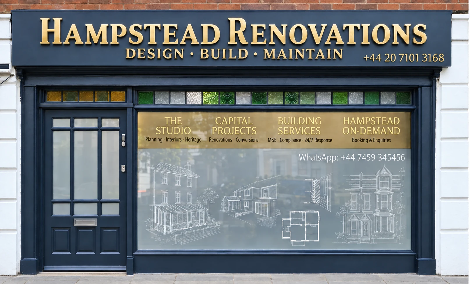
Hampstead Renovations design and build studio on Finchley Road
Our Hampstead studio · Finchley Road, NW3 6DN

Hertsmere towns

Choose your Hertsmere town

01 Six services

Radlett

Our Radlett page tests the borough rules set out here against the town's two conservation areas, its bungalow Article 4 directions, the Radlett Neighbourhood Plan and the Radlett Brook. From it you can open six Radlett service pages, from whole-house refurbishment to a provisional basement page.

  • Refurbishing the whole house
  • Extensions, kitchens, bathrooms
  • Lofts and a provisional basement page
Explore Radlett

02 Four services

Bushey

Bushey's hub reads the same policy against the High Street and Bushey Heath conservation areas, the Warren Road directions and the Colne. Four Bushey service pages hang from it, covering refurbishment, extensions, loft conversions and kitchens.

  • House refurbishment
  • Extensions and loft conversions
  • Kitchen renovation
Explore Bushey

The plan in force

Which Hertsmere plan decides an application today

Hertsmere Borough Council decides planning applications in the borough and describes a statutory duty to guide development there. Its Local Plan 2012-2027 has four parts: the Hertsmere Core Strategy (adopted January 2013) and Elstree Way Corridor Area Action Plan (adopted July 2015) and Site Allocations and Development Management Policies Plan (adopted 23 November 2016), plus the Policies Map.

The council says these documents carry full weight in planning decisions, and that the Local Plan 2003 no longer has weight. The Core Strategy has been applied to every application registered on or after 17 January 2013; it steers how and where land is allocated but does not allocate specific sites itself.

For a householder the SADM Policies Plan does most of the work. It supplies the environmental and other criteria against which all development proposals and planning applications are judged, and it holds Policy SADM 26, the Green Belt standards set out below.

Published 8 October 2026

The new Local Plan: Regulation 19

Full Council agreed at an extraordinary meeting on 7 October to publish the new draft. The Regulation 19 stage began on 8 October and runs until 19 November 2026; it is the final publication stage before the plan is submitted.

After 19 November 2026

What has to happen next

An independent Planning Inspector will examine the plan for legal compliance and soundness, and only after that examination can the council consider adopting it. The council has already removed several sites from the final draft, in Borehamwood, Potters Bar, Bushey and Radlett.

Until it is adopted, the new plan is emerging policy rather than the plan in force. We design Hertsmere schemes to the 2013 and 2016 documents, read the draft for anything that would bear on the house, and recheck its stage before each application goes in.

Sources: Hertsmere Borough Council: Local Plan 2012-2027; Hertsmere Borough Council: Local Plan 2012-2027 Core Strategy; Hertsmere Borough Council: Site Allocations and Development Management Policies Plan; Hertsmere Borough Council: Site Allocations and Development Management Policies Plan (adopted November 2016); Hertsmere Borough Council news: Council moves forward with new Local Plan for Hertsmere (October 2026); Hertsmere Borough Council: A new Local Plan for Hertsmere (Regulation 19 publication, checked 3 November 2026)

Green Belt

Hertsmere's SADM26 test for extensions and replacement homes

Outside the main towns, almost the whole of Hertsmere is in the Green Belt. Core Strategy Policy CS13 sets a general presumption against inappropriate development there, which will not be permitted unless very special circumstances exist, and the council assesses every Green Belt application against CS13 and the principles of Policy SADM 26.

SADM Policies Plan, November 2016

SADM 26 (ii): extensions and alterations

“an extension or alteration to a building must not individually or cumulatively be disproportionate to the original building; the addition(s) must be subordinate to the original”

The footnote defines the original building as “the building that was in existence on 1 July 1948, or if built after 1 July 1948, as so built”, and says the definition “may include a basement level”.

SADM Policies Plan, November 2016

SADM 26 (i): replacement buildings

A replacement building must be for the same use, and the policy does not allow it to be larger in any material way than the building it replaces.

The policy adds that even a like-for-like rebuild “is not necessarily acceptable”: the nature and intensity of the new use, its effect on amenity and landscape, and the purpose of the Green Belt locally are important considerations.

To judge scale, the council compares the existing and proposed development, looking among other things at the change in floor space, the change in volume, the change in site coverage by buildings and hardstanding, and changes in height and orientation. The policy names these measures rather than a percentage allowance.

Garden buildings are part of the sum. The plan's glossary says existing garages and outbuildings sited over 5 metres from the main dwelling will not be taken to comprise part of the original building, and SADM 26 asks for existing open and green space, including garden areas, to be retained.

National policy sits alongside. The National Planning Policy Framework of 17 August 2026 treats extending or altering a house as not inappropriate so long as the increase in size is not disproportionate, and a replacement should stay in the same use and be no larger, in material terms, than the building it replaces.

For a Hertsmere Green Belt house we begin with the planning history: what stood on the site in 1948 or was first built, every addition since and each outbuilding close to the house. The planning statement then sets the existing and proposed floor space, volume, coverage and height side by side, the comparison SADM 26 itself describes.

Sources: Hertsmere Borough Council: Local Plan 2012-2027; Hertsmere Borough Council: Local Plan Core Strategy DPD (adopted January 2013); Hertsmere Borough Council: Site Allocations and Development Management Policies Plan (adopted November 2016); MHCLG (GOV.UK): National Planning Policy Framework (published 17 August 2026, last updated 29 September 2026); MHCLG (GOV.UK): National Planning Policy Framework, Green Belt chapter, policies GB1 to GB8 (August 2026)

Design guide

The Planning and Design Guide rules a Hertsmere extension meets

The council's Planning and Design Guide is a Supplementary Planning Document, so its standards are used when planning applications are assessed. Part E, Guidelines for Residential Extensions and Alterations, dates from 2006, with an appendix on domestic garage conversions adopted in 2015.

The 45-degree line

Every extension, front, side or rear, should sit comfortably inside a 45-degree line taken from the nearest edge of the neighbouring front or rear facing windows. Part E says the council is likely to refuse one that breaches it.

Heights, dormers and roofs

Single storey extensions should stay within 3 metres in height with a flat roof, or 4 metres with a pitched one. Dormers belong on the rear roof slope, where in most cases they should take up no more than 60% of it; crown roofs are normally resisted.

Gaps and gardens

Where a street has significant separation between buildings, as parts of Radlett, Bushey, Elstree and Potters Bar do, that gap must be retained. The council also expects a house to keep the majority of its garden once extended.

Part E calls its numerical standards minimum requirements and says each case is judged on its merits, having regard to the site and the established character around it. The figures are a floor for a scheme to clear, not an allowance to build up to.

We plot the 45-degree lines from the neighbours' windows on the first sketch plans and elevations, so depth and height are set by the guide from the outset rather than cut back after an officer's comments.

Sources: Hertsmere Borough Council: Planning and Design Guide SPD; Hertsmere Borough Council: Planning and Design Guide Part E: Guidelines for Residential Extensions and Alterations (adopted 2006)

Basements

What Hertsmere's design guide says about basements

Part D of the guide, the 2016 draft the council has used for decisions taken on or after 15 September 2016, starts a basement with flood risk. It classes residential basements as highly vulnerable, so Flood Zone 3 is not appropriate for them; Flood Zone 2 may allow them after the Sequential and Exception Tests; and in Flood Zone 1 they will generally be acceptable, subject to other policy requirements.

Anywhere in Flood Zone 2 or 3, or at risk from surface water flooding, a site-specific assessment of flood risk is required for a basement, and mitigation may be needed. The 2023 Level 1 Strategic Flood Risk Assessment goes further for developed land within Flood Zone 3b, the functional floodplain: no basement, no basement extension and no conversion that moves a basement into a more vulnerable use will be permitted.

Wholly below ground

A basement under an existing house should be entirely beneath the ground, and the levels around the house should not be lowered to make it look like an extra storey.

Gardens and trees

Under a garden, the council needs to see that a mature garden can be kept above the basement, with soil and drainage details at application. Where trees or hedgerows may be affected, an arboricultural assessment will normally be required.

Lightwells

Lightwells and sunken terraces should be avoided in small front gardens and in conservation areas unless they are an established feature, and railings or grilles are required to secure them.

For Green Belt sites, the guide accepts that a basement can be a more acceptable way of adding space than building upward, but it is assessed in exactly the same way as development above ground when deciding whether it is inappropriate. The guide also asks whether the space could be provided above ground before a basement is accepted as the most sustainable answer.

We therefore never promise a Hertsmere basement at the first visit. The flood zone, a ground investigation with groundwater readings, the trees and the Green Belt position decide it, and we report those findings to you before a basement layout is drawn.

Sources: Hertsmere Borough Council: Planning and Design Guide SPD; Hertsmere Borough Council: Draft Planning and Design Guide SPD Part D, Guidelines for High Quality Sustainable Development (October 2016 draft, used for decisions since September 2016); Hertsmere Borough Council: New Local Plan supporting studies; Hertsmere Borough Council / AECOM: Level 1 Strategic Flood Risk Assessment (2023)

Heritage

Hertsmere's conservation areas, Article 4 directions and local list

There are 15 conservation areas in Hertsmere: Aldenham; Bushey High Street and Melbourne Road; Bushey Heath, High Road; Bushey Heath, The Lakes; Elstree Village; Letchmore Heath; Patchetts Green; Potters Bar, Darkes Lane (West); Potters Bar, The Royds; Radlett (South); Radlett (North); Ridge; Roundbush; Shenley; and South Mimms.

Designation gives the council control over demolishing substantial buildings, and the permitted development rules add restrictions inside a conservation area, in particular on side extensions and outbuildings in side gardens. Anyone proposing to cut down, top or lop a tree in one has to give notice, whether or not a Tree Preservation Order covers it.

Article 4 directions remove some or all permitted development rights from properties in a particular area, and each one is different. The council's list includes the Radlett bungalow groups; Warren Road, The Comyns, The Lake and Coles Green in Bushey Heath; Letchmore Heath; The Royds estate; Cage Pond Road and Hillcrest Road in Shenley; and single properties in Bushey, Elstree and Radlett. Under a direction, small works such as changing or adding windows, painting the front of the house or laying a hardstanding for a car can need planning permission.

Alongside the national list, the council keeps a List of Locally Important Buildings with over 380 entries, current as at June 2016. Local listing does not affect a building's permitted development rights, but it brings a presumption against demolition and an additional basis for requiring extensions and external alterations to sit sympathetically with the original building.

The appraisals behind the town conservation areas date from different years: Bushey High Street was last reviewed in 2009, the Radlett High Street area in 2010, Radlett South in October 2012 and Bushey Heath High Road in 2013. Our Radlett and Bushey pages read them street by street.

For a house in a conservation area, under a direction or on the local list, we photograph and record the existing fabric before design, check the planning history for earlier consents, and write the heritage statement from that record rather than from a template.

Sources: Hertsmere Borough Council: Conservation areas in Hertsmere; Hertsmere Borough Council: Article 4 Directions - Conservation; Hertsmere Borough Council: Locally listed buildings; Hertsmere Borough Council: Bushey High Street and Melbourne Road Conservation Area Appraisal; Hertsmere Borough Council: Radlett (North) Conservation Area Appraisal; Hertsmere Borough Council: Radlett South Conservation Area Appraisal; Hertsmere Borough Council: Bushey Heath High Road Conservation Area Appraisal
Flood risk

The brooks and the Colne: Hertsmere's flood picture

The River Colne flows from northeast to southwest through Hertsmere, from Colney Heath through to Watford. The Hilfield Brook runs east to west through North Bushey to meet it at Watford, the Radlett Brook, also known as Tykeswater, flows northwest to join it near Colney Street, and the borough's southern edge at Bushey Heath sits at the upstream end of the Hartsbourne Stream.

The 2023 assessment lists four Environment Agency flood warning areas in the borough: the Radlett and Borehamwood Brooks at Borehamwood, the Mimmshall Brook at Warrengate Road including Water End, the Radlett Brook at Radlett, and the River Colne near Bushey Hill Farm. It describes Borehamwood, Radlett and Potters Bar as at risk of flooding from several sources and mechanisms.

The ground changes across the borough. Hertsmere lies on the boundary between the chalk to the north and the London Clay and Reading Beds to the south; soils around Radlett and Shenley are generally well-drained and loamy-sandy, while across Borehamwood, Bushey and Potters Bar they are generally clays with low permeability. Groundwater flooding potential is limited across most of the borough, with some areas in the north-west, north-east and centre where it might occur, and the assessment reminds developers of several groundwater source protection zones.

Clay and chalk ask for different foundations and drainage. The Environment Agency flood map for the address is printed first and read against the assessment's own mapping; on clay our engineer designs the foundations around shrinkage and nearby trees, and where a soakaway is proposed we test infiltration on the site first, as the assessment says is required for infiltration drainage.

Sources: Hertsmere Borough Council / AECOM: Level 1 Strategic Flood Risk Assessment (2023); Hertsmere Borough Council: New Local Plan supporting studies

Neighbourhood plans

Radlett, Shenley and the Elstree and Borehamwood plan

Once approved at a referendum, a neighbourhood plan becomes part of the borough's statutory Development Plan, read alongside the council's own documents.

The Radlett Neighbourhood Plan, produced by Aldenham Parish Council, covers the urban area of Radlett within Aldenham Parish and passed its referendum on 6 May 2021. Shenley Parish Council has prepared a plan for Shenley, which the council's page lists as made, and applications in its area should come with a completed checklist showing how they adhere to it. Elstree and Borehamwood Town Council has submitted its plan, and the next step is examination.

Where an address falls inside a neighbourhood plan area, we read its policies with the borough's and answer both in one design and access statement, so the officer can see each requirement met in one place.

Sources: Hertsmere Borough Council: Neighbourhood Planning; Hertsmere Borough Council: Radlett Neighbourhood Plan; Hertsmere Borough Council: Radlett Neighbourhood Plan 2020-2036, Regulation 20 adoption statement (24 May 2021)

Sign-off

Building control for Hertsmere addresses

Our London team, the in-house architects, designers and structural engineers who work with Hampstead Chartered Surveyors & Building Consultancy, takes on projects across Hertsmere from Finchley Road, NW3. Hertsmere Borough Council decides the planning side; the building regulations go to Hertfordshire Building Control, which now provides the council's building control, unless you opt for a private registered building control approver instead.

Hertfordshire Building Control lists extensions, loft and garage conversions, internal alterations and basements among the work it checks. Planning permission is a separate approval from building regulations, and many projects need both.

Under the current regime its role is inspection and enforcement, not design advice. It also has a duty to take on cases where a private building control company can no longer carry out the function, so a project is not left without a body checking it.

Our engineers' calculations travel with the building regulations application, our site manager calls the surveyor out at each stage they want to see, and the handover file includes the completion certificate. Where work comes close to a neighbour's wall or foundations, we serve party wall notices well ahead of it.

Sources: Hertsmere Borough Council: Local Plan 2012-2027; Hertsmere Borough Council: Hertfordshire Building Control Limited; GOV.UK: Building regulations approval - when you need approval; Hertfordshire Building Control: FAQs; Hertfordshire Building Control: Regulatory information

Highways

Dropped kerbs in Hertsmere: who builds them

A new vehicle crossing in Hertsmere is built by Hertfordshire County Council, not by the borough: the borough's guidance says the county's Highways department must carry out the work. You need planning permission first if you live on a classified road, meaning an A, B or C road, and not if you live on an unclassified one.

An application for a domestic crossing may be refused or modified on safety grounds. Before construction the fence, wall or hedge at the crossing point must be removed, and once the crossing is completed satisfactorily it is part of the public highway, with Highways taking over its maintenance.

We draw the crossing, the driveway levels and the surface water route together, and where a classified road needs planning permission we submit it alongside the householder application so the kerb request can follow straight on.

Sources: Hertsmere Borough Council: Dropped Kerbs and Crossovers

Across the boundary

Hertsmere towns next to Barnet and Harrow

Several Hertsmere postcodes cross into London. Postcode records show WD23 taking in addresses in Harrow, Hertsmere and Watford, WD6 in Barnet and Hertsmere, and HA7 in Barnet, Brent, Harrow and Hertsmere, so the postcode alone cannot tell you which council is responsible. Harrow's own conservation pages group Stanmore with Edgware.

Inside the borough, Bushey, Bushey Heath and Potters Bar have no parish or town council, Elstree and Borehamwood share a town council, and Aldenham Parish Council covers Radlett, Aldenham and Letchmore Heath. Planning for all of them is decided by Hertsmere Borough Council.

Stanmore, Edgware and Mill Hill are London areas, outside Hertsmere, and our Stanmore, Edgware and Mill Hill pages cover them. If an address sits near the line, tell us and we can check the council before anything is drawn.

Sources: postcodes.io (ONSPD-derived): outcode WD23; postcodes.io (ONSPD-derived): outcode WD6; postcodes.io (ONSPD-derived): outcode HA7; London Borough of Harrow: Conservation areas and Article 4; Hertsmere Borough Council: Parish and Town Councils; Hertsmere Borough Council: Local Plan 2012-2027

Our Hampstead base, serving Hertsmere

Talk to our Finchley Road studio

Our studio is in Hampstead on Finchley Road, at NW3 6DN. We serve Hertsmere from this office. Bring us the practical questions about your house, flat or bathroom and the result you want to achieve.

Contact the studio to discuss your brief and arrange the next step. If you already have drawings, a lease or planning correspondence, tell us what is available.

Book a free feasibility visit
Hampstead Renovations
Unit 3 Palace Court
250 Finchley Road
London NW3 6DN

020 7101 3168
contact@hampsteadrenovations.co.uk

Find our studio on Google Maps

Next pages to read

Hertsmere guides, and a London project to compare

For a house in Radlett or Bushey, start with our Radlett or Bushey page, which applies this borough policy to the town's own streets and designations. The Hertfordshire page covers what is common to every district, from permitted development to the Chilterns and groundwater.

Our renovation guides follow a project from survey to sign-off, and the pages on house extensions, basement conversions and loft conversions explain how each type of job is run. When you get in touch, the address, any earlier planning references and some photos of the house let us do the desk check before we visit.

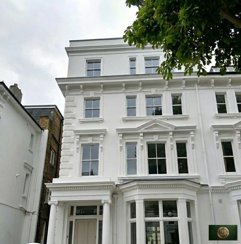
Outside Hertsmere, and in London rather than Hertfordshire: Project example: Belsize Park, NW3. That project of ours is a Victorian townhouse of five storeys; its case study records a basement conversion, a rear extension and loft work, carried out together with a full refurbishment of the interior.

Sources: Hampstead Renovations: Belsize Park Gardens, NW3 case study

Hertsmere questions

Planning and building in Hertsmere: common questions

Which plan decides a planning application in Hertsmere today?

The adopted Local Plan 2012-2027, made up of the Hertsmere Core Strategy (adopted January 2013) and Elstree Way Corridor Area Action Plan (adopted July 2015) and Site Allocations and Development Management Policies Plan (adopted 23 November 2016), with the Policies Map. The council gives these documents full weight in planning decisions, and the Local Plan 2003 no longer has weight. A neighbourhood plan approved at referendum, such as Radlett's, also forms part of the development plan for its area.

What stage is the new Hertsmere Local Plan at?

Regulation 19 publication, the final stage before the plan is submitted for examination. It began on 8 October and runs until 19 November 2026, after Full Council agreed on 7 October to publish the draft. An independent Planning Inspector will then examine it, and the council can consider adopting it only after that. Until then it is emerging policy, and applications are decided on the adopted plan.

How does Hertsmere test an extension or a replacement home in the Green Belt?

Under Policy SADM 26, read with Core Strategy Policy CS13. An extension or alteration must not individually or cumulatively be disproportionate to the original building, meaning the building in existence on 1 July 1948, or as built if later, and additions must be subordinate. A replacement for the same use may not be larger, in any material way, than the building it replaces. The council compares floor space, volume, site coverage and height, and a basement level can count.

Can I build a basement in Hertsmere?

Possibly, depending on the flood zone, the ground and the setting. The draft Part D guide, used for decisions since 15 September 2016, says residential basements are not appropriate in Flood Zone 3, may be permitted in Flood Zone 2 after the Sequential and Exception Tests, and will generally be acceptable in Flood Zone 1. The 2023 flood assessment rules them out on developed land in Flood Zone 3b. Green Belt basements are assessed like development above ground. We investigate the ground before promising anything.

Who provides building control for Hertsmere addresses?

Hertfordshire Building Control provides the council's building control service. Alternatively you can bring in a private registered building control approver, and that approver notifies the local authority with an initial notice. Either way, regulations approval is separate from planning permission, and extensions, loft and garage conversions, internal alterations and basements are all work building control checks.

Who builds a dropped kerb in Hertsmere?

Hertfordshire County Council's Highways department carries out the work, not the borough. Planning permission is needed first on a classified (A, B or C) road but not on an unclassified one, the fence, wall or hedge at the crossing point must be removed before construction, and once finished the crossing becomes part of the public highway.

Independent
Surveying
Hampstead Renovations operates alongside Hampstead Chartered Surveyors & Building Consultancy — an RICS Regulated firm providing chartered building surveying, under shared directorship.

Book a free feasibility visit

Hertfordshire overview
Renovations in Hertfordshire →

See how Hertsmere fits within our wider Hertfordshire pages.

Full Service Directory

Pages for Hertsmere

Every town page we publish for Hertsmere.

Hertsmere

Radlett →

Hertsmere

Bushey →

Chat with us!