
Chalfont St Giles · Chiltern · Buckinghamshire

Chalfont St Giles Renovations & Design-Build — HP8

Updated 6 November 2026

Our London team designs, engineers and builds house and flat projects in Chalfont St Giles, run from the Finchley Road studio in Hampstead, NW3.

Chalfont St Giles is a parish of its own, with Jordans inside it, a conservation area at its historic centre, its own Neighbourhood Plan and the River Misbourne running through the middle. We place each address against those layers before a line is drawn. Rules that cover the whole of the former Chiltern plan area are kept on our Chiltern page.

Serving Chalfont St Giles from our Hampstead studio · NW3 6DN
020 7101 3168

Hampstead Renovations design and build studio on Finchley Road
Our Hampstead studio · Finchley Road, NW3 6DN

Chalfont St Giles projects

Choose the work your Chalfont St Giles home needs

Chalfont St Giles homes

What Chalfont St Giles's houses are built like

The parish covers 1,275 hectares and held around 2,492 dwellings at the 2011 Census, by the Neighbourhood Plan's count. Most of that housing sits in two villages, Chalfont St Giles itself and Jordans, a Green Belt settlement in the south of the parish.

The 2017 townscape study describes a village in two halves, one on each side of the Misbourne valley, with the valley floor itself left undeveloped. The Neighbourhood Plan puts the built-up area east and west of the A413.

The oldest layer is the centre. The parish church is Norman and dates from the 12th century; Stonewell's Farm is a 15th or 16th century timber-framed hall-house; and the study finds that the 16th century buildings, with some of the early 17th, tend to be timber-framed, while later ones, such as the 19th century Reading Room, are brick.

Most of the rest is 20th century. An estate between Deanway and Bottrells Lane was largely finished by 1925; Bottrells Lane, Dodd Lane and Back Lane were built up between 1925 and 1955; and between the wars the first houses went up north of the A413. East of the valley, detached houses were set in large plots. Additions after 1955 brought large villas on Mill Lane and Stratton Chase Drive and infill between Narcot Lane and the Lagger; the several developments since 1975 have largely been backland detached houses reached by cul-de-sacs.

Census 2021 counts the parish in output areas, and they differ sharply. In output area E00089623, 135 of 141 households lived in detached houses. In E00089615 only 3 of 117 did; 52 were semi-detached and 33 lived in a purpose-built block of flats.

The census ward named Chalfont St Giles is drawn wider than the parish: it includes output area E00089650, which the ONS places in Chalfont St Peter parish. Across that ward, 2,392 of 4,414 households were in detached houses, 1,016 in semi-detached, 579 in terraced houses and 297 in purpose-built flats. The Neighbourhood Plan reads the 2011 figures the same way, finding a higher share of single houses or bungalows in the parish than the district, regional or national averages.

At a first visit we work out which of these layers a house belongs to. Its age, its structure and its planning position all follow from that.

Sources: Chalfont St Giles Parish Council: Neighbourhood Plan for Chalfont St Giles Parish 2014-2036; Chiltern and South Bucks District Councils (hosted by Buckinghamshire Council): Chiltern & South Bucks Townscape Character Study Part 3, Chiltern Settlements (November 2017); ONS Open Geography Portal: Output Area (2021) to Parish (2024) best-fit lookup (query); ONS/Nomis: Census 2021 TS044 accommodation type (NM_2062_1), 2021 output areas best-fitting Chalfont St Giles parish; ONS/Nomis: Census 2021 TS044 household totals for each 2021 output area in the 2022 ward Chalfont St Giles (E05013134); ONS/Nomis: Census 2021 TS044 Accommodation type, 2022 ward Chalfont St Giles (E05013134)

Approvals

Checks a Chalfont St Giles project goes through

The parish lies in the Chiltern area, and the rules shared across it, including the Green Belt tests, are set out on our Chiltern page. The cards below take them in the order a Chalfont St Giles project meets them, with the parish's own layer on top.

Who decides

Projects in Chalfont St Giles are taken on by our London team: in-house architects, designers and structural engineers, working with Hampstead Chartered Surveyors & Building Consultancy. Applications go to Buckinghamshire Council, which still uses the legacy Chiltern plans to decide them in this part of the county.

The Neighbourhood Plan

The parish was designated a neighbourhood area on 20 December 2012, and its plan runs from 2014 to 2036; the council lists it among the Chiltern area's made plans. Its heritage policy asks development anywhere in the parish to conserve or enhance the Chalfont St Giles and Jordans conservation areas and the settings of listed buildings.

Conservation area or not

The village centre conservation area dates from 1969 and was amended in 2001. Inside it, Policy CA1 refuses buildings, extensions or alterations that fail to preserve or enhance its character, and being article 2(3) land it loses the permitted development route for side extensions, rear extensions of more than one storey and roof enlargements.

Which side of the Green Belt line

The village's built-up area is excluded from the Green Belt, but the Green Belt surrounds it, and the Neighbourhood Plan notes rows of houses inside it at Three Households and Bowstridge Lane. Jordans is a Green Belt settlement. Which side of the line a house stands on decides which Local Plan extension test applies.

Building regulations

Buckinghamshire Council's building control service takes applications, books site inspections and holds a property's building control history. An owner may appoint a private registered building control approver instead, which then tells the council about the work with an initial notice.

Trees, neighbours and listing

A tree in the conservation area without a preservation order still needs a section 211 notice to the council before certain work. Listed building consent may be needed for works to a listed building, and work at or near a shared boundary means telling the neighbours first.

Sources: ONS Open Geography Portal: Parish to Ward to Local Authority District (December 2019) Lookup in England and Wales (query); Buckinghamshire Council: Local Development Scheme, 3. Our current plans and documents (last updated 16 March 2026); Chalfont St Giles Parish Council: Neighbourhood Plan for Chalfont St Giles Parish 2014-2036; Buckinghamshire Council: Neighbourhood planning - the plans; Chiltern District Council: Chiltern District Local Plan, adopted 1 September 1997 (alterations 29 May 2001; consolidated September 2007 and November 2011); Buckinghamshire Departments of Architecture and Planning (1969), as amended by Chiltern District Council (2001), hosted by Buckinghamshire Council: Conservation Area V4, Chalfont St. Giles; legislation.gov.uk: GPDO 2015 (SI 2015/596), Schedule 1 Part 1, Article 2(3) land (latest available revised); legislation.gov.uk: GPDO 2015 (SI 2015/596), Schedule 2 Part 1, development within the curtilage of a dwellinghouse (latest available revised); Buckinghamshire Council: Building regulations and control; GOV.UK: Building regulations approval - when you need approval; GOV.UK: Building regulations approval (printable guide); GOV.UK: Tree Preservation Orders and trees in conservation areas (planning guidance); GOV.UK (Planning Practice Guidance): When is permission required?; GOV.UK: Party walls and building work - overview

Local policy

The village centre, the Misbourne and the Chilterns edge

Three things shape most decisions here: the conservation area at the heart of the village, the flood zones along the Misbourne, and the Chilterns landscape to the north. Over all three, the Neighbourhood Plan asks for design sympathetic to the historic environment wherever growth happens.

The village centre conservation area

It reflects the original heart of the village and holds three public amenity spaces and many listed buildings. The townscape study describes The Green enclosed by a compact group of historic buildings with glimpses of the 12th century church between them, a High Street whose old buildings form a continuous façade along part of its length, and red and heather brick mixtures under red-brown plain clay tiles.

Listed buildings

The Neighbourhood Plan's 2017 schedule puts the parish church and Milton's Cottage at Grade I and the Old Rectory in School Lane at Grade II*. Grade II entries run along the High Street and Deanway, among them the Reading Room, Pilgrims Rest and the Deanway group of Candy Cottage, Cobblers Cottage and Sandalwood.

Views into and out of the centre

Policy CA2 refuses development that fails to preserve or enhance the important views within, into or out of a conservation area. The townscape study names the Old Rectory on the north side of Dean Way as a key historic feature of the townscape, and we treat any scheme within sight of it with that in mind.

Jordans

The parish also takes in Jordans, a planned village designed by Fred Rowntree in 1916, with its own conservation area. A large parcel of land there belongs to Jordans Village Limited, whose Management Scheme, the Neighbourhood Plan explains, requires the company's approval for alterations, extensions and developments, privately owned properties included.

Areas of Special Character

The 2017 study names two residential areas in the north-west of the village: Stratton Chase Drive to Dodds Lane, and Nightingales Lane to Gorelands Lane. It calls both particularly vulnerable to change, because of their low-density pattern of detached houses in large garden plots.

Chilterns National Landscape

National Landscapes are the legal areas of outstanding natural beauty. Natural England's map returns none at its reference point for the village, while the Neighbourhood Plan places the Chilterns one in the northern part of the parish, with the parish on its edge.

The postcode does not settle any of this. Besides Chalfont St Giles, HP8 takes in parts of Amersham, Chalfont St Peter, Chenies and Little Chalfont parishes and reaches into Three Rivers in Hertfordshire, so we work from the parish and the address.

For every address we check the conservation area boundary, the listing, the flood zone and the National Landscape line before suggesting a planning route.

Sources: Chalfont St Giles Parish Council: Neighbourhood Plan for Chalfont St Giles Parish 2014-2036; Chiltern and South Bucks District Councils: Strategic Flood Risk Assessment Level 1 (November 2018); Chiltern and South Bucks District Councils (hosted by Buckinghamshire Council): Chiltern & South Bucks Townscape Character Study Part 3, Chiltern Settlements (November 2017); Chiltern District Council: Chiltern District Local Plan, adopted 1 September 1997 (alterations 29 May 2001; consolidated September 2007 and November 2011); Buckinghamshire County Council and Chiltern District Council (hosted by Buckinghamshire Council): Landscape Character Area 20.1, St Giles Undulating Farmland; MHCLG (GOV.UK): NPPF Annex B, Glossary (August 2026); Natural England Open Data: Areas of Outstanding Natural Beauty (England), point query at the OS Open Names point for Chalfont St Giles; ONS Postcode Directory via postcodes.io (ONSPD-derived): outcode HP8

Building fabric

Building types in Chalfont St Giles and what they mean for the work

Each kind of house in the parish raises its own survey questions. These are the ones we ask first.

Timber-framed cottages

What should survive a refurbishment of a timber-framed cottage?

The study finds the village's 16th century buildings, and some of the early 17th, mostly timber-framed, and the county's landscape assessment speaks of black and white Tudor houses in the Misbourne villages.

We draw the frame in the measured survey before any opening is planned, and repair sound timber rather than replace it.

Brick and plain clay tile

Which materials suit an alteration near The Green?

Red and heather brick mixtures with red-brown plain clay tiles mark the historic buildings, and Policy CA1 asks for natural materials that match the existing in type, colour and texture, with synthetic ones refused.

Matching brick and tile is sourced before a planning drawing is finished.

Short Edwardian terraces

What is worth keeping on the Sycamore Road terraces?

The townscape study picks out short Edwardian terraces on Sycamore Road with bay windows, low eaves and white painted render.

Low eaves cut the headroom a loft can gain, so we measure them at the first visit.

Inter-war and post-war roads

How are the 1920s to 1950s houses approached?

The Deanway to Bottrells Lane estate was largely complete by 1925, and Bottrells Lane, Dodd Lane and Back Lane filled in between 1925 and 1955. In central Jordans the plan records detached houses of the 1920s to the 1950s with moderate gardens.

Foundations, wall ties and the roof timbers are checked before any extension or loft is drawn.

Large detached houses in big plots

What matters most on the larger plots?

East of the valley the study records detached houses in large plots, and in the two Areas of Special Character very large detached houses in mock historic styles, where hard front gardens and hard boundaries already weaken the character.

Hedges, trees and the gap to the boundary go into the brief from the start.

Bungalows

Can a bungalow in the village be enlarged?

The plan counts bungalows among the village's mostly two-storey houses, and records that the community opposes smaller houses being bought, knocked down and replaced by very large dwellings that overwhelm their neighbours.

We test an upward or outward scheme against the street and next door before detailed drawings start.

Sources: Chiltern and South Bucks District Councils (hosted by Buckinghamshire Council): Chiltern & South Bucks Townscape Character Study Part 3, Chiltern Settlements (November 2017); Buckinghamshire County Council and Chiltern District Council (hosted by Buckinghamshire Council): Landscape Character Area 19.2, Lower Misbourne Settled River Valley; Chiltern District Council: Chiltern District Local Plan, adopted 1 September 1997 (alterations 29 May 2001; consolidated September 2007 and November 2011); Chalfont St Giles Parish Council: Neighbourhood Plan for Chalfont St Giles Parish 2014-2036

On site

Access, parking and dropped kerbs in Chalfont St Giles

The Local Plan records some on-street short-term parking around The Green, and the Neighbourhood Plan describes a parish that depends on cars for lack of public transport. A site in the centre therefore starts with where vans, a skip and deliveries can stand.

Lowering the kerb outside a house to give a car access needs a vehicular access licence from Buckinghamshire Council, and the dimensioned drawing sent with the application may not show it any wider than 4.6m.

Front gardens matter here. In the Areas of Special Character the townscape study already counts hard surfaces and hard boundary treatments as weakening the character, and across the village it notes hedges dividing front gardens from the street, so a new parking area is weighed against both.

Beyond the village the lanes wind between tall hedgerows and trees, and the Local Plan points extension proposals to its car parking standards in Policies TR11 and TR16.

Skip, scaffold and delivery positions are agreed with you before anything arrives, the approach is walked for larger lorries, and pavements outside the house are kept clear for people on foot.

Sources: Chiltern District Council: Chiltern District Local Plan, adopted 1 September 1997 (alterations 29 May 2001; consolidated September 2007 and November 2011); Chalfont St Giles Parish Council: Neighbourhood Plan for Chalfont St Giles Parish 2014-2036; Buckinghamshire Council: Apply for a dropped kerb licence; Chiltern and South Bucks District Councils (hosted by Buckinghamshire Council): Chiltern & South Bucks Townscape Character Study Part 3, Chiltern Settlements (November 2017); Buckinghamshire County Council and Chiltern District Council (hosted by Buckinghamshire Council): Landscape Character Area 20.1, St Giles Undulating Farmland

Scope

Scoping a Chalfont St Giles project before a quote

No figure is put on a project until its scope is fixed, and in this parish we fix it in the following order.

  1. Feasibility visit

    You walk us round the house or flat and tell us what should change; we note its age, structure and how a van reaches the door.

  2. Address checks

    Conservation area, listing, Green Belt line, flood zone, National Landscape boundary and, in Jordans, the estate's own approval are confirmed for the property.

  3. Measured survey

    Our surveyors record the building in plan, section and elevation, including the roof void, frame, chimneys and original joinery.

  4. Drawings

    The design follows the planning route open to that address: householder rights where they genuinely apply, otherwise a full application with the documents the council asks for.

  5. Engineering and sign-off

    Our structural engineers size beams, foundations and drainage, and the building control route is chosen before anything is priced.

  6. Written scope

    Strip-out, structure, services, finishes and making good are set out item by item, and the quote is built line by line from that list.

Ready to take the next step? Send the property address and a short outline of what you want to change.

Book a feasibility visit

Our Hampstead base, serving Chalfont St Giles

Talk to our Finchley Road studio

Our studio is in Hampstead on Finchley Road, at NW3 6DN. We serve Chalfont St Giles from this office. Bring us the practical questions about your house, flat or bathroom and the result you want to achieve.

Contact the studio to discuss your brief and arrange the next step. If you already have drawings, a lease or planning correspondence, tell us what is available.

Book a feasibility visit
Hampstead Renovations
Unit 3 Palace Court
250 Finchley Road
London NW3 6DN

020 7101 3168
contact@hampsteadrenovations.co.uk

Find our studio on Google Maps

The Misbourne

A river through the middle of the village

The 2018 flood assessment for the Chiltern and South Bucks areas says the Misbourne flows north to south through Chalfont St Giles, with several properties and farm buildings in Flood Zone 3a. In a 1% annual chance flood the water on the High Street would be under 0.5 metres deep, though the risk to life depends on how fast it moves, and a blocked flood relief culvert could raise the risk.

It has flooded before. The river came over into the High Street in 2001. In February 2014, after the wettest winter on record, the Misbourne burst its banks north-west of the village, crossing Upper Stone Meadow, filling Blizzards Yard car park and running over the High Street into Lower Stone Meadow. Groundwater flooding followed near the telephone exchange in March and April 2014.

Away from the river, surface water has flooded roads around the parish through poor drainage, raised groundwater and field runoff. The assessment logs a flood on London Road near Turners Wood Drive in January 2014, and one consultee's response to it calls Nightingales Lane notorious for flooding, mostly within this parish.

So the flood position of a plot is settled before floor levels, drainage or anything below ground is designed, starting from the Environment Agency's flood map for planning.

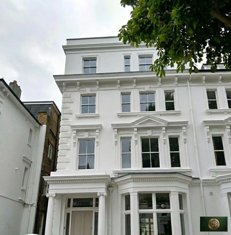
Outside Chalfont St Giles, and in London rather than Buckinghamshire: Project example: Belsize Park, NW3. That project of ours is a Victorian townhouse of five storeys; its case study records a basement conversion, a rear extension and loft work, carried out together with a full refurbishment of the interior.

Sources: Chiltern and South Bucks District Councils: Strategic Flood Risk Assessment Level 1 (November 2018); Environment Agency (GOV.UK service): Get flood risk information for planning in England (Flood map for planning); Hampstead Renovations: Belsize Park Gardens, NW3 case study

Chalfont St Giles questions

Renovating in Chalfont St Giles: questions we are asked

Is my home in the Chalfont St Giles village centre conservation area?

The conservation area covers the original heart of the village around The Green, and dates from 1969 with an amendment in 2001. Its exact line is on the council's map, which we check for every address. A house inside it is article 2(3) land with fewer householder permitted development rights, and Local Plan Policy CA1 applies to any change that needs permission.

What does the Neighbourhood Plan for Chalfont St Giles Parish cover?

The whole parish, Jordans included, for the period 2014 to 2036. Its policies cover rural exception sites for affordable housing, the local economy, Local Green Spaces, heritage assets and conservation areas, and the design of new development, which should respond to the character zones the plan maps.

Is my address in the Misbourne Flood Zone 3a through the village?

Several properties and farm buildings along the Misbourne are in Flood Zone 3a, and the flood assessment also shows Flood Zone 3b reaching properties on the High Street. We look up your address on the Environment Agency's flood map for planning, the service used for planning applications, before anything is designed.

Which Green Belt test applies to an extension in Chalfont St Giles?

It depends on where the house stands. In the village's built-up area, which is excluded from the Green Belt, Policy H13 applies. On the Green Belt rows the Local Plan lists, such as Three Households, Dibden Hill/Bowstridge Lane and Narcot Lane, Policy GB12 allows extensions that meet Policies H13 to H17 but refuses ones that push built form into the open land at a settlement edge. Elsewhere in the Green Belt, Policy GB13 asks that an extension is subordinate to the original dwelling and not intrusive in the landscape. Our Chiltern page has the full wording.

Is Chalfont St Giles in the Chilterns National Landscape?

Not at its centre: Natural England's map returns no National Landscape at its reference point for the village. The Neighbourhood Plan places the Chilterns protected landscape in the northern part of the parish, so a house on that side may lie inside it, which would make it article 2(3) land. We check the map for each address.

Who signs off building regulations in Chalfont St Giles?

Buckinghamshire Council's building control service, through an application and site inspections, or a private registered building control approver you appoint, which notifies the council with an initial notice. Without that approval you would not have the certificates of compliance a later sale may need.

Independent
Surveying
Hampstead Renovations operates alongside Hampstead Chartered Surveyors & Building Consultancy — a firm providing chartered building surveying, under shared directorship.

Book a feasibility visit

Buckinghamshire overview
Renovations in Buckinghamshire →

See how Chalfont St Giles fits within our wider Buckinghamshire pages.

Full Service Directory

Pages for Chalfont St Giles

Every service page we publish for Chalfont St Giles.

Chalfont St Giles

House Refurbishment in Chalfont St Giles →

Chalfont St Giles

House Extensions in Chalfont St Giles →

Chalfont St Giles

Kitchen Renovation in Chalfont St Giles →

Chalfont St Giles

Bathroom Renovation in Chalfont St Giles →

Chalfont St Giles

Loft Conversions in Chalfont St Giles →

Chalfont St Giles

Basement Conversions in Chalfont St Giles →

Chalfont St Giles

Flat Refurbishment in Chalfont St Giles →

Chat with us!