Amersham · Chiltern · Buckinghamshire

Amersham Renovations & Design-Build — HP6

Updated 6 November 2026

Our London team takes on renovation, extension and conversion projects across Amersham, from the brick and timber-framed houses of the Old Town to the Metro-land streets on the hill, working from the Finchley Road studio in Hampstead, NW3.

Amersham is one parish in two parts: the medieval market town in the Misbourne valley, and Amersham-on-the-Hill, which grew around the Metropolitan Railway station. Listing, flood risk and groundwater weigh very differently in each, so we settle which part a property belongs to before anything is drawn. Rules covering the whole Chiltern area are on our Chiltern page.

Serving Amersham from our Hampstead studio · NW3 6DN
020 7101 3168

Hampstead Renovations design and build studio on Finchley Road
Our Hampstead studio · Finchley Road, NW3 6DN

Amersham projects

Choose the work your Amersham home needs

01 Whole house

House Refurbishment in Amersham

Renewing an Amersham house, whether a box-framed cottage behind a brick front on the High Street or a rendered inter-war semi near the station. Wiring, heating, insulation and joinery are specified around what the walls and roof are made of, and around any listing.

  • Listed building checks
  • Heating and rewiring
  • Matching brick, render and tile
Explore House Refurbishment in Amersham

02 More space

House Extensions in Amersham

Rear and side extensions drawn against the built-up area's extension policies or, beyond the town's edge, the Green Belt tests. Conservation area, flood zone and a neighbour's daylight are all checked before the first sketch.

  • Built-up area or Green Belt
  • Flood zone check
  • Party wall notices
Explore House Extensions in Amersham

05 Roof space

Loft Conversions in Amersham

Rooms in the roof of a Metro-land semi or a detached house on the hill, lit by dormers or rooflights where the planning route allows. Inside a conservation area a roof enlargement needs planning permission, so the drawings go to the council first.

  • Dormer and roof design
  • Protected escape stair
  • Party wall for beams
Explore Loft Conversions in Amersham

07 Flats

Flat Refurbishment in Amersham

Refurbishing flats in Amersham's purpose-built blocks, converted buildings and rooms over shops, with the lease and the neighbours above and below in mind. Sound through the floor and the fire door to the shared landing are designed in from the outset.

  • Freeholder consent under the lease
  • Sound between flats
  • Fire-rated entrance doors
Explore Flat Refurbishment in Amersham

Amersham homes

What Amersham's houses are built like

The census counts Amersham's homes in two council wards whose names carry the town's. In 2021 the Amersham and Chesham Bois ward held 4,218 households, 1,673 of them in detached houses and 833 in purpose-built blocks of flats; Penn Wood and Old Amersham held 4,426, with 2,235 detached and 485 in purpose-built flats.

As their names show, neither ward stops at the parish: one takes in Chesham Bois and the other reaches Penn Wood, so the figures describe the wider area. Semi-detached houses (957 and 890 households) and terraces (560 and 636) make up most of the rest.

In the valley the stock is old and much of it listed. The county's Historic Towns Assessment counts 183 listed buildings across modern Amersham, the majority dated to the 17th and 18th centuries though they may hide earlier structures, and notes that many of the town's medieval buildings were refronted in brick or stone.

On the ridge the town belongs to the twentieth century. The Metropolitan railway arrived in 1892, the 1997 Local Plan describes Amersham-on-the-Hill as wholly 20th century development, and the 2017 Townscape Character Study records that large areas of Amersham went up between the wars.

That growth produced Arts and Crafts estates at Elm Close and the Weller Estate, mock-historic detached houses, and listed modern-movement work: High and Over and the Sun Houses by Amyas O'Connell. Between 1955 and 1978 an estate of detached houses on curving roads and cul-de-sacs was laid out at the western edge, and much building since has been on backland.

Close to Copperkins Lane, check the parish before anything else: the Townscape Character Study treats the lane as the settlement boundary with Chesham Bois, which is a separate parish with its own conservation area.

Sources: ONS/Nomis: Census 2021 TS044 Accommodation type, 2022 ward Amersham and Chesham Bois (E05013121); ONS/Nomis: Census 2021 TS044 Accommodation type, 2022 ward Penn Wood and Old Amersham (E05013154); Buckinghamshire County Council with English Heritage: Amersham, Buckinghamshire Historic Towns Assessment Report (2009); Buckinghamshire Council (Chiltern and South Bucks District Councils): Chiltern & South Bucks Townscape Character Study Part 3, Chiltern Settlements (Chris Blandford Associates, November 2017); Chiltern District Council: Chiltern District Local Plan, adopted 1 September 1997 (alterations 29 May 2001; consolidated September 2007 and November 2011); ONS Postcode Directory via postcodes.io (ONSPD-derived): outcode HP6; planning.data.gov.uk (MHCLG): conservation areas in the former Chiltern district (E07000005)

Approvals

Checks an Amersham project goes through

Decisions here still rest on the legacy plans for the east planning area, which the council uses to make local planning decisions; our Chiltern area page sets them out with the Green Belt tests. The cards show where that policy lands on an Amersham address.

Who decides

Planning applications for Amersham addresses go to Buckinghamshire Council and are decided under Chiltern District Local Plan (adopted 1 September 1997, consolidated September 2007 and November 2011) and Core Strategy for Chiltern District (adopted 15 November 2011). Our London team, in-house architects, designers and structural engineers working with Hampstead Chartered Surveyors & Building Consultancy, prepares the drawings, statements and application.

Conservation areas

Four cover parts of the parish: Amersham Old Town (1969, amended 1992), Shardeloes Parkland, Elm Close and the Weller Estate (all 1992). Inside them the 1997 plan refuses alterations that would not preserve or enhance the area, and asks for natural materials matching those of the existing buildings.

Green Belt

The built-up area of Amersham is left out of the Green Belt, which surrounds it. Two rows of houses inside the Green Belt are named in the plan, London Road East and Cokes Lane (south), and fall under GB12; other Green Belt houses face GB13. Both are quoted on the Chiltern page.

Listed buildings

Policy LB1 refuses consent for alterations that would not preserve a listed building's character, and national guidance warns that listed building consent may be needed for works to one. The Market Hall, at Grade II*, is the best known of the town's 183.

Building regulations

Buckinghamshire Council's building control service takes applications and books site inspections, or a private registered building control approver can do the job and notify the council with an initial notice. Building regulations approval is separate from planning permission, and plenty of projects need both.

Neighbours and trees

Neighbours must be given notice before you build on the line between two properties, open up a shared wall, or excavate near their foundations to a greater depth than they go. In a conservation area, a tree without a Tree Preservation Order is still protected under section 211, and the council must be notified before work on it.

Sources: Buckinghamshire Council: Local Development Scheme, 3. Our current plans and documents (last updated 16 March 2026); Chiltern District Council: Chiltern District Local Plan, adopted 1 September 1997 (alterations 29 May 2001; consolidated September 2007 and November 2011); Chiltern District Council: Core Strategy for Chiltern District (adopted 15 November 2011); GOV.UK (Planning Practice Guidance): When is permission required?; planning.data.gov.uk (MHCLG, Historic England data): listed building 1221420, Market Hall, Amersham; Buckinghamshire County Council with English Heritage: Amersham, Buckinghamshire Historic Towns Assessment Report (2009); Buckinghamshire Council: Building regulations and control; GOV.UK: Building regulations approval - when you need approval; GOV.UK: Building regulations approval (printable guide); GOV.UK: Party walls and building work - work you must tell your neighbour about; GOV.UK: Tree Preservation Orders and trees in conservation areas (planning guidance)

Local policy

Old Amersham, the Misbourne and the Weller Estate

Old Amersham's conservation area was designated in 1969 and last reviewed in 1992, and it takes in the curtilages of properties, including the burgage plots behind the High Street. The Core Strategy describes most of the Old Town as conservation area, with over 150 listed buildings.

Amersham Old Town

The south side of the High Street holds the grander houses on large burgage plots, many of them substantial late medieval and post-medieval buildings. The north side is plainer and more uniform: brick terraces of the 17th and 18th centuries on small, narrow plots running back to the Misbourne.

Shardeloes Parkland

Designated in 1992 and lying just beyond the town limits, Shardeloes Park is also a Grade II* registered garden: a largely 18th-century landscape with woodland and an artificial lake.

Elm Close

Early social housing of the 1920s by the Amersham Public Utility Company: thirty Arts and Crafts semi-detached houses designed by J H Kennard and grouped round a central green on garden city lines.

Weller Estate

Early building by the Metropolitan Railway's estate company along The Drive, Woodside Road, Green Lane, Grimsdells Lane and Highfield Close. At Highfield Close the houses are all semi-detached, in one style, round a triangular green.

The Misbourne flows west to east through the Old Town. The 2018 Strategic Flood Risk Assessment puts many properties on Broadway, Market Square, Church Street and High Street in Flood Zone 2, with Flood Zone 3a in places, and says that in prolonged rain the river overtops its banks while the roads speed the water on to other areas.

Rain and groundwater add to the river. In June 2016 there were 23 instances of internal flooding on the Old Amersham High Street after heavy rainfall, and the assessment records rising groundwater causing or worsening flooding in several basement properties in Old Amersham.

A blockage in the flood relief culvert could raise the risk further, and the Environment Agency is investigating options to reduce flooding along the Misbourne, Old Amersham included.

Every address is looked up on the Environment Agency's flood map for planning before design. The river's course through the rest of the area is covered on our Chiltern page.

Sources: Buckinghamshire County Council with English Heritage: Amersham, Buckinghamshire Historic Towns Assessment Report (2009); Chiltern District Council: Core Strategy for Chiltern District (adopted 15 November 2011); Chiltern District Council: Chiltern District Local Plan, adopted 1 September 1997 (alterations 29 May 2001; consolidated September 2007 and November 2011); planning.data.gov.uk (MHCLG): conservation areas in the former Chiltern district (E07000005); Chiltern and South Bucks District Councils: Strategic Flood Risk Assessment Level 1 (November 2018); Environment Agency (GOV.UK service): Get flood risk information for planning in England (Flood map for planning)

Two sections

Old Amersham (HP7) and Amersham-on-the-Hill (HP6): one parish, two sections

The Core Strategy describes Amersham's built-up area as two distinct parts. Old Amersham is a linear settlement on the old Aylesbury to London road beside the Misbourne; Amersham-on-the-Hill is centred about a mile north, on the ridge between the Misbourne and Chess valleys.

Both postcode districts take in Amersham parish. The postcode nearest the Market Hall is HP7 0DG and the one nearest Elm Close is HP6 5DD, and each falls in the parish, which ONS places in the Chiltern district across the Amersham Town and Amersham-on-the-Hill wards.

The ground differs as much as the buildings. Under the Old Town lies middle Chalk with alluvium along the river, and the soils by the river and High Street are subject to periodic waterlogging from a fluctuating groundwater table. The ridge is upper Chalk, mostly capped with clay with flints, under slowly permeable loamy or clayey soils.

The hill town came late. Landowners' opposition pushed the railway up onto the valley side above the Old Town, and the Historic Towns Assessment blames the slow start of building there on the time it took to lay water mains across Amersham from the Coleshill waterworks of 1898.

For that reason we establish, at the first visit, which of the two parts a property belongs to, because the checks that follow depend on it.

Sources: Chiltern District Council: Core Strategy for Chiltern District (adopted 15 November 2011); Buckinghamshire County Council with English Heritage: Amersham, Buckinghamshire Historic Towns Assessment Report (2009); ONS Postcode Directory via postcodes.io (ONSPD-derived): outcode HP6; ONS Postcode Directory via postcodes.io (ONSPD-derived): outcode HP7; ONS Postcode Directory via postcodes.io (ONSPD-derived): nearest postcode to the Market Hall point, Old Amersham; ONS Postcode Directory via postcodes.io (ONSPD-derived): nearest postcode to the Elm Close conservation area point, Amersham-on-the-Hill; ONS Open Geography Portal: Parish to Ward to Local Authority District (December 2019) Lookup in England and Wales (query); Buckinghamshire Council (Chiltern and South Bucks District Councils): Chiltern & South Bucks Townscape Character Study Part 3, Chiltern Settlements (Chris Blandford Associates, November 2017)

Building fabric

Building types in Amersham and what they mean for the work

Materials follow the period. In the market and borough zone the assessment lists handmade and painted brick, box frames with brick infill or render, handmade clay tile and natural slate; in the twentieth-century zones on the hill, machine-made brick and render under machine clay tiles.

Refronted medieval houses

What is behind an Old Town frontage?

Many medieval buildings in the town were given new brick or stone fronts, and the Amersham Museum occupies a 15th-century timber-framed building on the north side of the High Street.

We open up older fabric in recorded stages and settle the repair approach once the structure is visible, never on a guess about what sits behind the brick.

Yards on the river side

Why are the north-side plots so tight?

Those plots are squeezed between the road and the river, and the north side was worked more intensively for tanning and malting. Many of its yards and outbuildings survive, though plenty have been converted inside to offices or shops.

Access, drainage and any rear addition are planned around the yard as it stands, with the river boundary taken from the measured survey.

Estate-company houses

What did the railway's estate company build?

It laid out several large estates, mainly in the Arts and Crafts style, from the 1920s to the 1950s. Along The Drive into Batchelors Way the late-1920s semi-detached houses are of concrete block.

Block walls, render and timber detailing are opened and tested before insulation or new openings are specified.

Painted walls, black timber

What gives the Metro-land streets their look?

The Townscape Character Study picks out The Drive, Woodside Close and parts of Sycamore Road, where some houses carry painted walls with black timbered panels and 1930s details.

We draw those features on the survey so that new windows, porches and render repairs keep them.

Art Deco landmarks

Which twentieth-century houses are listed?

High and Over House and the four Sun Houses, all by Amyas O'Connell in the Art Deco style of the 1930s, are listed, and residents told the study they value the art deco character of High Over Park.

A listed modern house follows the same consent route as an old one, and its windows and flat roofs are repaired to the original details.

Houses in large gardens

What are the Areas of Special Character?

The study names three, covering Copperkins Lane, Weedon Lane, Devonshire Avenue and Hervines Road; South Road, part of Sycamore Road and Parkfield Avenue; and parts of The Drive, Highland Road and Stanley Hill Avenue. Along the woodland roads large detached houses in mock-historic styles sit in big, secluded gardens.

Front gardens, hedges and the space between houses are surveyed and kept in the design.
Sources: Buckinghamshire County Council with English Heritage: Amersham, Buckinghamshire Historic Towns Assessment Report (2009); Buckinghamshire Council (Chiltern and South Bucks District Councils): Chiltern & South Bucks Townscape Character Study Part 3, Chiltern Settlements (Chris Blandford Associates, November 2017)

On site

Access, parking and dropped kerbs in Amersham

Access differs from street to street. The Old Town's High Street is unusually wide, a sign of the medieval market's prosperity, yet the plots behind it are narrow; on the hill the Townscape Character Study lists commuter parking in residential streets as an issue to reduce.

Lowering the kerb for a new driveway needs a vehicular access licence from Buckinghamshire Council, and the application includes a drawing of the access, which may be no wider than 4.6m.

In the Areas of Special Character the study finds the character weakened where front gardens have been hard-surfaced and boundaries made hard, so any new parking there is laid out to keep as much hedge and planting as the plot allows.

Before anything is delivered we agree with you where a lorry can pull in, where the skip will sit and how the footway outside stays clear, and our site manager writes those arrangements into the site plan.

Sources: Buckinghamshire County Council with English Heritage: Amersham, Buckinghamshire Historic Towns Assessment Report (2009); Buckinghamshire Council (Chiltern and South Bucks District Councils): Chiltern & South Bucks Townscape Character Study Part 3, Chiltern Settlements (Chris Blandford Associates, November 2017); Buckinghamshire Council: Apply for a dropped kerb licence

Scope

Scoping an Amersham project before a quote

No figure is put on an Amersham project until we understand the building, the consent route and the ground beneath it. The quote is then assembled from a written scope rather than an allowance.

  1. Visit

    We walk the house and garden with you, note what you would like to change, and look at how the street will take scaffold and deliveries.

  2. Address checks

    Conservation area, listing, Green Belt, flood zone, source protection zone and protected trees are confirmed for that exact address.

  3. Measured survey

    Our surveyors draw the building as it stands, including the roof structure, floor build-ups and drainage runs.

  4. Design and consent route

    Drawings are prepared for whichever route is open: permitted development where it applies, a householder or listed building application, or the freeholder's consent for a flat.

  5. Engineering and sign-off

    Our structural engineers design beams, foundations and any retaining walls, and we agree with you which building control body will inspect.

  6. Written scope

    Each item from strip-out to handover is listed, and the price is put together line by line from that list.

Ready to take the next step? Send the property address and a short outline of what you want to change.

Book a feasibility visit

Our Hampstead base, serving Amersham

Talk to our Finchley Road studio

Our studio is in Hampstead on Finchley Road, at NW3 6DN. We serve Amersham from this office. Bring us the practical questions about your house, flat or bathroom and the result you want to achieve.

Contact the studio to discuss your brief and arrange the next step. If you already have drawings, a lease or planning correspondence, tell us what is available.

Book a feasibility visit
Hampstead Renovations
Unit 3 Palace Court
250 Finchley Road
London NW3 6DN

020 7101 3168
contact@hampsteadrenovations.co.uk

Find our studio on Google Maps

The market street

Why so much of Old Amersham survives

The Historic Towns Assessment credits the survival of Old Amersham's historic fabric to modern building having happened away from the High Street. The market and borough zone alone holds 82 of the town's 183 listed buildings, vernacular and Georgian with some Victorian and little modern intrusion.

The plan of the town is medieval: its surviving layout suggests a planned linear town, with burgage plots running back from the High Street. The assessment rates the chance of waterlogged archaeological deposits as high along the north side, which lies within the Misbourne's flood zones.

Old Amersham is also the town's principal area of archaeological notification, and a point query of the Environment Agency's groundwater data at the Market Hall returns source protection zone 1.

So in historic fabric we design around what is there: repairs to brick, frame and tile come first, and anything below ground is scoped with archaeology and water in mind.

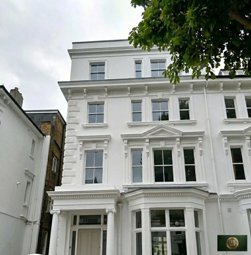
Outside Amersham, and in London rather than Buckinghamshire: Project example: Belsize Park, NW3. That project of ours is a Victorian townhouse of five storeys; its case study records a basement conversion, a rear extension and loft work, carried out together with a full refurbishment of the interior.

Sources: Buckinghamshire County Council with English Heritage: Amersham, Buckinghamshire Historic Towns Assessment Report (2009); Buckinghamshire Council (Chiltern and South Bucks District Councils): Chiltern & South Bucks Townscape Character Study Part 3, Chiltern Settlements (Chris Blandford Associates, November 2017); Environment Agency: Source Protection Zones (merged), point query at the Market Hall, Old Amersham; Hampstead Renovations: Belsize Park Gardens, NW3 case study

Amersham questions

Renovating in Amersham: questions we are asked

Is my home in Old Amersham or Amersham-on-the-Hill, and does it change the rules?

Both parts lie in Amersham parish and are decided by the same council under the same plans, but the checks weigh differently. Old Amersham is the linear market town along the Misbourne, mostly conservation area with over 150 listed buildings and partly in Flood Zone 2. Amersham-on-the-Hill, about a mile north on the ridge, grew up from the opening of the Metropolitan Railway and is wholly twentieth century, so listing and flood risk usually matter less there.

Which conservation areas cover Amersham?

Four. Amersham Old Town was designated in 1969 and amended in 1992; Shardeloes Parkland, Elm Close and the Weller Estate followed in 1992. The Weller Estate covers The Drive, Woodside Road, Green Lane, Grimsdells Lane and Highfield Close. Chesham Bois, across Copperkins Lane, has a conservation area of its own. In any of them, roof enlargements to a house fall outside permitted development, and the plan expects alterations to preserve or enhance the area.

Where in Amersham could a basement be realistic, given the Old Town's groundwater record?

Old Amersham is the hardest place. Rising groundwater has caused or worsened flooding in several basement properties there, much of the High Street is in Flood Zone 2, and the Market Hall falls inside a groundwater source protection zone 1, where the Environment Agency normally objects in principle to development that may disturb an aquifer. Point queries at Elm Close and the Weller Estate on the hill return zone 3 only and no flood zone, so there a basement turns on site investigation.

Which Green Belt policies apply to an extension near Amersham?

Inside the built-up area, which is excluded from the Green Belt, extensions are judged under Policy H13 and the policies that elaborate it on neighbours, design and spacing. Outside it, GB12 covers houses in the rows of dwellings the plan names, London Road East and Cokes Lane (south) among them, and GB13 covers the rest, permitting extensions that are subordinate to the original dwelling and not intrusive in the landscape. Our Chiltern page quotes both in full.

Is my Amersham address in the Misbourne flood zones?

In the Old Town it may well be. The 2018 assessment places many properties on Broadway, Market Square, Church Street and High Street in Flood Zone 2, with Flood Zone 3a in parts, and the national flood zone data puts the Market Hall in Flood Zone 2. The High Street and Broadway also flood from surface water in heavy rain. On the hill the assessment maps surface water flow paths broadly following the railway towards Little Chalfont. We look up each address on the Environment Agency's flood map for planning.

Who signs off building regulations in Amersham?

Buckinghamshire Council's building control service, through which you make an application and book site inspections, or a private registered building control approver, who informs the council of the work with an initial notice. If an installer registered under a competent person scheme does the work, you do not have to apply yourself. Keep the paperwork: without approval you will not have the certificates of compliance you may need to sell.

Who approves a dropped kerb for an Amersham driveway?

Buckinghamshire Council. A vehicular access licence is needed before the kerb outside your house is lowered, and the application carries a drawing of the access, which can be no wider than 4.6m. Whether the driveway also needs planning permission is a separate question, which we check for the address.

How do you serve Amersham from your Finchley Road studio?

Our London team works from the Finchley Road studio in Hampstead, NW3; we have no office in the county. In-house architects, designers and structural engineers, with Hampstead Chartered Surveyors & Building Consultancy carrying out building surveys, take on Amersham projects and come out to the property for the survey, design meetings and the build itself.

Independent
Surveying
Hampstead Renovations operates alongside Hampstead Chartered Surveyors & Building Consultancy — a firm providing chartered building surveying, under shared directorship.

Book a feasibility visit

Buckinghamshire overview
Renovations in Buckinghamshire →

See how Amersham fits within our wider Buckinghamshire pages.

Full Service Directory

Pages for Amersham

Every service page we publish for Amersham.

Amersham

House Refurbishment in Amersham →

Amersham

House Extensions in Amersham →

Amersham

Kitchen Renovation in Amersham →

Amersham

Bathroom Renovation in Amersham →

Amersham

Loft Conversions in Amersham →

Amersham

Basement Conversions in Amersham →

Amersham

Flat Refurbishment in Amersham →

Chat with us!