
Marlow · Wycombe · Buckinghamshire

Marlow Renovations & Design-Build — SL7

Updated 6 November 2026

Our London team takes on house and flat projects in Marlow, planned from the Finchley Road studio in Hampstead, NW3; we have no premises in the county.

This page follows a Marlow project from the address outwards: how close the Thames comes, whether the building is listed or inside the conservation area, and where the Green Belt and the Chilterns boundary begin. Policy for the whole Wycombe plan area, the Green Belt volume test included, is on our Wycombe page.

Serving Marlow from our Hampstead studio · NW3 6DN
020 7101 3168

Hampstead Renovations design and build studio on Finchley Road
Our Hampstead studio · Finchley Road, NW3 6DN

Marlow projects

Choose the work your Marlow home needs

01 Whole house

House Refurbishment in Marlow

Refurbishing a Marlow house, from a brick cottage in a listed row or a refronted timber-framed house in the old centre to a detached house on higher ground. Listing and conservation status are settled first, because they decide which consents the work needs.

  • Listing and consent checks
  • Heating and electrics renewed
  • Repair before replacement
Explore House Refurbishment in Marlow

02 More room

House Extensions in Marlow

Rear and side extensions drawn to the route the address allows: permitted development, a householder application, or the Green Belt volume test at the town's edges. Near the Thames the flood zone is read before any footprint.

  • Flood zone read first
  • Green Belt volume where it applies
  • Foundations and steel in-house
Explore House Extensions in Marlow

05 Roof space

Loft Conversions in Marlow

Loft rooms under Marlow's pitched and mansard roofs, by permitted development where the house qualifies and by application inside the conservation area or the Chilterns National Landscape. A protected way down from the new floor is part of every scheme.

  • Dormer or rooflights
  • Protected escape route
  • Party wall notices
Explore Loft Conversions in Marlow

06 Below ground

Basement Conversions in Marlow

Existing cellars converted and new basements tested against the Thames flood zones, the town's groundwater record and the chalk beneath. Where the flood rules exclude a basement, we tell you at feasibility.

  • Flood zone and groundwater
  • Site investigation
  • Underpinning and neighbours
Explore Basement Conversions in Marlow

Marlow homes

What Marlow's houses are built like

The 2021 Census counted 4,736 households in the Marlow ward. Detached houses accounted for 34.6 per cent of them, terraced houses for 23.4 per cent and semi-detached houses for 23.1 per cent, while 14.9 per cent lived in purpose-built blocks of flats.

The ward is not the whole town. Marlow South East is counted with Flackwell Heath and Little Marlow in a separate ward of 4,502 households, so the shares above leave that part of Marlow out. The postcode reaches wider still: postcode data lists Bisham and Medmenham among SL7's parishes and Windsor and Maidenhead among its councils, which is why this page speaks of the town rather than the postcode.

Homes in the ward are roomy by number of bedrooms: 36.1 per cent of households had four or more and 32.8 per cent had three, against 9.3 per cent with one. Ownership dominates, with 72.6 per cent owning, 16.3 per cent renting privately and 10.6 per cent renting from a social landlord.

The old town is a different stock again. Government planning data dates the Marlow conservation area from 10 March 1969, and the council's Historic Environment Record describes the listed buildings inside it one by one, from timber-framed houses refronted in brick to the Grade I suspension bridge that William Tierney Clark built between 1831 and 1836.

Our first visit places the building in this picture: a listed house in the old centre, a house on the riverside streets, a semi or detached house on higher ground, or a flat. Its consents, its flood position and its building control route follow from that answer.

Sources: ONS/Nomis: Census 2021 TS044 Accommodation type, 2022 ward Marlow (E05013153); ONS/Nomis: Census 2021 TS044 Accommodation type, 2022 ward Flackwell Heath, Little Marlow and Marlow South East (E05013144); postcodes.io (ONSPD-derived): outcode SL7; ONS/Nomis: Census 2021 TS050 Number of bedrooms, 2022 ward Marlow (E05013153); ONS/Nomis: Census 2021 TS054 Tenure, 2022 ward Marlow (E05013153); planning.data.gov.uk (MHCLG): conservation area entity 44010553, Marlow; Buckinghamshire Council Heritage Portal (Historic Environment Record): West Street, Marlow (MBC19960); Buckinghamshire Council Heritage Portal (Historic Environment Record): Marlow Bridge, The Causeway (MBC3591); planning.data.gov.uk (MHCLG, Historic England data): listed buildings within the Marlow conservation area boundary (entity 44010553)

Approvals

Checks a Marlow project goes through

The Wycombe plans, policies DM42 and DM43 on the Green Belt and the council's June 2025 assessment of both are set out on our Wycombe page. Below is how they meet a Marlow address, with the local checks that sit on top.

Who decides

Applications for Marlow addresses are decided by Buckinghamshire Council, which still uses the Wycombe District Local Plan (adopted August 2019) and Delivery and Site Allocations Plan (adopted 2013) in the former Wycombe district. It asks interested parties for their views, neighbouring properties and Marlow Town Council among them, and the town council's committee minutes its responses.

Our London team of in-house architects, designers and structural engineers, working with Hampstead Chartered Surveyors & Building Consultancy, prepares the drawings and the application from the Finchley Road studio.

Conservation area or not

The Marlow conservation area takes in the middle of the town, and the council lists a Marlow character survey among its appraisals, which it uses to inform planning decisions.

Inside the boundary, conservation areas count as article 2(3) land, so several householder permitted development rights are narrower than elsewhere.

Listed buildings

The national list holds 166 entries inside the conservation area alone, from Marlow Place, Grade I, to the terrace on Mill Road and the Borlase Cottages on Chapel Street.

Any alteration that would affect a listed building's character as a building of special architectural or historic interest needs listed building consent, and that includes work inside.

Green Belt and the Chilterns

The Local Plan protects the Green Belt identified on its Policies Map and calls Marlow severely constrained by it. Our Wycombe page quotes the DM43 volume test for a house inside it.

On the northern urban fringe, at the end of a row of houses along Seymour Court Road, the plan records a site within the Chilterns Area of Outstanding Natural Beauty.

Building control

Building regulations approval comes from Buckinghamshire Council's building control service or from a private registered building control approver, who then serves the council an initial notice.

It is a separate decision from planning permission, and plenty of schemes need both.

Neighbours and trees

Building onto a party wall, or excavating close to and below a neighbour's foundations, triggers the duty to tell that neighbour under the party wall rules.

Trees in the conservation area without a preservation order are still protected by section 211, and its provisions require a section 211 notice to the planning authority.

Sources: Buckinghamshire Council: Local Development Scheme, 3. Our current plans and documents (last updated 16 March 2026); Buckinghamshire Council: Regulation 10A Review of the Wycombe District Local Plan and the Delivery and Site Allocations Plan (June 2025); Marlow Town Council: Planning & Transport Committee; Marlow Town Council: home page; planning.data.gov.uk (MHCLG): conservation area point query 51.5707,-0.7756 (Marlow centre); Buckinghamshire Council: Conservation areas in Buckinghamshire; legislation.gov.uk: GPDO 2015 (SI 2015/596), Schedule 1 Part 1, Article 2(3) land (latest available revised); legislation.gov.uk: Town and Country Planning (General Permitted Development) (England) Order 2015 (SI 2015/596), article 2 (latest available revised); planning.data.gov.uk (MHCLG, Historic England data): listed buildings within the Marlow conservation area boundary (entity 44010553); legislation.gov.uk (The National Archives): Planning (Listed Buildings and Conservation Areas) Act 1990, section 7 (restriction on works affecting listed buildings); Wycombe District Council: Wycombe District Local Plan (adopted August 2019); Buckinghamshire Council: Building regulations and control; GOV.UK: Building regulations approval (printable guide); GOV.UK: Building regulations approval - when you need approval; GOV.UK: Party walls and building work - overview; GOV.UK: Party walls and building work - work you must tell your neighbour about; GOV.UK: Tree Preservation Orders and trees in conservation areas (planning guidance)

Local policy

Marlow's conservation area, the Thames and the Chilterns

The Local Plan counts the town's setting on the banks of the River Thames and its location in the Chilterns Area of Outstanding Natural Beauty among its key assets, and calls Marlow severely constrained by Green Belt, that landscape designation and the floodplain of the river.

From 10 March 1969

The conservation area

Government planning data gives the Marlow conservation area a start date of 10 March 1969, and a point in the middle of the town falls inside its boundary.

The plan's principles for Marlow ask that the historic core be recognised as key to the town's character, and that its historic riverside setting be safeguarded.

SFRA, November 2014

Flood Zones 3a and 3b

The district's flood risk assessment puts the area west of Marlow Bridge around Pound Lane in Flood Zone 3a, with many residential properties on the main road and the cul-de-sacs off it, and the housing enclosed by the A404, Lock Road and the railway east of the station in Zones 3a and 3b.

Southwest of the town, the land between the river and Harleyford Lane is all Zone 3b, holding only the marina, lakes and open fields.

Flood Zone 2

A number of properties between Glade Road and the A404, south of Westhorpe Road, lie in Flood Zone 2.

For comparison, Zone 3a is land with a 1 in 100 or greater chance of river flooding in any year, and Zone 3b is defined as where water has to flow or be stored in times of flood.

The winter of 2013-14

The assessment records houses flooded internally by the Thames that winter on Gossmore Lane, Pound Lane, Mill Road, Pound Crescent and Quarrydale Drive, and roads recorded as flooded ranging from Lock Road and Lower Pound Lane to St Peters Street and Spinners Walk.

From where some of those roads lie, it concludes the water came from a combination of river, surface water and groundwater flooding.

Groundwater and drainage

Marlow and Little Marlow are classed as at increased risk of groundwater flooding, with incidents affecting roads and properties in winter 2013-14 and earlier.

Two significant critical drainage areas drain through the town to the Thames, and smaller, more localised ones lie within the town centre.

The Chilterns National Landscape

Natural England's boundary, as government planning data returns it, puts a point on Marlow's northern edge inside the Chilterns and the town-centre point outside. Natural England has stopped its boundary review, and the existing line remains in place.

The Chilterns National Landscape is legally an area of outstanding natural beauty, which places it among the article 2(3) designations that narrow householder rights.

Flood maps move. The 2014 assessment itself recorded notable reductions of Zone 3a along the west side of Fieldhouse Lane and in the block of Station Road, Mill Road and Lock Road, and in its Regulation 10A review, dated June 2025, the council rates the evidence behind flood policy DM39 as partially out of date. We therefore read the assessment beside the Environment Agency's current flood map for planning.

Sources: Wycombe District Council: Wycombe District Local Plan (adopted August 2019); planning.data.gov.uk (MHCLG): conservation area entity 44010553, Marlow; planning.data.gov.uk (MHCLG): conservation area point query 51.5707,-0.7756 (Marlow centre); Wycombe District Council: Strategic Flood Risk Assessment Level 1 Update (November 2014); planning.data.gov.uk (MHCLG, Natural England data): AONB point query 51.585,-0.785 (north edge of Marlow); planning.data.gov.uk (MHCLG, Natural England data): AONB point query 51.5707,-0.7756 (Marlow centre); Natural England: Chilterns AONB Boundary Review - Natural Beauty Assessment (NECR691), publication record (uploaded 2026/06/26); Chilterns National Landscape (Chilterns Conservation Board): Chilterns National Landscape Boundary Review (page last updated 25 June 2025); legislation.gov.uk: GPDO 2015 (SI 2015/596), Schedule 1 Part 1, Article 2(3) land (latest available revised); legislation.gov.uk: Town and Country Planning (General Permitted Development) (England) Order 2015 (SI 2015/596), article 2 (latest available revised); Buckinghamshire Council: Regulation 10A Review of the Wycombe District Local Plan and the Delivery and Site Allocations Plan (June 2025); Environment Agency (GOV.UK service): Get flood risk information for planning in England (Flood map for planning)

Building fabric

Building types in Marlow and what they mean for the work

The council's Historic Environment Record holds an entry for each listed building in Marlow. A few of them show the range of construction a renovation in the old town can open up.

Timber frames behind brick

What lies behind a West Street front?

The record describes West Street houses of the sixteenth or seventeenth century, timber-framed with some wattle and daub, refronted in the nineteenth century; another older timber-framed house received an eighteenth-century front and keeps a timber-framed wing at the back.

Before any wall is opened we find out what carries the floors, since a brick face can hide a frame doing that job.

Eighteenth-century town houses

What is under a High Street house?

One High Street house is described as three storeys, attic and cellar in vitreous brick, and served as Marlow's post office from 1912 to 1991; a late eighteenth-century neighbour of three storeys and cellar is now shops.

Where a cellar already exists, a basement becomes a conversion question, and we survey it before anything else.

Cottage terraces

How do you change one house in a listed row?

The Borlase Cottages on Chapel Street are a row of seven houses built in 1788: a long terrace of two-storey cottages in chequer brick under an old tile roof, designed symmetrically with the doors in pairs.

In a row composed as one design we draw the neighbouring fronts as well as yours before proposing any new opening.

Mansards and attics

What happens to an attic under a listed roof?

The End House, late eighteenth-century, stands at the road junction on the approach from the river to the High Street under a mansard roof of old tiles, and a West Street house of two storeys and attic already carries a modern dormer.

In a listed house any new roof opening waits for listed building consent, and we design it around the roof's existing structure.

Two cottages made one

What does an old joined house hide?

On St Peter's Street, two sixteenth- or seventeenth-century timber-framed houses are now one, the timbering and plaster of the upper floor exposed by restoration; close by is an early nineteenth-century brick house with flat eaves.

St Peters Street also appears on the assessment's list of roads that flooded in the winter of 2013-14, so repairs there are planned with flood resilience in mind.

Beyond the old core

What about the detached and terraced houses?

Outside the listed centre the census takes over: 1,638 households in the ward lived in detached houses in 2021, and 1,109 in terraced ones.

For these we begin with the plot: its flood zone, its drainage and whether the Green Belt or the Chilterns boundary reaches it.

Sources: Buckinghamshire Council Heritage Portal (Historic Environment Record): West Street, Marlow (MBC19960); Buckinghamshire Council Heritage Portal (Historic Environment Record): Borlase Cottages, Chapel Street, Marlow (MBC19843); Buckinghamshire Council Heritage Portal (Historic Environment Record): High Street, Marlow (MBC19868); Buckinghamshire Council Heritage Portal (Historic Environment Record): West Street, Marlow (MBC19937); Buckinghamshire Council Heritage Portal (Historic Environment Record): High Street, Marlow (MBC19874); planning.data.gov.uk (MHCLG, Historic England data): listed buildings within the Marlow conservation area boundary (entity 44010553); Buckinghamshire Council Heritage Portal (Historic Environment Record): The End House, High Street, Marlow (MBC19884); legislation.gov.uk (The National Archives): Planning (Listed Buildings and Conservation Areas) Act 1990, section 7 (restriction on works affecting listed buildings); Buckinghamshire Council Heritage Portal (Historic Environment Record): St Peter's Street, Marlow (MBC19904); Buckinghamshire Council Heritage Portal (Historic Environment Record): St Peter's Street, Marlow (MBC19901); Wycombe District Council: Strategic Flood Risk Assessment Level 1 Update (November 2014); ONS/Nomis: Census 2021 TS044 Accommodation type, 2022 ward Marlow (E05013153)

On site

Access, parking and dropped kerbs in Marlow

The Local Plan notes significant traffic congestion in the town, and Marlow Town Council counts highway safety, traffic and parking among the issues it can consider when it comments on an application.

Vehicles are part of the picture at most addresses. In the Marlow ward, 35.7 per cent of households had two cars or vans in 2021 and 12.5 per cent three or more, while 12.1 per cent had none, so a skip or scaffold can compete with parked cars for kerb space.

Lowering the kerb for a new or wider drive needs a vehicular access licence from Buckinghamshire Council, applied for with a drawing of an access no wider than 4.6m.

The 2014 flood assessment adds that hardstanding over 5sqm in the front garden of a residential property must be permeable, so a new parking space is designed together with its drainage.

Before anything is ordered we map where lorries will stop, find a place for skips and scaffolding that blocks nobody's drive, and put the arrangement on a single sheet the neighbours can read.

Sources: Wycombe District Council: Wycombe District Local Plan (adopted August 2019); Marlow Town Council: Planning & Transport Committee; ONS/Nomis: Census 2021 TS045 Car or van availability, 2022 ward Marlow (E05013153); Buckinghamshire Council: Apply for a dropped kerb licence; Wycombe District Council: Strategic Flood Risk Assessment Level 1 Update (November 2014)

Scope

Scoping a Marlow project before a quote

A Marlow quote follows the facts of the building: whether it is listed, which flood zone it is in, what ground it stands on and which planning route it takes. We establish each of those before any figure.

  1. Feasibility visit

    We walk the building and garden with you, see how it was put together, and look at how materials and a skip would reach it.

  2. Address checks

    Listing, conservation area, flood zone, groundwater, Green Belt, the Chilterns boundary, protected trees and shared walls, each checked for this one address.

  3. Measured survey

    Our surveyors record the building as it stands, including earlier extensions, cellars and roof voids, since all of them can matter to the planning route.

  4. Design to the route

    Permitted development where it is open to the address; otherwise an application, with listed building consent and a flood risk assessment where the building needs them.

  5. Engineering

    Our structural engineers size beams, footings and any retaining walls, and the building control route is agreed before pricing starts.

  6. Written scope

    Every item of work is listed in writing, from the first strip-out to handover, and that list is what we price, line by line.

Ready to take the next step? Send the property address and a short outline of what you want to change.

Book a feasibility visit

Our Hampstead base, serving Marlow

Talk to our Finchley Road studio

Our studio is in Hampstead on Finchley Road, at NW3 6DN. We serve Marlow from this office. Bring us the practical questions about your house, flat or bathroom and the result you want to achieve.

Contact the studio to discuss your brief and arrange the next step. If you already have drawings, a lease or planning correspondence, tell us what is available.

Book a feasibility visit
Hampstead Renovations
Unit 3 Palace Court
250 Finchley Road
London NW3 6DN

020 7101 3168
contact@hampsteadrenovations.co.uk

Find our studio on Google Maps

Marlow and its river

A town between the Thames and the chalk

The Local Plan calls Marlow a vibrant town with many assets, its riverside setting and its place in the Chilterns chief among them, with Higginson Park and its leisure centre on the Thames-side; it also records that the town has suffered from significant flooding in recent years.

The record goes back further. In Winter 2000/01 thirty properties in Marlow were affected by groundwater and thirty-five by the Thames, and Thames Water's postcode data to April 2014 counted 38 incidents of external sewer flooding and 9 internal in the region the assessment labels SL7, Marlow and Little Marlow.

Beneath it all is chalk, which dominates the district's geology. The plan's principles for the town include protecting it from flooding and protecting its landscape setting, and the plan expects new development to be focused within the town and more limited in scale.

On a Marlow plot we therefore fix floor levels, drainage and any work below ground only once the flood zone and ground conditions of that plot are known. A neighbour's answer is never taken as proof of yours.

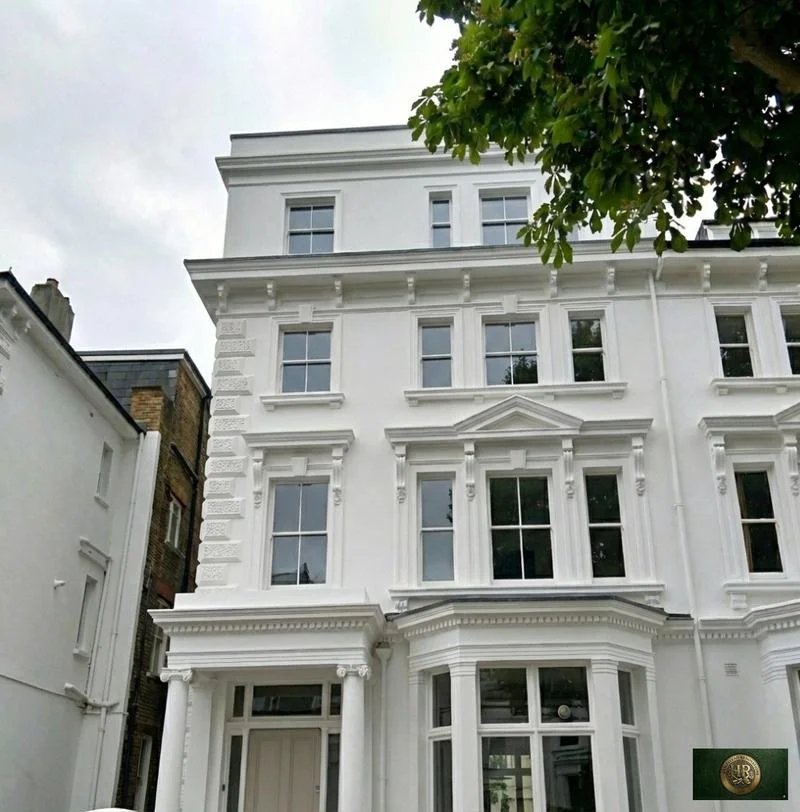
Outside Marlow, and in London rather than Buckinghamshire: Project example: Belsize Park, NW3. That project of ours is a Victorian townhouse of five storeys; its case study records a basement conversion, a rear extension and loft work, carried out together with a full refurbishment of the interior.

Sources: Wycombe District Council: Wycombe District Local Plan (adopted August 2019); Wycombe District Council: Strategic Flood Risk Assessment Level 1 Update (November 2014); Hampstead Renovations: Belsize Park Gardens, NW3 case study

Marlow questions

Renovating in Marlow: questions we are asked

Is my Marlow address in the Thames flood zones?

It may be. The 2014 flood risk assessment places the area west of Marlow Bridge around Pound Lane in Flood Zone 3a, the housing between the A404, Lock Road and the railway east of the station in Zones 3a and 3b, and properties between Glade Road and the A404, south of Westhorpe Road, in Zone 2. A council review published in June 2025 calls the evidence behind its flood policy partially out of date, so we check the Environment Agency's flood map for planning for your address before design.

Where in Marlow could a basement be realistic, given the Thames flood zones?

Away from the river zones. The 2014 assessment says basements are not permitted for new development in Flood Zone 3b; in Zone 3a basement dwellings are not permitted, no sleeping accommodation is allowed at basement level and every basement needs an access point above the 1 in 100 river flood level, including climate change. In Zone 2 a basement dwelling has to pass the exception test. Marlow is also classed as at increased risk of groundwater flooding, so a ground investigation comes first anywhere in the town.

Is my home in the Marlow conservation area?

The boundary takes in the middle of the town: a point in the centre falls inside the area that government planning data records for the Marlow conservation area, dating it from 10 March 1969. The council lists a Marlow character survey on its conservation areas page. We confirm the line for your address, because inside it some permitted development rights are narrower and unprotected trees still need a section 211 notice before work.

Does the Chilterns National Landscape reach my Marlow home?

On the northern edge it can. A government planning data query puts a point on Marlow's north edge inside the Chilterns and the town-centre point outside, and the Local Plan records a site at the end of Seymour Court Road, on the northern urban fringe, as within the Area of Outstanding Natural Beauty. Inside it, roof additions, side extensions and rear extensions of more than one storey fall outside householder permitted development.

Which Green Belt test applies around Marlow, and how current is it?

Policy DM43 of the Wycombe Local Plan treats the extension or replacement of a dwelling in the Green Belt as appropriate only when it satisfies one or more of its conditions, with volume measured as gross external volume including any basement. Reviewing the plan in June 2025, the council found DM42 and DM43 partially out of date, so national Green Belt policy is weighed as well. Our Wycombe page quotes the test in full, and the Policies Map shows whether your address is in the Green Belt.

Does Marlow have a neighbourhood plan?

Not on the council's own list. Its status table of made and emerging neighbourhood plans for the west planning area, as of March 2026, names places such as Daws Hill, Little Marlow and Wooburn and Bourne End, but no plan for Marlow itself. Applications in the town are decided on the Wycombe plans, which the council still uses for local planning decisions, and we check the list again before any application.

Who signs off building regulations in Marlow?

Buckinghamshire Council's building control service, unless you appoint a private registered building control approver, who then gives the council an initial notice. Either way the approval is separate from planning permission, and without it you will not have the certificates of compliance you may need when you sell.

What happens at a feasibility visit to a Marlow house?

We go round the building and garden with you, note how it was built and what has been added since, and look at how a site would be reached from the road. Afterwards we check the address for listing, conservation area, flood zone, Green Belt and the Chilterns boundary, and tell you which planning and building control routes apply before any design or figure. Our London team covers Marlow from the Finchley Road studio in Hampstead.

Independent
Surveying
Hampstead Renovations operates alongside Hampstead Chartered Surveyors & Building Consultancy — a firm providing chartered building surveying, under shared directorship.
Explore Nearby Areas

Book a feasibility visit

Buckinghamshire overview
Renovations in Buckinghamshire →

See how Marlow fits within our wider Buckinghamshire pages.

Full Service Directory

Pages for Marlow

Every service page we publish for Marlow.

Marlow

House Refurbishment in Marlow →

Marlow

House Extensions in Marlow →

Marlow

Kitchen Renovation in Marlow →

Marlow

Bathroom Renovation in Marlow →

Marlow

Loft Conversions in Marlow →

Marlow

Basement Conversions in Marlow →

Marlow

Flat Refurbishment in Marlow →

Chat with us!