
Gerrards Cross · South Bucks · Buckinghamshire

Gerrards Cross Renovations & Design-Build — SL9

Updated 6 November 2026

Gerrards Cross houses, from the red brick and pebbledash of the Edwardian garden village to the architect-designed homes on the slopes around Bulstrode Camp, are surveyed, designed and built by our London team, working from the Finchley Road studio in Hampstead, NW3.

The town has two conservation areas, two Residential Areas of Exceptional Character, a neighbourhood plan made in December 2025 and Green Belt beyond its edges. Which of those reach your address is settled at the first visit; the policy shared by the whole of the old district is explained on our South Bucks page.

Serving Gerrards Cross from our Hampstead studio · NW3 6DN
020 7101 3168

Hampstead Renovations design and build studio on Finchley Road
Our Hampstead studio · Finchley Road, NW3 6DN

Gerrards Cross projects

Choose the work your Gerrards Cross home needs

01 Whole house

House Refurbishment in Gerrards Cross

Renewal of an Edwardian or inter-war house: rewiring, heating, windows and roofs, with the original brickwork, casements and chimneys repaired rather than lost. Each room's planning and building regulations position is worked out before anything is stripped.

  • Room-by-room condition record
  • Timber casements and clay tile
  • Heating and wiring signed off
Explore House Refurbishment in Gerrards Cross

Gerrards Cross homes

What Gerrards Cross's houses are built like

The town as most people know it was made by a railway. By the time the line opened in April 1906 the developers were already busy: north of the tracks the Orchehill estate was laid out with sites for modern shops and over 200 houses, and to the south George Hampton laid out every building plot on Bulstrode Way, Layters Way, Marsham Way, Fulmer Way and Vicarage Way.

Much of Bulstrode Way and Layters Way had been built by 1917, many houses custom-designed by local architects and put up singly or in small groups. Expansion resumed in the 1920s. The Woodhill estate was sold as individual plots from 1923 and filled slowly into the 1930s, the Dukes Wood estate and Windsor Road followed in the late 1920s and 1930s, and after the 1932 sale of the Bulstrode estate Camp Road was laid out around the ancient British camp, with particularly large houses.

The 2021 Census counted 3,408 households in the Gerrards Cross ward. Detached houses held 1,950 of them, 57.2% of the total, against 411 semi-detached and 290 terraced; 620 households were in purpose-built blocks of flats. The neighbourhood plan adds that 60.9% of households in the wider Gerrards Cross middle layer super output area had four or more bedrooms, and 22.7% one or two.

Not everything is large or Edwardian. An early council house development went up in Gaviots Way in 1922, and the appraisal records flats replacing large houses in recent years, particularly along Packhorse Road, alongside back-land building.

At the first visit we place the house in its layer of the town: a garden-village house of the Edwardian years, an inter-war house on one of the later estates, a post-war close or a recent rebuild. Each asks for a different survey and a different planning conversation.

Sources: South Bucks District Council: Gerrards Cross Common and Centenary Conservation Areas Character Appraisal (April 2009); Chiltern and South Bucks District Councils: Chiltern & South Bucks Townscape Character Study Part 3, South Bucks settlements (November 2017); ONS/Nomis: Census 2021 TS044 Accommodation type, 2022 ward Gerrards Cross (E05013145); Gerrards Cross Town Council / Buckinghamshire Council: Gerrards Cross Neighbourhood Plan 2017-2040, Made Plan (December 2025)
Approvals

Checks a Gerrards Cross project goes through

Three layers of policy meet at a Gerrards Cross address. Buckinghamshire Council decides the applications and still uses the plans it inherited from the former district councils to make local decisions; the neighbourhood plan, made in December 2025, sits beside them; and the Green Belt tests apply to houses beyond the area the plans exclude from it. The district-wide policies themselves are set out on our South Bucks page rather than repeated here.

Neighbourhood plan made 17 December 2025

Who decides

Applications for Gerrards Cross houses go to Buckinghamshire Council. In this part of the county it applies the 1999 Local Plan and the 2011 Core Strategy, and since the referendum of 23 October 2025 the town's own neighbourhood plan as well.

The Green Belt edge

Gerrards Cross is one of the larger settlements the 1999 plan leaves out of the Green Belt, and the appraisal notes that the designation has stopped the town growing west and east. For a house beyond that line, saved policy GB10 governs extensions, and its floorspace count includes subterranean ones.

Building regulations

Building regulations approval is a separate consent from planning permission, and one scheme may well require the two. Applications and site inspections can go through Buckinghamshire Council's building control service, or you can appoint a private registered building control approver.

Neighbours and the highway

Building near or on a shared boundary means telling the neighbours under the party wall rules. Lowering the kerb for a new driveway needs a vehicular access licence from Buckinghamshire Council.

Sources: Buckinghamshire Council: Local Development Scheme, 3. Our current plans and documents (last updated 16 March 2026); Gerrards Cross Town Council / Buckinghamshire Council: Gerrards Cross Neighbourhood Plan 2017-2040, Made Plan (December 2025); South Bucks District Council: South Bucks District Local Plan, adopted March 1999, consolidated September 2007 and February 2011; South Bucks District Council: Gerrards Cross Common and Centenary Conservation Areas Character Appraisal (April 2009); GOV.UK: Building regulations approval - when you need approval; Buckinghamshire Council: Building regulations and control; GOV.UK: Party walls and building work - overview; Buckinghamshire Council: Apply for a dropped kerb licence

Local policy

Gerrards Cross's conservation areas, its 2025 plan and Camp Road

The Gerrards Cross Common Conservation Area was first designated in 1987 and redesignated with revised boundaries on 28 April 2009. The same date created the Gerrards Cross Centenary Conservation Area, for the part of the town built after the railway arrived in 1906. One character appraisal covers both, and the council uses such appraisals to inform its planning decisions.

The Common

The appraisal prizes the Common as an increasingly rare survival of common-edge settlement, ringed by buildings of different ages, styles, materials and size. The local palette is red brick and plain clay roof tiles, flat roofs are not characteristic, and lime render and limewash are what historic fabric should be repaired with.

The Centenary area

This is the Edwardian garden village with its shopping centre, and its architecture is predominantly influenced by Arts and Crafts, in high-quality materials. The appraisal lists what erodes it: uPVC replacement windows and doors, lost chimneys, flat-roofed side extensions and garages, painted brickwork and front gardens turned into hard-standing.

Areas of Exceptional Character

Is my road in one of them?

The 1999 plan identifies two in Gerrards Cross. One is based around Windsor Road, Manor Lane and Camp Road, the other around Vicarage Way, Marsham Way, Hill Waye and Woodhill Avenue. Under saved policy H10, house extensions and ancillary buildings that would harm their exceptional character are refused, and trees, hedges, verges and the lack of kerbs are among the features expected to survive.

Camp Road

Camp Road was laid out after the Bulstrode estate sale in 1932, around the ancient British camp, and built up with particularly large houses. The plan describes very spacious development with gardens rolling towards the highway, plots of about 2,500 square metres, 30-metre frontages, around 15 metres between buildings and narrow roads without footpaths or kerb stones.

The Gerrards Cross Neighbourhood Plan covers the whole parish and was prepared by the town council. It was approved at referendum on 23 October 2025 and made on 17 December 2025. Its design policy points residential schemes and conversions inside the settlement boundary to the 2017 Townscape Character Study and asks them to be proportionate to the scale, layout and character of what surrounds them, in external materials that complement the area; further policies keep trees and hedgerows and conserve heritage assets above and below ground.

Flood risk from rivers is concentrated on one side. The River Misbourne flows along the eastern boundary of Gerrards Cross, and the Level 1 Strategic Flood Risk Assessment of December 2018 places several properties and land there in Flood Zone 3a. The same assessment records a flood on the A40 north-west of the town in January 2014.

Each address is checked at the outset on the Environment Agency's flood map for planning, the service it provides for planning applications, alongside the conservation area maps and the plan's settlement boundary.

Sources: South Bucks District Council: Gerrards Cross Common and Centenary Conservation Areas Character Appraisal (April 2009); Buckinghamshire Council: Conservation areas in Buckinghamshire; South Bucks District Council: South Bucks District Local Plan, adopted March 1999, consolidated September 2007 and February 2011; Gerrards Cross Town Council / Buckinghamshire Council: Gerrards Cross Neighbourhood Plan 2017-2040, Made Plan (December 2025); Chiltern and South Bucks District Councils: Strategic Flood Risk Assessment Level 1 (December 2018); Environment Agency (GOV.UK service): Get flood risk information for planning in England (Flood map for planning)

Building fabric

Building types in Gerrards Cross and what they mean for the work

The 2017 Townscape Character Study divides the town into eight character types, from the tightly formed centre and the park edge round the Common to green suburban roads, woodland roads and apartment blocks. It names four Areas of Special Character: Camp Road, St Huberts Close, Meadway Park and Hillcrest Way.

The garden village

What gives these houses their character?

Nearly all are two storeys, some with an attic storey, with a vertical emphasis: plenty of gables, prominent chimney stacks and pitched roofs, sometimes hipped or half-hipped. Chimneys are often decorative, laid in herringbone or slanting brick, and the houses were meant to be admired from the side as well as the front.

A side elevation therefore gets the same design attention as the front.

Woodland roads

What changes on the slopes?

Around Windsor Road and Manor Lane the 1999 plan finds large detached houses individually designed before the war, mock Tudor among them, on lanes without footways. The study's woodland roads have older houses set into the slope without retaining walls, and it warns that undercroft parking and bulky roof additions look out of scale.

Levels are surveyed before anything is sized.

Later groups

What about the newer closes?

St Huberts Close has houses clad in white timber, or brick below black timber boarding, under shallow pitched roofs; Meadway Park pairs brick below with white boarding above. Marsham Lodge is a Span estate in sandlime brick and dark vertical weatherboard, with covenants forming a building scheme its residents' society manages.

In each, the design answers the group, not just the house.

Whatever its age, a house is surveyed for what it is built of, how it has been altered and which original details are left, and the design starts from that record rather than from a catalogue.

Sources: Chiltern and South Bucks District Councils: Chiltern & South Bucks Townscape Character Study Part 3, South Bucks settlements (November 2017); South Bucks District Council: Gerrards Cross Common and Centenary Conservation Areas Character Appraisal (April 2009); South Bucks District Council: South Bucks District Local Plan, adopted March 1999, consolidated September 2007 and February 2011; Chiltern and South Bucks District Councils: Chiltern & South Bucks Townscape Character Study Part 3, section 4.0 Planning and Design Principles (November 2017)

On site

Access, parking and dropped kerbs in Gerrards Cross

A new or wider driveway crossing needs a vehicular access licence from Buckinghamshire Council. Before applying you need planning permission or a letter from its planning team saying none is required, a contractor qualified under the New Roads and Street Works Act 1991, a plan of any change to the front wall, fence or hedge, and an access drawn no wider than 4.6m.

Frontages carry real weight in this town. The appraisal counts wide or extra driveways and hedges lost to hard-standing among the threats to the garden village, where a plot traditionally had one driveway entrance and a narrow pedestrian gate. When a house is extended, saved policy H11 also expects adequate off-street parking to be provided or kept on site.

Roads near the station feel more pressure. The neighbourhood plan records that commuters driving in to use the railway station make residents' parking problems worse; it leaves parking for new homes to the county-wide guidance, and says the town council will consider local standards at a review of the plan.

Before a start date we agree with you where deliveries, a skip and welfare facilities will stand, how hedges, verges and gravel are protected, and how neighbours keep their access. That site plan becomes part of the written scope.

Sources: Buckinghamshire Council: Apply for a dropped kerb licence; South Bucks District Council: Gerrards Cross Common and Centenary Conservation Areas Character Appraisal (April 2009); South Bucks District Council: South Bucks District Local Plan, adopted March 1999, consolidated September 2007 and February 2011; Gerrards Cross Town Council / Buckinghamshire Council: Gerrards Cross Neighbourhood Plan 2017-2040, Made Plan (December 2025)

Scope

Scoping a Gerrards Cross project before a quote

A figure written down before the house, its planning route and the limits of its plot are understood is not worth much, so every quote we give is built up from the stages below.

  1. Feasibility visit

    We walk the house and garden with you, note how and when it was built and altered, and look at how a site could run from the road.

  2. Address checks

    Conservation area lines, the exceptional-character areas, the settlement boundary, the flood map and groundwater zones, each read for your address.

  3. Measured survey

    Hampstead Chartered Surveyors & Building Consultancy measures and records the building; our engineers look at structure, drainage and trees wherever they shape the design.

  4. Design and approvals

    Our architects draw the options, then prepare the planning application where one is needed and the building regulations submission.

  5. Written scope and quote

    Every item, its specification and its sequence set down, so the quote can be checked line by line against the drawings.

Ready to take the next step? Send the property address and a short outline of what you want to change.

Book a feasibility visit

Our Hampstead base, serving Gerrards Cross

Talk to our Finchley Road studio

Our studio is in Hampstead on Finchley Road, at NW3 6DN. We serve Gerrards Cross from this office. Bring us the practical questions about your house, flat or bathroom and the result you want to achieve.

Contact the studio to discuss your brief and arrange the next step. If you already have drawings, a lease or planning correspondence, tell us what is available.

Book a feasibility visit
Hampstead Renovations
Unit 3 Palace Court
250 Finchley Road
London NW3 6DN

020 7101 3168
contact@hampsteadrenovations.co.uk

Find our studio on Google Maps

Our work

A London project to compare with Gerrards Cross

Our London team takes on projects in Gerrards Cross: in-house architects, designers and structural engineers, working with Hampstead Chartered Surveyors & Building Consultancy on the surveys. Planning applications are decided by Buckinghamshire Council, and the building regulations are checked by Buckinghamshire Council's building control service or, if you prefer, by a private registered building control approver.

We keep no premises in the county. Design, drawings, applications and the running of every job come from our Finchley Road studio in Hampstead, NW3, and the people who survey your house are the people who then manage the work on it.

When a finished example would help a decision, the nearest we can show you is a London one, and we describe it as exactly that.

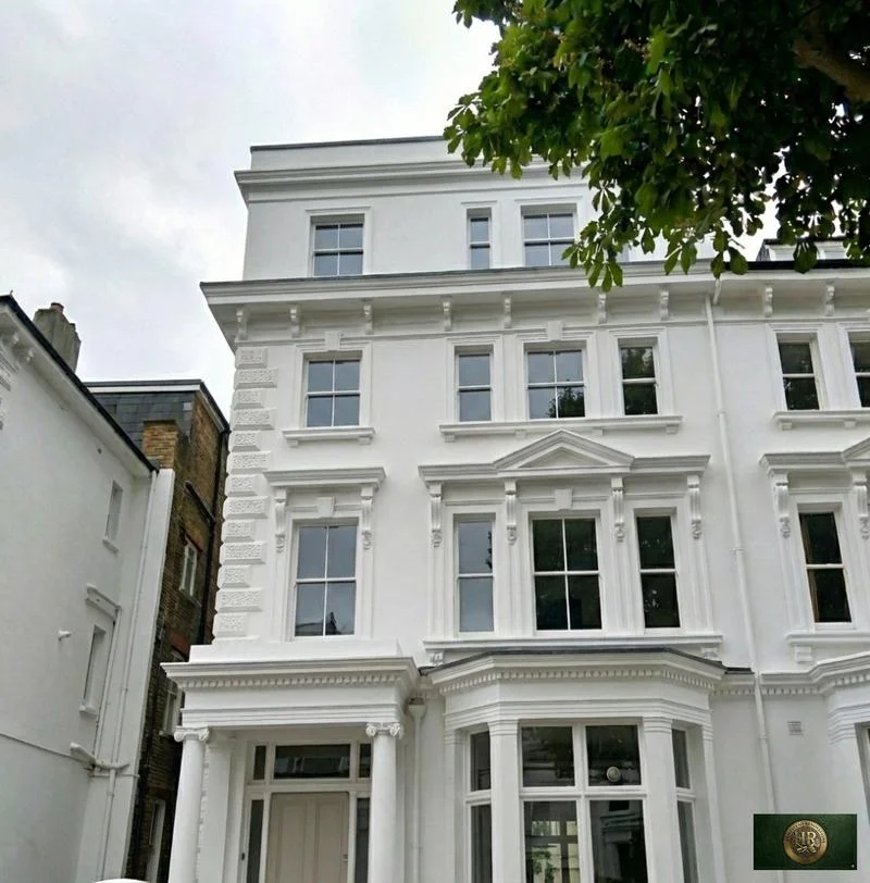
Outside Gerrards Cross, and in London rather than Buckinghamshire: Project example: Belsize Park, NW3. That project of ours is a Victorian townhouse of five storeys; its case study records a basement conversion, a rear extension and loft work, carried out together with a full refurbishment of the interior.

Sources: Buckinghamshire Council: Local Development Scheme, 3. Our current plans and documents (last updated 16 March 2026); GOV.UK: Building regulations approval - when you need approval; Buckinghamshire Council: Building regulations and control; Hampstead Renovations: Belsize Park Gardens, NW3 case study

Gerrards Cross questions

Renovating in Gerrards Cross: questions we are asked

What does the Gerrards Cross Neighbourhood Plan, made in December 2025, say about extensions?

Its design policy is written for residential development and conversions inside the settlement boundary: schemes in proportion to their surroundings, external materials that complement the area and the guidance of the 2017 Townscape Character Study. It also protects trees and hedgerows. For a house extension it works alongside the saved 1999 policies it lists as relevant, among them H11 on alterations and extensions and GB10 for houses in the Green Belt.

Is my home in one of Gerrards Cross's two areas of exceptional character (around Windsor Road, Manor Lane and Camp Road, or around Vicarage Way)?

The two areas are drawn on the 1999 plan's proposals map: one based around Windsor Road, Manor Lane and Camp Road, the other around Vicarage Way, Marsham Way, Hill Waye and Woodhill Avenue. A house on one of those roads is probably inside, but the mapped line decides, so we check it for your address. Within either area, policy H10 resists extensions and outbuildings that would harm the exceptional character.

Is my house in the Gerrards Cross Common or Centenary conservation area?

The Common area follows the Common and its common-edge buildings. The Centenary area covers the part of the town built after the railway came in 1906, including the whole of Marsham Way, Fulmer Way and Vicarage Way. Both boundaries date from 28 April 2009 and are mapped with the council's character appraisal, which we read against your address before anything else.

Which Green Belt test applies to an extension on the edge of Gerrards Cross?

The town itself is one of the settlements the 1999 plan excludes from the Green Belt. For a house beyond that edge, saved policy GB10 on extensions to dwellings in the Green Belt applies, read with the national policy that an extension must not be disproportionate to the original building. Both are explained on our South Bucks page, and we establish the size of the original house before drawing anything.

Is my address near the River Misbourne flood zone?

The Misbourne runs along the eastern boundary of Gerrards Cross, and the 2018 flood risk assessment puts several properties and land beside it in Flood Zone 3a. The conservation areas stand on a gravel terrace at around 85 metres, sloping down to the Misbourne valley on the north-east. For any single address the Environment Agency's flood map for planning is the check, and we run it first.

Who signs off building regulations in Gerrards Cross?

Either Buckinghamshire Council's building control service, through which you apply and book the site inspections, or a private registered building control approver, who tells the council about the work by an initial notice. The approval is separate from planning permission, and without it you may not have the certificates of compliance you need when you come to sell.

Who approves a dropped kerb for a Gerrards Cross driveway?

Buckinghamshire Council issues a vehicular access licence for it. You first need planning permission or a letter from the planning team confirming none is needed, a contractor with the New Roads and Street Works Act qualification and a drawing showing an access no wider than 4.6m. In the conservation areas we weigh the appraisal's concern about wide or extra driveways before proposing one.

How do you serve Gerrards Cross from your Finchley Road studio?

The Finchley Road studio in Hampstead, NW3, is where our London team works: in-house architects, designers and structural engineers, with Hampstead Chartered Surveyors & Building Consultancy for surveys. We keep no premises in the county. We come to the house for the feasibility visit, the surveys and every site meeting, and one project manager is responsible for the work on site.

Independent
Surveying
Hampstead Renovations operates alongside Hampstead Chartered Surveyors & Building Consultancy — a firm providing chartered building surveying, under shared directorship.
Explore Nearby Areas

Book a feasibility visit

Buckinghamshire overview
Renovations in Buckinghamshire →

See how Gerrards Cross fits within our wider Buckinghamshire pages.

Full Service Directory

Pages for Gerrards Cross

Every service page we publish for Gerrards Cross.

Gerrards Cross

House Refurbishment in Gerrards Cross →

Gerrards Cross

House Extensions in Gerrards Cross →

Gerrards Cross

Kitchen Renovation in Gerrards Cross →

Gerrards Cross

Bathroom Renovation in Gerrards Cross →

Gerrards Cross

Loft Conversions in Gerrards Cross →

Gerrards Cross

Basement Conversions in Gerrards Cross →

Gerrards Cross

Flat Refurbishment in Gerrards Cross →

Chat with us!