Runnymede · Surrey

Runnymede Renovations & Design-Build — Surrey

Updated 2 November 2026

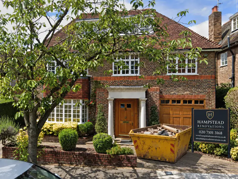
Runnymede houses refurbished, extended and converted by a single design and build team that works out of Finchley Road, NW3.

Our Runnymede town pages link here for the district's own policy: the 2030 Local Plan and the plan being prepared to replace it, Green Belt policy EE14 quoted in full, the neighbourhood plans, conservation and the local list, heathland, flood risk and building control.

Serving Runnymede from our Hampstead studio · NW3 6DN
020 7101 3168

Hampstead Renovations design and build studio on Finchley Road
Our Hampstead studio · Finchley Road, NW3 6DN

Runnymede towns

Choose your Runnymede town

01 Six services

Virginia Water

Our Virginia Water page links six services, from kitchens and bathrooms to extensions, loft conversions and basements, and applies the Runnymede policy on this page to houses there. Read it together with the neighbourhood plan section below.

  • Whole-house refurbishment
  • Extensions, lofts and basements
  • Kitchen and bathroom renovation
Explore Virginia Water

The plan in force

Which Runnymede plan decides an application today

The Runnymede 2030 Local Plan, adopted by the council on 16 July 2020, contains the suite of policies against which planning applications in the borough are determined, and plans for development in the period up to 2030.

It superseded every saved policy of the Runnymede Local Plan 2001 following independent examination; the Inspector issued her final report on 28 May 2020.

The development plan for Runnymede is wider than that one document. It also takes in any made neighbourhood plan, policy NRM6 of the South East Plan, which is concerned with development near the Thames Basin Heaths Special Protection Area, and the county's waste and minerals policies.

In January 2021 the council approved the conclusions of a review of the 2030 plan, and a new Local Plan is now being prepared under the new plan-making legislation and the revised National Planning Policy Framework. The council gave formal notice on 29 June 2026 that it was starting work on the Runnymede Local Plan, which will cover the borough, and its Planning Committee approved the timetable on 25 February 2026.

The timetable as at 23 October 2026 shows Gateway 1 and the start of plan-making between 1 and 30 October 2026, the vision and strategy going out for public comment from 1 June 2027 to 13 July 2027, and adoption indicated for April 2029. The council reviews the timetable monthly and updates it as necessary.

Until that plan is adopted we design Runnymede projects against the 2030 Local Plan and any neighbourhood plan for the area, and we look at the council's timetable again before each submission rather than relying on the dates here.

Sources: Runnymede Borough Council: Adopted Runnymede 2030 Local Plan (council page); Runnymede Borough Council: Runnymede 2030 Local Plan Adoption Statement; Runnymede Borough Council: Statutory Plan Making Notices (notice of intention to commence); Runnymede Borough Council: Runnymede Local Plan Timetable (new Local Plan)

Green Belt

Runnymede's Green Belt test for extensions and basements

Householder work in Runnymede's Green Belt is assessed under policy EE14 of the 2030 Local Plan, “Extensions and Alterations to and Replacement of Buildings in the Green Belt”. The plan says the council “will continue to exercise strict control over development within the Green Belt”.

Runnymede 2030 Local Plan, July 2020

Policy EE14: the test

“The extension of a building is not inappropriate development provided that it does not result in disproportionate additions over and above the size of the original building.

The replacement of a building is not inappropriate development provided the new building is in the same use and is not materially larger than the building it replaces. In all cases, development proposals should maintain openness of the Green Belt and not conflict with the purposes of including the land in the Green Belt. In addition, new development should not materially increase the prominence of the development at the site.”

Runnymede 2030 Local Plan, July 2020

Policy EE14: what the council weighs

“When assessing a proposal, the following considerations will be taken into account:

  • The planning history of the site (post 1st July 1948) including any previous extensions or enlargements including previous works carried out under permitted development;
  • The current lawful use of the existing building(s);
  • The use of the proposed building(s)/extension;
  • Existing and proposed floorspace including mezzanine levels, space under roofs and covered balconies;
  • Existing and proposed built footprint which may increase the spread and site coverage and reduce distances to boundaries;
  • Changes in mass, bulk and height of buildings including roof form changes and features, and any raising off ground to provide voids/flood mitigation;
  • Scale of buildings including from different aspects within and outside the site;
  • Inclusion of features which may impact on openness including basements and sunken areas, light wells, changes to ground levels including any exposed parts of buildings and ramps;
  • Other ancillary aspects of a development proposal such as garages and other outbuildings, walls and gates, areas of hardstanding and their use and external storage will be considered additionally in respect of the built envelope, function and linkages to the main dwelling. These may cumulatively impact on the openness of the Green Belt.”

The text before the policy sets the baseline. The original building is “its size as it existed on 1 July 1948 or as first built if after this date”, and “Previous alterations and extensions will be included when considering the proportionality and cumulative effect of a proposed extension or alteration.” Scale, height and massing should be proportionate to the existing dwelling, and a scheme judged disproportionate is treated as inappropriate development, permitted only where very special circumstances can be shown.

Going underground does not avoid the test. The plan states that “a basement is still an addition to the size of the original or existing building, and as such may result in disproportionality or a materially larger replacement, and therefore be contrary to Green Belt policy, causing harm to the Green Belt.”

Because EE14 looks at planning history back to 1948, including permitted development, and at floorspace, footprint, height and features such as light wells, we assemble that history and measure every earlier extension, outbuilding and hard surface before design. The application then shows existing and proposed figures for each measure the policy names, side by side.

Sources: Runnymede Borough Council: Runnymede 2030 Local Plan (adopted document, PDF)

Neighbourhood plans

Virginia Water and Englefield Green neighbourhood plans

The Virginia Water Neighbourhood Plan 2024-2035 was adopted on 3 June 2026 and now forms part of the statutory development plan for Runnymede. It is used alongside the 2030 Local Plan, policy NRM6 of the South East Plan and the county minerals and waste plans to decide applications in its neighbourhood area.

Its policies include high quality design, supported by a Design Code, the natural environment, traffic and transport and community facilities. For a house in the area, the design policies and the Code sit next to the Local Plan from the first sketch.

The Englefield Green Village Neighbourhood Plan was adopted on 31 January 2024 and is also part of the statutory development plan. It too has a Design Code behind its design policy, with policies on sustainable construction, the historic and natural environment, local green space and community facilities.

The council's neighbourhood planning page also records a plan produced by the Thorpe Neighbourhood Forum. In Ottershaw, the forum and its neighbourhood area remain in place and the forum can continue preparing a plan.

Where a neighbourhood plan applies, our planning statement deals with its policies and Design Code point by point, not just with the Local Plan, and the drawings show how the scheme meets them.

Sources: Runnymede Borough Council: Virginia Water Neighbourhood Plan 2024-2035 (made); Runnymede Borough Council: Englefield Green Village Neighbourhood Plan 2022-2030 (made); Runnymede Borough Council: Neighbourhood planning (index); Runnymede Borough Council: Ottershaw Neighbourhood Plan (forum and area only)

Heritage

Runnymede conservation areas, Article 4 and the local list

Designation as a conservation area “introduces a general control over the demolition of unlisted buildings”. When the 2030 Local Plan was adopted it referred to “the Borough's seven conservation areas”.

The council's pages include Chertsey, designated in October 1969 and extended in November 1987; Egham, designated on 22 April 1993; Egham Hythe, a compact area centred on a small enclave of properties beside the Thames; Englefield Green, first designated in January 1970, whose revised boundaries took effect on 1 December 2023; and Caxton Avenue and Coombelands Lane in Addlestone, designated on 1 October 2023.

Policy EE5 reaches alterations, extensions and renovation as well as new buildings, and an application in a conservation area must be a full one, with “contextual elevational drawings which illustrate any effects on neighbouring buildings”. A conservation area is also Article 2(3) land, which narrows householder permitted development; the Surrey page sets out how.

The council's Article 4 page describes a direction confirmed on 29 June 2026 that will require planning permission for a change of use from commercial, business and service use to residential in the five Strategic Employment Areas. It comes into force on 8 February 2027 and concerns change of use, not alterations to houses.

Runnymede's Local List was adopted by its Planning Committee on 11 September 2019, and 77 assets in Englefield Green were added as of 31 October 2025, under policy EE8. Locally listed buildings carry no additional planning controls, but they can be a material consideration when applications are decided.

For listed buildings, policy EE4 expects historic fabric and features to be “retained in situ and repaired rather than replaced wherever possible”.

We check conservation area, listing and local list status for the address before the first visit, and where any applies we record the historic fabric before proposing changes to it.

Sources: Runnymede Borough Council: Conservation areas (list and reviews); Runnymede Borough Council: Runnymede 2030 Local Plan (adopted document, PDF); Runnymede Borough Council: Chertsey conservation area; Runnymede Borough Council: Egham conservation area; Runnymede Borough Council: Egham Hythe conservation area; Runnymede Borough Council: Englefield Green conservation area (appraisal and management plan adopted); Runnymede Borough Council: Caxton Avenue conservation area (Addlestone); legislation.gov.uk (The National Archives): GPDO 2015, Schedule 1, Part 1 - Article 2(3) land; Runnymede Borough Council: Article 4 Direction Class E to C3 use on Strategic Employment Areas; Runnymede Borough Council: Locally listed buildings

Flood risk

Thames and Bourne flood risk in Runnymede

River flooding from the Thames and its main tributaries, the Chertsey Bourne, the Addlestone Bourne and the River Wey, is the primary source of flooding in Runnymede. The Thames Catchment Flood Management Plan identifies the area as developed floodplain with no formal built flood defences.

The Local Plan records major floods in 1898, 1947, 1968, 2003 and late 2013 into early 2014, and the council's 2018 Strategic Flood Risk Assessment says that a large part of Runnymede is at risk of flooding.

Under policy EE13, development in Flood Zone 2 or 3, on a site over 1ha in Flood Zone 1, or in a dry island (minor development there excepted) needs a site-specific Flood Risk Assessment proportionate to its scale; the policy's footnote confirms this includes minor development and replacement buildings. Where practical, the council expects flood resilience and resistance measures suitable for the lifetime of the development, and sustainable drainage gets priority in areas at risk.

The 2018 assessment adds that assessments for minor development in Flood Zone 3 should show the proposal is safe and will not increase flood risk elsewhere, and that in parts of the borough small schemes, including those built under permitted development, can have a cumulative effect on flood risk.

Runnymede SFRA, 2018

Flood Zone 3

“basement extensions to existing dwellings and basement dwellings in Flood Zone 3 should not be permitted due to the vulnerability of users.”

Runnymede SFRA, 2018

Flood Zone 2

“In flood zone 2, the exception test would need to be passed before such development could be permitted.”

Runnymede SFRA, 2018

Zones 2, 3a and 3b

Basement applications should be supported by a flood risk assessment with sustainable drainage details and a check on perimeter drainage; the council may ask for a groundwater survey where the water table is high, and Thames Water recommends positive pumped devices.

The assessment notes that basements reaching beyond the footprint of the house and under the garden have become increasingly popular in Runnymede, and that “This is most commonly seen in the Virginia Water area.”

Policy EE13 also safeguards the land that may be needed for the River Thames Scheme, as shown on the Policies Map.

For every Runnymede address we print the Environment Agency's Flood Map for Planning, read the 2018 assessment and settle floor levels, resilience and drainage before the layout is fixed. Whether a basement is possible at all in Flood Zone 2 or 3 is answered first, before any design time is spent on it.

Sources: Runnymede Borough Council: Runnymede 2030 Local Plan (adopted document, PDF); Runnymede Borough Council: Runnymede 2030 Strategic Flood Risk Assessment (Level 1, January 2018)
Heathland

Thames Basin Heaths and new homes in Runnymede

Policy EE10 permits no additional residential development within 400m of the Thames Basin Heaths Special Protection Area. Additional residential development between 400m and 5km must put in place adequate measures to avoid and mitigate potential effects on the Special Protection Area, delivered before occupation, in perpetuity, and agreed with Natural England.

The council's heathland SPD, adopted on 14 April 2021, applies this where there is a net increase in dwelling units, conversions included. Replacement dwellings are not subject to it, and residential annexes “will be considered on an individual basis”.

So an extension, loft or basement that adds no dwelling sits outside these measures, while a scheme that creates a separate dwelling, or an annexe that could be lived in on its own, is raised with the council before design.

Sources: Runnymede Borough Council: Runnymede 2030 Local Plan (adopted document, PDF); Runnymede Borough Council: Thames Basin Heaths Special Protection Area SPD

Design guidance

Runnymede's Design SPD for extensions and alterations

The Runnymede Design SPD was adopted on 15 July 2021 and supersedes the council's Householder Guide of 2003. As a supplementary planning document it is a material consideration in decisions.

It defines householder development as including extensions, conservatories, loft conversions, dormer windows, garages, outbuildings, swimming pools, walls, fences, footway crossovers, porches and satellite dishes.

Size and dominance

“Extensions should not dominate the original building. They should be smaller and lower than the original building, in order to respect its scale and form.” Materials should, in most cases, match the original, and any contrast has to be justified.

Side extensions

Side extensions should be subordinate, through a set-back, a lower height or a more restrained design, and two-storey and first floor side extensions should in most cases keep a gap of at least 1 metre to the side boundary.

Lofts and dormers

Dormers should sit below the main ridge and stop short of the eaves. “Loft conversions may not require planning permission, but are likely to require approval under the Building Regulations.”

The guide says its angles and dimensions are given to assist applicants and that individual cases are considered on their own merits, so we treat them as the starting point for the design conversation, not a ceiling or an entitlement.

Sources: Runnymede Borough Council: Runnymede Design Supplementary Planning Document (adopted July 2021); Runnymede Borough Council: Supplementary Planning documents and other guidance (index)

Sign-off

Building control for Runnymede addresses

Building control for Runnymede addresses is provided by Runnymede Borough Council's in-house Building Control team, for Runnymede Borough Council, until 31 March 2027, and from 1 April 2027 the provider named by West Surrey Council. The council describes a team of surveyors and engineers who make sure building work in the borough meets the national regulations.

Owners may instead appoint a private Registered Building Control Approver, regulated by the Building Safety Regulator. The council keeps a register of them but cannot intervene in work they oversee.

Site inspections are arranged as the work proceeds, and demolishing a building or part of one needs a demolition notice. The council is clear that boundary disputes, damage caused by building work and the Party Wall Act are civil matters outside building control.

We make the application with the engineer's calculations, book inspections at each stage, and deal with party wall notices as a separate workstream, so the neighbours' position is settled before excavation or work on a shared wall starts.

West Surrey Council takes on responsibility for all local council services from 1 April 2027 and will name the provider from then. For a Runnymede job that will still be on site at that point, we confirm the arrangement in advance.

Sources: Runnymede Borough Council: About building control - What is building control; Runnymede Borough Council: Building control (council landing page); Surrey councils (Future Surrey hub): West Surrey Council (Future Surrey LGR hub)

Our Hampstead base, serving Runnymede

Talk to our Finchley Road studio

Our studio is in Hampstead on Finchley Road, at NW3 6DN. We serve Runnymede from this office. Bring us the practical questions about your house, flat or bathroom and the result you want to achieve.

Contact the studio to discuss your brief and arrange the next step. If you already have drawings, a lease or planning correspondence, tell us what is available.

Book a free feasibility visit
Hampstead Renovations
Unit 3 Palace Court
250 Finchley Road
London NW3 6DN

020 7101 3168
contact@hampsteadrenovations.co.uk

Find our studio on Google Maps

From 1 April 2027

Runnymede planning after vesting day

Runnymede is one of six districts that form West Surrey under the Surrey (Structural Changes) Order 2026, with Guildford, Spelthorne, Surrey Heath, Waverley and Woking. Planning decisions rest with Runnymede Borough Council until 31 March 2027; West Surrey Council from 1 April 2027. The outgoing councils are wound up and dissolved on 1 April 2027.

Runnymede's 2030 Local Plan carries over. Regulation 19 of the 2008 transitional regulations gives a local plan adopted by a predecessor council before the reorganisation date effect on and after that date as if it had been adopted by that council's related planning successor, for the part of its area that corresponds to the area the plan relates to, so EE14, EE13, EE10 and the other 2030 Local Plan policies on this page keep applying to Runnymede addresses.

West Surrey Council must adopt a local plan for the whole of West Surrey within five years starting with the reorganisation date. In the meantime it may revise or replace an inherited plan for part of its area, and may adopt, with or without modification, a plan a predecessor council prepared but had not adopted by the reorganisation date.

Highway consents, dropped kerbs included, move as well: Surrey County Council until 31 March 2027; West Surrey Council from 1 April 2027. The new council takes over the county council's present services along with those of the six districts.

Until vesting day the existing councils operate as normal, and the Future Surrey hub's West Surrey page asks residents to keep contacting their existing council about services.

If a Runnymede project will still be awaiting a decision or on site in spring 2027, we agree with the council which body will issue the planning decision, the completion certificate and any highways approval, so nothing is left addressed to a council that no longer exists.

Outside Runnymede, and in London rather than Surrey: Holland Avenue, Wimbledon SW20. That completed project of ours combined a loft conversion, a double-storey extension to the rear and side, and a whole-home refurbishment, as its case study describes.

Sources: legislation.gov.uk (The National Archives): The Surrey (Structural Changes) Order 2026 (S.I. 2026/264); The Surrey (Structural Changes) Order 2026 (S.I. 2026/264), article 3; The Local Government (Structural Changes) (Transitional Arrangements) (No.2) Regulations 2008 (S.I. 2008/2867), regulation 19, as amended (text at 1 November 2026); Surrey County Council: Vehicle crossovers or dropped kerbs (Surrey County Council); Surrey councils (Future Surrey hub): West Surrey Council (Future Surrey LGR hub); Hampstead Renovations: Holland Avenue, Wimbledon SW20 case study

Runnymede questions

Planning and building in Runnymede: common questions

Which council decides planning in Runnymede now, and from 1 April 2027?

Runnymede Borough Council until 31 March 2027; West Surrey Council from 1 April 2027. The new council covers Guildford, Runnymede, Spelthorne, Surrey Heath, Waverley and Woking and also takes over the services the county council provides now, so dropped kerbs and highways change hands too: Surrey County Council until 31 March 2027; West Surrey Council from 1 April 2027. The Runnymede 2030 Local Plan carries over to the new council for the same area.

Which plan applies to my Runnymede home while the new Local Plan is prepared?

The Runnymede 2030 Local Plan, adopted on 16 July 2020, together with any neighbourhood plan made for that area, such as Virginia Water's, adopted on 3 June 2026, or Englefield Green's, adopted on 31 January 2024. The council gave notice on 29 June 2026 that it had started preparing a new Runnymede Local Plan; its timetable as at 23 October 2026 indicates adoption in April 2029, and the council reviews that timetable monthly.

How big can a Green Belt extension be in Runnymede?

Policy EE14 of the 2030 Local Plan states the test in its own words: "The extension of a building is not inappropriate development provided that it does not result in disproportionate additions over and above the size of the original building." The original building is the one that existed on 1 July 1948, or as first built if later, and earlier alterations and extensions, including work done under permitted development, are included when the council considers proportionality and cumulative effect. The council looks at floorspace, footprint, mass, bulk and height and at features such as basements and light wells, and the plan says a basement is still an addition to the size of the building.

Is my Runnymede home in a conservation area or covered by an Article 4 direction?

Check the council's conservation area pages for the address: they include Chertsey, Egham, Egham Hythe, Englefield Green and Caxton Avenue and Coombelands Lane in Addlestone. Policy EE5 requires a full application with contextual elevations in a conservation area, which is also Article 2(3) land with narrower permitted development rights. The council's Article 4 page describes a direction on change of use from commercial to residential in the five Strategic Employment Areas, in force from 8 February 2027; it does not concern householder alterations.

Does building control in Runnymede stay with the council's own team after April 2027?

Runnymede Borough Council's in-house Building Control team, for Runnymede Borough Council, until 31 March 2027, and from 1 April 2027 the provider named by West Surrey Council. West Surrey Council takes on all local council services from 1 April 2027 and will name the provider, and we confirm it for any project that runs past vesting day. Owners can also choose a private Registered Building Control Approver instead of the council's team.

How do I check the flood risk for a Runnymede address before planning work?

Use the Environment Agency's Flood Map for Planning to see whether an application needs a flood risk assessment, then read the council's 2018 Strategic Flood Risk Assessment. Policy EE13 requires an assessment for development in Flood Zones 2 and 3, on sites over 1ha in Flood Zone 1 and, apart from minor development, in a dry island. For basements, the 2018 assessment says basement extensions to existing dwellings in Flood Zone 3 should not be permitted, and in Flood Zone 2 the exception test must be passed first.

Independent
Surveying
Hampstead Renovations operates alongside Hampstead Chartered Surveyors & Building Consultancy — an RICS Regulated firm providing chartered building surveying, fire safety and project advisory services, under shared directorship. Both practices are based in Hampstead NW3, giving Runnymede clients access to professional oversight from survey through to handover.
Explore Nearby Areas

Book a free feasibility visit

Surrey overview
Renovations in Surrey →

See how Runnymede fits within our wider Surrey pages.

Full Service Directory

Pages for Runnymede

Every town page we publish for Runnymede.

Runnymede

Virginia Water →

Chat with us!